 with our Megalithic Portal iPhone app")


<< Text Pages >> Malhauksküppel - Stone Row / Alignment in Germany in Hesse
Submitted by AlexHunger on Saturday, 08 October 2005 Page Views: 2542
Neolithic and Bronze AgeSite Name: MalhauksküppelCountry: Germany
NOTE: This site is 13.255 km away from the location you searched for.
Land: Hesse Type: Stone Row / Alignment
Nearest Town: Fulda Nearest Village: Morles
Latitude: 50.633738N Longitude: 9.858637E
Condition:
| 5 | Perfect |
| 4 | Almost Perfect |
| 3 | Reasonable but with some damage |
| 2 | Ruined but still recognisable as an ancient site |
| 1 | Pretty much destroyed, possibly visible as crop marks |
| 0 | No data. |
| -1 | Completely destroyed |
| 5 | Superb |
| 4 | Good |
| 3 | Ordinary |
| 2 | Not Good |
| 1 | Awful |
| 0 | No data. |
| 5 | Can be driven to, probably with disabled access |
| 4 | Short walk on a footpath |
| 3 | Requiring a bit more of a walk |
| 2 | A long walk |
| 1 | In the middle of nowhere, a nightmare to find |
| 0 | No data. |
| 5 | co-ordinates taken by GPS or official recorded co-ordinates |
| 4 | co-ordinates scaled from a detailed map |
| 3 | co-ordinates scaled from a bad map |
| 2 | co-ordinates of the nearest village |
| 1 | co-ordinates of the nearest town |
| 0 | no data |
Internal Links:
External Links:
Stone Row / Alignment in Hesse
IMPORTANT NOTE: Site believed to be near this position.
Stone row in fields, partially covered by bushes, between Morles and Hofaschenbach.
You may be viewing yesterday's version of this page. To see the most up to date information please register for a free account.
Do not use the above information on other web sites or publications without permission of the contributor.
Nearby Images from Flickr
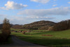
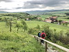
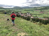
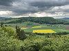
The above images may not be of the site on this page, but were taken nearby. They are loaded from Flickr so please click on them for image credits.
Click here to see more info for this site
Nearby sites
Click here to view sites on an interactive map of the areaKey: Red: member's photo, Blue: 3rd party photo, Yellow: other image, Green: no photo - please go there and take one, Grey: site destroyed
Download sites to:
KML (Google Earth)
GPX (GPS waypoints)
CSV (Garmin/Navman)
CSV (Excel)
To unlock full downloads you need to sign up as a Contributory Member. Otherwise downloads are limited to 50 sites.
Turn off the page maps and other distractions
Nearby sites listing. In the following links * = Image available
3.6km NNE 31° Spahl (2) Barrow Cemetery
5.2km NNE 30° Spahl (1) Artificial Mound
10.3km SSE 164° Milseburg Hillfort
11.5km NNE 29° Rasdorfer Berg (1) Artificial Mound
11.6km NNE 29° Rasdorfer Berg (2) Artificial Mound
11.6km NE 44° Schleidsberg Causewayed Enclosure
13.0km NNE 28° Am Klingraine Artificial Mound
14.5km NNE 31° Borscher Aue Artificial Mound
14.8km NNE 23° Standofsberg Causewayed Enclosure
16.5km NNE 24° Lindig Barrow Cemetery
16.6km NW 321° Unterstoppel Lange Steine Sculptured Stone
16.8km NNE 29° Hubenberg Ancient Village or Settlement
17.0km NW 317° Lange Steine Haunetal* Carving
17.2km NE 42° Arzberg Causewayed Enclosure
17.8km ENE 59° Hessenkuppe Hillfort
18.1km NE 55° Bilstein Mound Artificial Mound
18.3km E 98° Weiber Wetzstein Marker Stone
18.4km E 82° Fischberg Causewayed Enclosure
18.8km NNE 19° Pferdsdorf Barrow Cemetery
19.1km E 89° Kaltennordheim (2) Barrow Cemetery
19.2km NE 56° Oechsen Artificial Mound
19.5km NE 34° Deicheroda Barrow Cemetery
20.4km NE 38° Geiskopf Ancient Village or Settlement
21.2km E 86° Kaltennordheim (1) Causewayed Enclosure
21.3km NE 54° Baier Hillfort
View more nearby sites and additional images


 We would like to know more about this location. Please feel free to add a brief description and any relevant information in your own language.
 Wir möchten mehr über diese Stätte erfahren. Bitte zögern Sie nicht, eine kurze Beschreibung und relevante Informationen in Deutsch hinzuzufügen.
 Nous aimerions en savoir encore un peu sur les lieux. S'il vous plaît n'hesitez pas à ajouter une courte description et tous les renseignements pertinents dans votre propre langue.
 Quisieramos informarnos un poco más de las lugares. No dude en añadir una breve descripción y otros datos relevantes en su propio idioma.