


<< Our Photo Pages >> Blankenau Kreppelstein - Ancient Cross in Germany in Hesse
Submitted by krautrock on Tuesday, 20 April 2010 Page Views: 2671
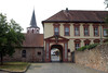
Early Medieval (Dark Age)Site Name: Blankenau KreppelsteinCountry: Germany
NOTE: This site is 14.294 km away from the location you searched for.
Land: Hesse Type: Ancient Cross
Nearest Town: Blankenau Nearest Village: Fulda
Latitude: 50.551020N Longitude: 9.464370E
Condition:
| 5 | Perfect |
| 4 | Almost Perfect |
| 3 | Reasonable but with some damage |
| 2 | Ruined but still recognisable as an ancient site |
| 1 | Pretty much destroyed, possibly visible as crop marks |
| 0 | No data. |
| -1 | Completely destroyed |
| 5 | Superb |
| 4 | Good |
| 3 | Ordinary |
| 2 | Not Good |
| 1 | Awful |
| 0 | No data. |
| 5 | Can be driven to, probably with disabled access |
| 4 | Short walk on a footpath |
| 3 | Requiring a bit more of a walk |
| 2 | A long walk |
| 1 | In the middle of nowhere, a nightmare to find |
| 0 | No data. |
| 5 | co-ordinates taken by GPS or official recorded co-ordinates |
| 4 | co-ordinates scaled from a detailed map |
| 3 | co-ordinates scaled from a bad map |
| 2 | co-ordinates of the nearest village |
| 1 | co-ordinates of the nearest town |
| 0 | no data |
Internal Links:
External Links:
")
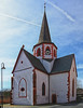
Kreppelstein.
April 2010
German Info: http://www.heimatfreunde-blankenau.de/index.php?option=com_content&task=view&id=26&Itemid=44
You may be viewing yesterday's version of this page. To see the most up to date information please register for a free account.
")
")
")
Do not use the above information on other web sites or publications without permission of the contributor.
Nearby Images from Flickr

The above images may not be of the site on this page, but were taken nearby. They are loaded from Flickr so please click on them for image credits.
Click here to see more info for this site
Nearby sites
Click here to view sites on an interactive map of the areaKey: Red: member's photo, Blue: 3rd party photo, Yellow: other image, Green: no photo - please go there and take one, Grey: site destroyed
Download sites to:
KML (Google Earth)
GPX (GPS waypoints)
CSV (Garmin/Navman)
CSV (Excel)
To unlock full downloads you need to sign up as a Contributory Member. Otherwise downloads are limited to 50 sites.
Turn off the page maps and other distractions
Nearby sites listing. In the following links * = Image available
24.8km SE 140° Heubach Schwarzenberg* Standing Stones
25.0km SE 139° Frauenstein* Standing Stone (Menhir)
25.0km SE 139° Taufstein* Natural Stone / Erratic / Other Natural Feature
27.1km NE 37° Lange Steine Haunetal* Carving
28.1km NE 38° Unterstoppel Lange Steine Sculptured Stone
29.3km ENE 72° Malhauksküppel Stone Row / Alignment
30.5km WSW 249° Dicker Stein Eichelsdorf Standing Stone (Menhir)
30.6km E 91° Milseburg Hillfort
32.1km ENE 67° Spahl (2) Barrow Cemetery
33.3km ENE 66° Spahl (1) Artificial Mound
34.8km NNW 340° Metzenberg* Hillfort
36.0km NNW 334° Wippchensteine Natural Stone / Erratic / Other Natural Feature
38.5km ENE 60° Rasdorfer Berg (1) Artificial Mound
38.6km ENE 60° Rasdorfer Berg (2) Artificial Mound
39.8km ENE 59° Am Klingraine Artificial Mound
40.0km ENE 64° Schleidsberg Causewayed Enclosure
40.5km NE 56° Standofsberg Causewayed Enclosure
41.0km WSW 251° Kindstein* Standing Stone (Menhir)
41.4km ENE 58° Borscher Aue Artificial Mound
42.1km SW 230° Glauberg Siedlung* Hillfort
42.1km NE 55° Lindig Barrow Cemetery
42.1km SW 232° Glauberg Museum* Museum
42.2km NNW 328° Hügelgrab von Wiera* Round Barrow(s)
42.3km SW 230° Glauberg Fürstengrabhügel* Round Barrow(s)
42.3km SW 230° Keltenwelt am Glauberg* Museum
View more nearby sites and additional images


 We would like to know more about this location. Please feel free to add a brief description and any relevant information in your own language.
 Wir möchten mehr über diese Stätte erfahren. Bitte zögern Sie nicht, eine kurze Beschreibung und relevante Informationen in Deutsch hinzuzufügen.
 Nous aimerions en savoir encore un peu sur les lieux. S'il vous plaît n'hesitez pas à ajouter une courte description et tous les renseignements pertinents dans votre propre langue.
 Quisieramos informarnos un poco más de las lugares. No dude en añadir una breve descripción y otros datos relevantes en su propio idioma.