


<< Our Photo Pages >> Pozzo di Piazzalunga - Holy Well or Sacred Spring in Italy in Lombardia
Submitted by CoppellaiaMatta on Wednesday, 24 April 2024 Page Views: 14
Springs and Holy WellsSite Name: Pozzo di PiazzalungaCountry: Italy
NOTE: This site is 21.211 km away from the location you searched for.
Region: Lombardia Type: Holy Well or Sacred Spring
Nearest Town: Morbegno Nearest Village: Ardenno
Latitude: 46.173461N Longitude: 9.638902E
Condition:
| 5 | Perfect |
| 4 | Almost Perfect |
| 3 | Reasonable but with some damage |
| 2 | Ruined but still recognisable as an ancient site |
| 1 | Pretty much destroyed, possibly visible as crop marks |
| 0 | No data. |
| -1 | Completely destroyed |
| 5 | Superb |
| 4 | Good |
| 3 | Ordinary |
| 2 | Not Good |
| 1 | Awful |
| 0 | No data. |
| 5 | Can be driven to, probably with disabled access |
| 4 | Short walk on a footpath |
| 3 | Requiring a bit more of a walk |
| 2 | A long walk |
| 1 | In the middle of nowhere, a nightmare to find |
| 0 | No data. |
| 5 | co-ordinates taken by GPS or official recorded co-ordinates |
| 4 | co-ordinates scaled from a detailed map |
| 3 | co-ordinates scaled from a bad map |
| 2 | co-ordinates of the nearest village |
| 1 | co-ordinates of the nearest town |
| 0 | no data |
Internal Links:
External Links:
")
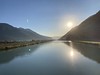
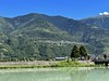
Piazzalunga, a small hamlet in Sondrio Province, is mostly known because the last woman to be accused of witchcraft in this Province used to live there.
My sister sent me a couple of pictures of the local well, which isn't on the tourist trail nor it's known as "sacred", according to the local people.
A carved stone at it's threshold might suggest otherwise!
You may be viewing yesterday's version of this page. To see the most up to date information please register for a free account.
")
Do not use the above information on other web sites or publications without permission of the contributor.
Nearby Images from Flickr
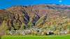
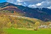
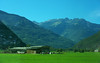
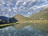
The above images may not be of the site on this page, but were taken nearby. They are loaded from Flickr so please click on them for image credits.
Click here to see more info for this site
Nearby sites
Click here to view sites on an interactive map of the areaKey: Red: member's photo, Blue: 3rd party photo, Yellow: other image, Green: no photo - please go there and take one, Grey: site destroyed
Download sites to:
KML (Google Earth)
GPX (GPS waypoints)
CSV (Garmin/Navman)
CSV (Excel)
To unlock full downloads you need to sign up as a Contributory Member. Otherwise downloads are limited to 50 sites.
Turn off the page maps and other distractions
Nearby sites listing. In the following links * = Image available
1.8km NE 52° San Giuseppe* Rock Art
17.5km NW 318° Cairns at St Moritz* Cairn
19.1km NNW 348° Masso-Avello Stampa* NOT SET
21.6km NNW 337° Sasc di Pè (Foot soles slab)* Rock Art
24.0km NW 320° Dasile* Rock Art
24.2km NW 314° Parco Marmitte dei Giganti* Ancient Mine, Quarry or other Industry
25.6km N 11° Maloja Stone with ornaments* Rock Art
25.6km N 11° Maloja Mortar Stone* Rock Art
36.3km NW 322° Sass del Pariuliin* Rock Art
37.1km NW 324° I sassi del Camanin* Rock Art
37.4km WNW 284° Sass Pagan (Pagan stone)* Rock Art
37.4km NNW 328° Val Sterla* Rock Art
37.4km NNW 326° Sass del Sugherin del Mater* Rock Art
38.3km WNW 286° Capèla dèla Riva Rock Art
38.3km NW 325° Sasso altare* Rock Art
38.6km WNW 286° Sass de l'Orch Wackelstein Rock Art
38.9km WNW 286° Verdabbio Schalensteingebiet* Rock Art
39.1km NNW 329° La Corte* Rock Art
39.7km NW 308° Mesocco-Andergia Lepontische Stele Sculptured Stone
39.9km NNE 24° Druidenstein St. Moritz* Natural Stone / Erratic / Other Natural Feature
40.1km W 281° Carasole San Rocco* Rock Art
46.7km N 358° Tinizong Senslas Rock Art
48.6km WNW 281° Claro sito preistorico Standing Stone (Menhir)
49.5km NNW 341° Anselmo Gadola Collection* Museum
49.9km ENE 74° Rupe Magna* Rock Art
View more nearby sites and additional images


 We would like to know more about this location. Please feel free to add a brief description and any relevant information in your own language.
 Wir möchten mehr über diese Stätte erfahren. Bitte zögern Sie nicht, eine kurze Beschreibung und relevante Informationen in Deutsch hinzuzufügen.
 Nous aimerions en savoir encore un peu sur les lieux. S'il vous plaît n'hesitez pas à ajouter une courte description et tous les renseignements pertinents dans votre propre langue.
 Quisieramos informarnos un poco más de las lugares. No dude en añadir una breve descripción y otros datos relevantes en su propio idioma.