


<< Text Pages >> Su Gardu Nuraghe - Broch or Nuraghe in Italy in Sardinia (Sardegna)
Submitted by SolarMegalith on Tuesday, 27 September 2011 Page Views: 2021
Neolithic and Bronze AgeSite Name: Su Gardu NuragheCountry: Italy
NOTE: This site is 2.224 km away from the location you searched for.
Region: Sardinia (Sardegna) Type: Broch or Nuraghe
Nearest Town: Galtelli
Latitude: 40.365000N Longitude: 9.610833E
Condition:
| 5 | Perfect |
| 4 | Almost Perfect |
| 3 | Reasonable but with some damage |
| 2 | Ruined but still recognisable as an ancient site |
| 1 | Pretty much destroyed, possibly visible as crop marks |
| 0 | No data. |
| -1 | Completely destroyed |
| 5 | Superb |
| 4 | Good |
| 3 | Ordinary |
| 2 | Not Good |
| 1 | Awful |
| 0 | No data. |
| 5 | Can be driven to, probably with disabled access |
| 4 | Short walk on a footpath |
| 3 | Requiring a bit more of a walk |
| 2 | A long walk |
| 1 | In the middle of nowhere, a nightmare to find |
| 0 | No data. |
| 5 | co-ordinates taken by GPS or official recorded co-ordinates |
| 4 | co-ordinates scaled from a detailed map |
| 3 | co-ordinates scaled from a bad map |
| 2 | co-ordinates of the nearest village |
| 1 | co-ordinates of the nearest town |
| 0 | no data |
Internal Links:
External Links:
Nuraghe in Sardinia (Sardegna)
Remains of a Bronze Age nuraghe located 2 km from Galtelli.
You may be viewing yesterday's version of this page. To see the most up to date information please register for a free account.
Do not use the above information on other web sites or publications without permission of the contributor.
Nearby Images from Flickr
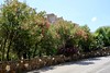
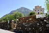
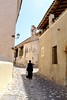

The above images may not be of the site on this page, but were taken nearby. They are loaded from Flickr so please click on them for image credits.
Click here to see more info for this site
Nearby sites
Click here to view sites on an interactive map of the areaKey: Red: member's photo, Blue: 3rd party photo, Yellow: other image, Green: no photo - please go there and take one, Grey: site destroyed
Download sites to:
KML (Google Earth)
GPX (GPS waypoints)
CSV (Garmin/Navman)
CSV (Excel)
To unlock full downloads you need to sign up as a Contributory Member. Otherwise downloads are limited to 50 sites.
Turn off the page maps and other distractions
Nearby sites listing. In the following links * = Image available
341m S 184° Torrocone Nuraghe Broch or Nuraghe
4.0km NE 39° Pontes Insediamento Nuragico* Ancient Village or Settlement
4.2km NNW 327° Calistru Nuraghe Broch or Nuraghe
4.6km N 350° Turrighe Domus de Janas Rock Cut Tomb
4.6km NNW 334° Caraucu Nuraghe Broch or Nuraghe
5.2km S 184° Grotta di Ispinigoli Cave or Rock Shelter
5.9km WSW 238° Biristeddi Tomba di Giganti* Chambered Tomb
6.0km WSW 237° Purgatoriu Villaggio Nuragico* Ancient Village or Settlement
6.1km SW 236° Purgatoriu Nuraghe* Broch or Nuraghe
6.4km S 191° Sas Venas Domus de Janas Rock Cut Tomb
7.1km WSW 241° Serra Orrios Villaggio Nuragico* Ancient Village or Settlement
7.1km WSW 241° Serra Orrios Tempio delle Riunione* Ancient Temple
7.2km WSW 241° Serra Orrios Temple* Ancient Temple
7.2km WSW 241° Serra Orrios Megaron* Ancient Temple
7.2km SSW 205° Motorra Dolmen* Burial Chamber or Dolmen
7.6km WSW 239° Oveni Nuraghe* Broch or Nuraghe
7.7km ENE 72° Santa Lucia Nuraghe Broch or Nuraghe
7.8km SW 234° Noriolo Nuraghe* Broch or Nuraghe
8.0km SSE 162° Codula Manna Nuraghe Broch or Nuraghe
8.1km NE 41° Doddoi Domus de Janas Rock Cut Tomb
8.2km W 281° S'Ena'e Thomes Tomba di Giganti* Chambered Tomb
9.0km WSW 243° Lottoniddo Tomba di Giganti Chambered Tomb
9.6km ENE 77° Portu Nuraghe* Broch or Nuraghe
9.6km S 185° Monte Longu Dolmen* Burial Chamber or Dolmen
10.4km NE 53° Sa Linnarta Complesso Nuragico Holy Well or Sacred Spring
View more nearby sites and additional images


 We would like to know more about this location. Please feel free to add a brief description and any relevant information in your own language.
 Wir möchten mehr über diese Stätte erfahren. Bitte zögern Sie nicht, eine kurze Beschreibung und relevante Informationen in Deutsch hinzuzufügen.
 Nous aimerions en savoir encore un peu sur les lieux. S'il vous plaît n'hesitez pas à ajouter une courte description et tous les renseignements pertinents dans votre propre langue.
 Quisieramos informarnos un poco más de las lugares. No dude en añadir una breve descripción y otros datos relevantes en su propio idioma.