


<< Our Photo Pages >> Werbach Grabhügelfeld - Barrow Cemetery in Germany in Baden-Wuerttemberg
Submitted by AlexHunger on Tuesday, 13 September 2005 Page Views: 4644
Neolithic and Bronze AgeSite Name: Werbach GrabhügelfeldCountry: Germany
NOTE: This site is 23.822 km away from the location you searched for.
Land: Baden-Wuerttemberg Type: Barrow Cemetery
Nearest Town: Wuerzburg Nearest Village: Werbach
Latitude: 49.672430N Longitude: 9.641540E
Condition:
| 5 | Perfect |
| 4 | Almost Perfect |
| 3 | Reasonable but with some damage |
| 2 | Ruined but still recognisable as an ancient site |
| 1 | Pretty much destroyed, possibly visible as crop marks |
| 0 | No data. |
| -1 | Completely destroyed |
| 5 | Superb |
| 4 | Good |
| 3 | Ordinary |
| 2 | Not Good |
| 1 | Awful |
| 0 | No data. |
| 5 | Can be driven to, probably with disabled access |
| 4 | Short walk on a footpath |
| 3 | Requiring a bit more of a walk |
| 2 | A long walk |
| 1 | In the middle of nowhere, a nightmare to find |
| 0 | No data. |
| 5 | co-ordinates taken by GPS or official recorded co-ordinates |
| 4 | co-ordinates scaled from a detailed map |
| 3 | co-ordinates scaled from a bad map |
| 2 | co-ordinates of the nearest village |
| 1 | co-ordinates of the nearest town |
| 0 | no data |
Internal Links:
External Links:
")
5 remaining small Celtic tumuli with kerbstones. Next to modern Cimetary in new housing development. 193 meters altitude. Artifacts in Tauberbischofshheim Landschaftmuseum
You may be viewing yesterday's version of this page. To see the most up to date information please register for a free account.
")
Do not use the above information on other web sites or publications without permission of the contributor.
Nearby Images from Flickr
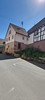

The above images may not be of the site on this page, but were taken nearby. They are loaded from Flickr so please click on them for image credits.
Click here to see more info for this site
Nearby sites
Click here to view sites on an interactive map of the areaKey: Red: member's photo, Blue: 3rd party photo, Yellow: other image, Green: no photo - please go there and take one, Grey: site destroyed
Download sites to:
KML (Google Earth)
GPX (GPS waypoints)
CSV (Garmin/Navman)
CSV (Excel)
To unlock full downloads you need to sign up as a Contributory Member. Otherwise downloads are limited to 50 sites.
Turn off the page maps and other distractions
Nearby sites listing. In the following links * = Image available
5.9km SSE 166° Tauberfraenkischen Landschaftmuseum Museum
12.4km SSW 203° Gelbrunn Wald Keltische Viereckschanze Ancient Village or Settlement
13.9km WSW 250° Hardheim Grabhügelgruppe* Round Barrow(s)
13.9km WSW 240° Erfatal-Hardheim Museum Museum
19.1km SSW 211° Hardheim Keltische Viereckschanze* Ancient Village or Settlement
20.2km ESE 106° Allersheim Grabhügelfeld Barrow Cemetery
23.4km SSW 210° Sindolsheim Grabhügel Artificial Mound
26.1km ESE 119° Fuchsenbühl Grabhügel Artificial Mound
27.9km SW 228° Hettingen Grabhügel Artificial Mound
29.3km WSW 248° Buttenthalhöhle Cave or Rock Shelter
31.9km E 93° Hopferstadt Ringheiligtum Henge
32.1km S 191° Bürgerwald Grabhügelgruppe Barrow Cemetery
32.5km SSW 209° Föstlein Grabhügelgruppe Barrow Cemetery
33.0km SSW 196° Steinig Wald Grabhügel Artificial Mound
34.5km S 171° Hoehle St.Wendel zum Stein Cave or Rock Shelter
36.3km ENE 75° Buchbrunn Settlement Ancient Village or Settlement
38.1km SE 142° Niederstetten Keltische Viereckschanze Ancient Village or Settlement
43.2km SE 127° Burgstall Oppidum* Hillfort
43.6km S 181° Niedernhall Grabhügelfeld Barrow Cemetery
44.3km SW 222° Römerhügel (Biligheim) Artificial Mound
44.4km ENE 61° Vogelburg Hillfort
44.7km ESE 109° Gollachgau Museum Museum
46.5km E 82° Schwanberg Hillfort Hillfort
48.4km NW 315° Summstein Grünbrücke* Modern Stone Circle etc
48.5km ENE 64° Grabstele Volkach Standing Stone (Menhir)
View more nearby sites and additional images


 We would like to know more about this location. Please feel free to add a brief description and any relevant information in your own language.
 Wir möchten mehr über diese Stätte erfahren. Bitte zögern Sie nicht, eine kurze Beschreibung und relevante Informationen in Deutsch hinzuzufügen.
 Nous aimerions en savoir encore un peu sur les lieux. S'il vous plaît n'hesitez pas à ajouter une courte description et tous les renseignements pertinents dans votre propre langue.
 Quisieramos informarnos un poco más de las lugares. No dude en añadir una breve descripción y otros datos relevantes en su propio idioma.