 with our Megalithic Portal iPhone app")


<< Text Pages >> Langhau Wald Keltische Viereckschanze - Ancient Village or Settlement in Germany in Baden-Wuerttemberg
Submitted by AlexHunger on Tuesday, 13 September 2005 Page Views: 2260
Multi-periodSite Name: Langhau Wald Keltische ViereckschanzeCountry: Germany
NOTE: This site is 3.578 km away from the location you searched for.
Land: Baden-Wuerttemberg Type: Ancient Village or Settlement
Nearest Town: Reutlingen Nearest Village: Obermachtal
Latitude: 48.218070N Longitude: 9.558280E
Condition:
| 5 | Perfect |
| 4 | Almost Perfect |
| 3 | Reasonable but with some damage |
| 2 | Ruined but still recognisable as an ancient site |
| 1 | Pretty much destroyed, possibly visible as crop marks |
| 0 | No data. |
| -1 | Completely destroyed |
| 5 | Superb |
| 4 | Good |
| 3 | Ordinary |
| 2 | Not Good |
| 1 | Awful |
| 0 | No data. |
| 5 | Can be driven to, probably with disabled access |
| 4 | Short walk on a footpath |
| 3 | Requiring a bit more of a walk |
| 2 | A long walk |
| 1 | In the middle of nowhere, a nightmare to find |
| 0 | No data. |
| 5 | co-ordinates taken by GPS or official recorded co-ordinates |
| 4 | co-ordinates scaled from a detailed map |
| 3 | co-ordinates scaled from a bad map |
| 2 | co-ordinates of the nearest village |
| 1 | co-ordinates of the nearest town |
| 0 | no data |
Be the first person to rate this site - see the 'Contribute!' box in the right hand menu.
Internal Links:
External Links:
Settlement in Baden-Württemberg
IMPORTANT NOTE: Site believed to be near this position. Iron age settlements aprox 66 Meters by 85 Meters in area and walls up to 1 Meter tall
You may be viewing yesterday's version of this page. To see the most up to date information please register for a free account.
Do not use the above information on other web sites or publications without permission of the contributor.
Nearby Images from Flickr
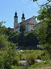
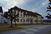


The above images may not be of the site on this page, but were taken nearby. They are loaded from Flickr so please click on them for image credits.
Click here to see more info for this site
Nearby sites
Click here to view sites on an interactive map of the areaKey: Red: member's photo, Blue: 3rd party photo, Yellow: other image, Green: no photo - please go there and take one, Grey: site destroyed
Download sites to:
KML (Google Earth)
GPX (GPS waypoints)
CSV (Garmin/Navman)
CSV (Excel)
To unlock full downloads you need to sign up as a Contributory Member. Otherwise downloads are limited to 50 sites.
Turn off the page maps and other distractions
Nearby sites listing. In the following links * = Image available
179m NNW 333° Langhau Wald Grabhügelgruppe Barrow Cemetery
4.9km N 10° Bärenhöhle Cave or Rock Shelter
6.1km S 183° Bussen Vorgeschichtliche Höhensiedlung Hillfort
8.4km ESE 119° Grundsheim Grabhügelgruppe Barrow Cemetery
9.1km NNW 330° Alt-Hayingen Hillfort
12.4km W 261° Grosse Heuneburg Upflamör Hillfort
12.6km SSE 151° Ödenahlen Ancient Village or Settlement
13.2km SSE 157° Grundwiesen Ancient Village or Settlement
13.8km SSW 206° Rauer Lehen Grabhügel Artificial Mound
15.4km SW 229° Ruchenholz Wald Keltische Viereckschanze 1 Ancient Village or Settlement
15.6km SW 234° Ruchenholz Wald Keltische Viereckschanze 2 Ancient Village or Settlement
16.7km SSE 166° Federseeried Prähistorische Siedlungslandschaft Ancient Village or Settlement
16.8km WSW 248° Alte Burg Langenenslingen Hillfort
16.9km SSE 167° Bad Buchau Museum* Museum
17.3km SW 221° Giessübel-Talhau Grabhügelgruppe* Artificial Mound
17.5km SW 218° Heunenburg* Hillfort
18.4km SW 217° Baumburg Artificial Mound
18.7km SSW 211° Bettelbühl Round Barrow(s)
18.9km SW 223° Hohmichele Grabhügel* Artificial Mound
19.1km SW 216° Lehenbühl Grabhügel Artificial Mound
19.1km SSE 161° Siedlung Forschner Ancient Village or Settlement
19.4km SW 217° Heunenburg Museum Museum
20.2km SE 143° Mittelbiberach Keltische Viereckschanze Ancient Village or Settlement
22.3km S 183° Schelmberg Wald Keltische Viereckschanze Ancient Village or Settlement
23.1km NE 39° Hohlefels Höhle* Cave or Rock Shelter
View more nearby sites and additional images


 We would like to know more about this location. Please feel free to add a brief description and any relevant information in your own language.
 Wir möchten mehr über diese Stätte erfahren. Bitte zögern Sie nicht, eine kurze Beschreibung und relevante Informationen in Deutsch hinzuzufügen.
 Nous aimerions en savoir encore un peu sur les lieux. S'il vous plaît n'hesitez pas à ajouter une courte description et tous les renseignements pertinents dans votre propre langue.
 Quisieramos informarnos un poco más de las lugares. No dude en añadir una breve descripción y otros datos relevantes en su propio idioma.