


<< Our Photo Pages >> Spiaggia del Riso Domus de Janas - Rock Cut Tomb in Italy in Sardinia (Sardegna)
Submitted by SolarMegalith on Saturday, 13 May 2017 Page Views: 1121
Multi-periodSite Name: Spiaggia del Riso Domus de JanasCountry: Italy
NOTE: This site is 0.492 km away from the location you searched for.
Region: Sardinia (Sardegna) Type: Rock Cut Tomb
Nearest Town: Villasimius
Latitude: 39.122303N Longitude: 9.509956E
Condition:
| 5 | Perfect |
| 4 | Almost Perfect |
| 3 | Reasonable but with some damage |
| 2 | Ruined but still recognisable as an ancient site |
| 1 | Pretty much destroyed, possibly visible as crop marks |
| 0 | No data. |
| -1 | Completely destroyed |
| 5 | Superb |
| 4 | Good |
| 3 | Ordinary |
| 2 | Not Good |
| 1 | Awful |
| 0 | No data. |
| 5 | Can be driven to, probably with disabled access |
| 4 | Short walk on a footpath |
| 3 | Requiring a bit more of a walk |
| 2 | A long walk |
| 1 | In the middle of nowhere, a nightmare to find |
| 0 | No data. |
| 5 | co-ordinates taken by GPS or official recorded co-ordinates |
| 4 | co-ordinates scaled from a detailed map |
| 3 | co-ordinates scaled from a bad map |
| 2 | co-ordinates of the nearest village |
| 1 | co-ordinates of the nearest town |
| 0 | no data |
Internal Links:
External Links:
I have visited· I would like to visit
SolarMegalith visited on 14th Apr 2017 - their rating: Cond: 4 Amb: 2 Access: 5
")
This Late Neolithic necropolis originally consised of several rock cut tombs, but only one remains intact. It has two chambers and a megalithic corridor consisting of stone slabs.
You may be viewing yesterday's version of this page. To see the most up to date information please register for a free account.
")
")
")
Do not use the above information on other web sites or publications without permission of the contributor.
Nearby Images from Flickr
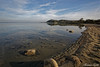
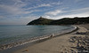
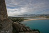
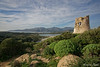
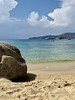
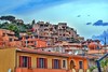
The above images may not be of the site on this page, but were taken nearby. They are loaded from Flickr so please click on them for image credits.
Click here to see more info for this site
Nearby sites
Click here to view sites on an interactive map of the areaKey: Red: member's photo, Blue: 3rd party photo, Yellow: other image, Green: no photo - please go there and take one, Grey: site destroyed
Download sites to:
KML (Google Earth)
GPX (GPS waypoints)
CSV (Garmin/Navman)
CSV (Excel)
To unlock full downloads you need to sign up as a Contributory Member. Otherwise downloads are limited to 50 sites.
Turn off the page maps and other distractions
Nearby sites listing. In the following links * = Image available
1.4km N 7° Bruncu Campulongu Nuraghe Broch or Nuraghe
1.7km N 357° Accu Sa Pira Nuraghe Broch or Nuraghe
3.1km NW 313° Giardone Nuraghe* Broch or Nuraghe
4.2km ENE 68° Punta Molentis Nuraghe Broch or Nuraghe
7.5km NE 42° Cala Pira Menhir Standing Stone (Menhir)
7.8km NW 323° Su Crastadroxiu Nuraghe Broch or Nuraghe
9.6km NW 306° Bruncu Morettu Nuraghe Broch or Nuraghe
10.5km NNE 26° Gibe Truttiri Nuraghe Broch or Nuraghe
12.5km NW 324° Sa Madrina Nuraghe Broch or Nuraghe
12.9km NNE 20° S'Omu 'e S'Orcu Nuraghe* Broch or Nuraghe
16.1km WNW 303° Tuvu Mannu Nuraghe* Broch or Nuraghe
16.3km NW 304° Callitas Nuraghe* Broch or Nuraghe
16.3km WNW 303° Palisteri Nuraghe* Broch or Nuraghe
16.8km N 352° Arcu Pintau 1 Nuraghe* Broch or Nuraghe
16.8km N 352° Arcu Pintau 2 Nuraghe* Broch or Nuraghe
17.4km NNE 20° Piscina Rei* Standing Stones
17.4km NNE 16° Is Calas* Standing Stones
17.5km NNE 17° Scalas Protonuraghe* Broch or Nuraghe
17.7km N 357° Monte Gruttas Nuraghe* Broch or Nuraghe
18.1km WNW 299° Diana Nuraghe* Broch or Nuraghe
18.2km NNW 348° Antoni Usai Nuraghe Broch or Nuraghe
18.5km NNE 12° Monte Crobu Protonuraghe* Broch or Nuraghe
18.8km NNE 12° Cuili Piras* Standing Stones
19.0km NNW 331° Monti Eccas Nuraghe Broch or Nuraghe
19.5km N 354° Meurru Nuraghe* Broch or Nuraghe
View more nearby sites and additional images


 We would like to know more about this location. Please feel free to add a brief description and any relevant information in your own language.
 Wir möchten mehr über diese Stätte erfahren. Bitte zögern Sie nicht, eine kurze Beschreibung und relevante Informationen in Deutsch hinzuzufügen.
 Nous aimerions en savoir encore un peu sur les lieux. S'il vous plaît n'hesitez pas à ajouter une courte description et tous les renseignements pertinents dans votre propre langue.
 Quisieramos informarnos un poco más de las lugares. No dude en añadir una breve descripción y otros datos relevantes en su propio idioma.