


<< Our Photo Pages >> Mangoldsall Modern Menhir - Modern Stone Circle etc in Germany in Baden-Wuerttemberg
Submitted by Martin_L on Friday, 28 July 2023 Page Views: 198
Modern SitesSite Name: Mangoldsall Modern MenhirCountry: Germany
NOTE: This site is 11.106 km away from the location you searched for.
Land: Baden-Wuerttemberg Type: Modern Stone Circle etc
Nearest Town: Schwäbisch Hall Nearest Village: Mangoldsall
Latitude: 49.227662N Longitude: 9.646911E
Condition:
| 5 | Perfect |
| 4 | Almost Perfect |
| 3 | Reasonable but with some damage |
| 2 | Ruined but still recognisable as an ancient site |
| 1 | Pretty much destroyed, possibly visible as crop marks |
| 0 | No data. |
| -1 | Completely destroyed |
| 5 | Superb |
| 4 | Good |
| 3 | Ordinary |
| 2 | Not Good |
| 1 | Awful |
| 0 | No data. |
| 5 | Can be driven to, probably with disabled access |
| 4 | Short walk on a footpath |
| 3 | Requiring a bit more of a walk |
| 2 | A long walk |
| 1 | In the middle of nowhere, a nightmare to find |
| 0 | No data. |
| 5 | co-ordinates taken by GPS or official recorded co-ordinates |
| 4 | co-ordinates scaled from a detailed map |
| 3 | co-ordinates scaled from a bad map |
| 2 | co-ordinates of the nearest village |
| 1 | co-ordinates of the nearest town |
| 0 | no data |
Internal Links:
External Links:
")
It stands approximately 2,5m tall.
There is no signpost. No reference in literature could be found as of yet. Hence it is assumed the stone has been erected in modern times even though its appearance is that of a prehistoric stone.
You may be viewing yesterday's version of this page. To see the most up to date information please register for a free account.
")
")
Do not use the above information on other web sites or publications without permission of the contributor.
Nearby Images from Flickr
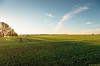

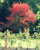
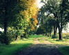

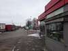
The above images may not be of the site on this page, but were taken nearby. They are loaded from Flickr so please click on them for image credits.
Click here to see more info for this site
Nearby sites
Click here to view sites on an interactive map of the areaKey: Red: member's photo, Blue: 3rd party photo, Yellow: other image, Green: no photo - please go there and take one, Grey: site destroyed
Download sites to:
KML (Google Earth)
GPX (GPS waypoints)
CSV (Garmin/Navman)
CSV (Excel)
To unlock full downloads you need to sign up as a Contributory Member. Otherwise downloads are limited to 50 sites.
Turn off the page maps and other distractions
Nearby sites listing. In the following links * = Image available
6.0km N 351° Niedernhall Grabhügelfeld Barrow Cemetery
14.4km SSE 153° Summstein Schwäbisch Hall Modern Stone Circle etc
16.3km NNE 18° Hoehle St.Wendel zum Stein Cave or Rock Shelter
16.6km E 82° Langenburg Keltische Viereckschanze Ancient Village or Settlement
19.0km NNW 341° Bürgerwald Grabhügelgruppe Barrow Cemetery
20.0km NNW 332° Steinig Wald Grabhügel Artificial Mound
22.4km SW 230° Summstein Lichtenstern I Modern Stone Circle etc
22.4km SW 230° Summstein Lichtenstern II Modern Stone Circle etc
22.8km SE 132° Stöckenburg Ancient Village or Settlement
23.2km SE 133° Vellberg Natur und Heimatmuseum Museum
25.0km E 101° Triensbach Grabhügelgruppe Barrow Cemetery
26.3km NW 323° Föstlein Grabhügelgruppe Barrow Cemetery
30.1km NE 50° Niederstetten Keltische Viereckschanze Ancient Village or Settlement
31.7km NNW 337° Sindolsheim Grabhügel Artificial Mound
32.5km W 272° Jagstfeld Grabhügelfeld Barrow Cemetery
34.0km WNW 299° Römerhügel (Biligheim) Artificial Mound
34.7km NNW 343° Hardheim Keltische Viereckschanze* Ancient Village or Settlement
35.5km SW 233° Katzenbuckel Artificial Mound
36.5km SW 222° Hexenbuckele Artificial Mound
37.0km WSW 238° Ilsfeld Erdwerk Henge
37.1km NW 326° Hettingen Grabhügel Artificial Mound
38.3km N 352° Gelbrunn Wald Keltische Viereckschanze Ancient Village or Settlement
40.0km SW 233° Mithraeum Mundelsheim Ancient Temple
41.1km NE 56° Burgstall Oppidum* Hillfort
41.1km ENE 66° Engelsburg Keltenwall* Hillfort
View more nearby sites and additional images


 We would like to know more about this location. Please feel free to add a brief description and any relevant information in your own language.
 Wir möchten mehr über diese Stätte erfahren. Bitte zögern Sie nicht, eine kurze Beschreibung und relevante Informationen in Deutsch hinzuzufügen.
 Nous aimerions en savoir encore un peu sur les lieux. S'il vous plaît n'hesitez pas à ajouter une courte description et tous les renseignements pertinents dans votre propre langue.
 Quisieramos informarnos un poco más de las lugares. No dude en añadir una breve descripción y otros datos relevantes en su propio idioma.