

<< Our Photo Pages >> Guadames Idols - Natural Stone / Erratic / Other Natural Feature in Libya
Submitted by AlexHunger on Monday, 10 July 2006 Page Views: 6525
Natural PlacesSite Name: Guadames IdolsCountry: Libya
NOTE: This site is 19.84 km away from the location you searched for.
Type: Natural Stone / Erratic / Other Natural Feature
Nearest Town: Ghadames Nearest Village: Ghadames
Latitude: 30.127780N Longitude: 9.514440E
Condition:
| 5 | Perfect |
| 4 | Almost Perfect |
| 3 | Reasonable but with some damage |
| 2 | Ruined but still recognisable as an ancient site |
| 1 | Pretty much destroyed, possibly visible as crop marks |
| 0 | No data. |
| -1 | Completely destroyed |
| 5 | Superb |
| 4 | Good |
| 3 | Ordinary |
| 2 | Not Good |
| 1 | Awful |
| 0 | No data. |
| 5 | Can be driven to, probably with disabled access |
| 4 | Short walk on a footpath |
| 3 | Requiring a bit more of a walk |
| 2 | A long walk |
| 1 | In the middle of nowhere, a nightmare to find |
| 0 | No data. |
| 5 | co-ordinates taken by GPS or official recorded co-ordinates |
| 4 | co-ordinates scaled from a detailed map |
| 3 | co-ordinates scaled from a bad map |
| 2 | co-ordinates of the nearest village |
| 1 | co-ordinates of the nearest town |
| 0 | no data |
Internal Links:
External Links:
")
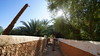
Natural stones shaped by erosion near trade town at Tunesian border. Position unknow, location to nearest town.
Note: Exact position unknown. Location to nearest town.
You may be viewing yesterday's version of this page. To see the most up to date information please register for a free account.
Do not use the above information on other web sites or publications without permission of the contributor.
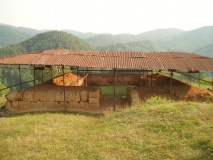
Nearby Images from Flickr


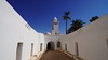
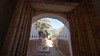
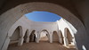
The above images may not be of the site on this page, but were taken nearby. They are loaded from Flickr so please click on them for image credits.
Click here to see more info for this site
Nearby sites
Click here to view sites on an interactive map of the areaKey: Red: member's photo, Blue: 3rd party photo, Yellow: other image, Green: no photo - please go there and take one, Grey: site destroyed
Download sites to:
KML (Google Earth)
GPX (GPS waypoints)
CSV (Garmin/Navman)
CSV (Excel)
To unlock full downloads you need to sign up as a Contributory Member. Otherwise downloads are limited to 50 sites.
Turn off the page maps and other distractions
Nearby sites listing. In the following links * = Image available
409.9km NE 43° Sabratha Ancient Village or Settlement
421.6km N 7° Gabes Archeology Museum Museum
464.2km NE 47° Oea.* Ancient Village or Settlement
464.2km NE 48° Tripoli National Museum Museum
468.7km NE 55° Tarhuna Rock Art* Rock Art
501.9km SSE 153° Wadi Bedis Rock Art 4 Rock Art
502.0km SE 146° Wadi Issanghaten Rock Art Rock Art
502.3km SSE 151° Wadi Bedis Rock Art 5 Rock Art
502.5km SSE 147° Wadi Tekniewen Rock Art 5 Rock Art
503.3km SSE 150° Wadi Alamas Rock Art 7 Rock Art
506.2km SE 144° Wadi Irahar Rock Art Rock Art
506.4km SSE 149° Wadi Isser Rock Art 4 Rock Art
506.5km SSE 147° Wadi Tekniewen Rock Art 4 Rock Art
507.9km SSE 154° Wadi I-n-Erahar Rock Art 4 Rock Art
509.3km SSE 150° Wadi Alamas Rock Art 6 Rock Art
513.1km SSE 150° Wadi Ti-n-Einessnis Rock Art 6 Rock Art
513.6km SSE 147° Wadi Tekniewen Rock Art 3 Rock Art
513.8km SSE 152° Wadi Bedis Rock Art 3 Rock Art
513.8km SE 143° Wadi I-n-Eihedh Rock Art 2 Rock Art
514.6km NNE 12° Thaenae Ancient Village or Settlement
515.6km SE 139° Garama Ancient Village or Settlement
515.9km SSE 153° Wadi I-n-Erahar Rock Art 3 Rock Art
517.2km SSE 149° Wadi Alamas Rock Art 5 Rock Art
517.4km SSE 150° Wadi Ti-n-Einessnis Rock Art 5 Rock Art
517.6km SSE 153° Wadi I-n-Erahar Rock Art 2 Rock Art
View more nearby sites and additional images


 We would like to know more about this location. Please feel free to add a brief description and any relevant information in your own language.
 Wir möchten mehr über diese Stätte erfahren. Bitte zögern Sie nicht, eine kurze Beschreibung und relevante Informationen in Deutsch hinzuzufügen.
 Nous aimerions en savoir encore un peu sur les lieux. S'il vous plaît n'hesitez pas à ajouter une courte description et tous les renseignements pertinents dans votre propre langue.
 Quisieramos informarnos un poco más de las lugares. No dude en añadir una breve descripción y otros datos relevantes en su propio idioma.