


<< Our Photo Pages >> La Corte - Rock Art in Italy in Lombardia
Submitted by CoppellaiaMatta on Wednesday, 17 April 2024 Page Views: 13
Rock ArtSite Name: La CorteCountry: Italy Region: Lombardia Type: Rock Art
Nearest Town: Chiavenna Nearest Village: Montespluga
Latitude: 46.473083N Longitude: 9.372283E
Condition:
| 5 | Perfect |
| 4 | Almost Perfect |
| 3 | Reasonable but with some damage |
| 2 | Ruined but still recognisable as an ancient site |
| 1 | Pretty much destroyed, possibly visible as crop marks |
| 0 | No data. |
| -1 | Completely destroyed |
| 5 | Superb |
| 4 | Good |
| 3 | Ordinary |
| 2 | Not Good |
| 1 | Awful |
| 0 | No data. |
| 5 | Can be driven to, probably with disabled access |
| 4 | Short walk on a footpath |
| 3 | Requiring a bit more of a walk |
| 2 | A long walk |
| 1 | In the middle of nowhere, a nightmare to find |
| 0 | No data. |
| 5 | co-ordinates taken by GPS or official recorded co-ordinates |
| 4 | co-ordinates scaled from a detailed map |
| 3 | co-ordinates scaled from a bad map |
| 2 | co-ordinates of the nearest village |
| 1 | co-ordinates of the nearest town |
| 0 | no data |
Internal Links:
External Links:
")
Altar stone near Madesimo (Sondrio Province).
Marmots have taken up residence underneath it but the surface is absolutely unscathed, it presents many single cup marks, some linked. Most of the engravings are along the northern edge of the stone, which is slightly sloped north to south. From the stream a series of regularly spaced flat rocks suggest a path to the altar.
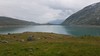
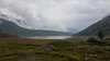
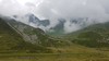
The stone is located at the very end of Madesimo's valley, there the eyes can only wonder upwards towards the surrounding mountains. A very peaceful spot.
You may be viewing yesterday's version of this page. To see the most up to date information please register for a free account.
")
Do not use the above information on other web sites or publications without permission of the contributor.
Nearby Images from Flickr
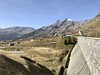
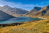
The above images may not be of the site on this page, but were taken nearby. They are loaded from Flickr so please click on them for image credits.
Click here to see more info for this site
Nearby sites
Click here to view sites on an interactive map of the areaKey: Red: member's photo, Blue: 3rd party photo, Yellow: other image, Green: no photo - please go there and take one, Grey: site destroyed
Download sites to:
KML (Google Earth)
GPX (GPS waypoints)
CSV (Garmin/Navman)
CSV (Excel)
To unlock full downloads you need to sign up as a Contributory Member. Otherwise downloads are limited to 50 sites.
Turn off the page maps and other distractions
Nearby sites listing. In the following links * = Image available
1.8km SSE 168° Val Sterla* Rock Art
3.5km SSW 201° I sassi del Camanin* Rock Art
4.9km SSW 201° Sass del Pariuliin* Rock Art
13.9km SW 231° Mesocco-Andergia Lepontische Stele Sculptured Stone
14.1km NNE 17° Anselmo Gadola Collection* Museum
15.8km SSE 162° Dasile* Rock Art
16.8km S 169° Parco Marmitte dei Giganti* Ancient Mine, Quarry or other Industry
18.1km SE 138° Sasc di Pè (Foot soles slab)* Rock Art
21.9km SE 132° Masso-Avello Stampa* NOT SET
22.1km SSE 157° Cairns at St Moritz* Cairn
23.2km NE 55° Tinizong Senslas Rock Art
25.5km NNE 15° Carschenna* Rock Art
26.4km ESE 108° Maloja Stone with ornaments* Rock Art
26.4km ESE 108° Maloja Mortar Stone* Rock Art
28.0km SW 216° Capèla dèla Riva Rock Art
28.0km SW 216° Sass de l'Orch Wackelstein Rock Art
28.1km SW 217° Verdabbio Schalensteingebiet* Rock Art
29.1km SSW 213° Sass Pagan (Pagan stone)* Rock Art
29.2km N 8° Cazis Petrushügel* Ancient Village or Settlement
31.8km SW 216° Carasole San Rocco* Rock Art
36.1km SW 229° Claro sito preistorico Standing Stone (Menhir)
36.6km E 85° Druidenstein St. Moritz* Natural Stone / Erratic / Other Natural Feature
37.0km NNW 343° Crap de Pops Natural Stone / Erratic / Other Natural Feature
37.3km NNW 338° Crest la Cuppa Rock Art
37.3km NNW 338° Ruschein Schalenstein Rock Art
View more nearby sites and additional images


 We would like to know more about this location. Please feel free to add a brief description and any relevant information in your own language.
 Wir möchten mehr über diese Stätte erfahren. Bitte zögern Sie nicht, eine kurze Beschreibung und relevante Informationen in Deutsch hinzuzufügen.
 Nous aimerions en savoir encore un peu sur les lieux. S'il vous plaît n'hesitez pas à ajouter une courte description et tous les renseignements pertinents dans votre propre langue.
 Quisieramos informarnos un poco más de las lugares. No dude en añadir una breve descripción y otros datos relevantes en su propio idioma.