

<< Text Pages >> Capo-Castinco menhirs - Sculptured Stone in France in Corsica:Corse-nord (2B)
Submitted by TheCaptain on Wednesday, 08 September 2010 Page Views: 2707
Multi-periodSite Name: Capo-Castinco menhirsCountry: France
NOTE: This site is 0.951 km away from the location you searched for.
Département: Corsica:Corse-nord (2B) Type: Sculptured Stone
Nearest Town: Bastia Nearest Village: Santo Pietro-di-Tenda
Latitude: 42.604000N Longitude: 9.258000E
Condition:
| 5 | Perfect |
| 4 | Almost Perfect |
| 3 | Reasonable but with some damage |
| 2 | Ruined but still recognisable as an ancient site |
| 1 | Pretty much destroyed, possibly visible as crop marks |
| 0 | No data. |
| -1 | Completely destroyed |
| 5 | Superb |
| 4 | Good |
| 3 | Ordinary |
| 2 | Not Good |
| 1 | Awful |
| 0 | No data. |
| 5 | Can be driven to, probably with disabled access |
| 4 | Short walk on a footpath |
| 3 | Requiring a bit more of a walk |
| 2 | A long walk |
| 1 | In the middle of nowhere, a nightmare to find |
| 0 | No data. |
| 5 | co-ordinates taken by GPS or official recorded co-ordinates |
| 4 | co-ordinates scaled from a detailed map |
| 3 | co-ordinates scaled from a bad map |
| 2 | co-ordinates of the nearest village |
| 1 | co-ordinates of the nearest town |
| 0 | no data |
Be the first person to rate this site - see the 'Contribute!' box in the right hand menu.
Internal Links:
External Links:
statue-menhirs in Corse:Corse-nord (2B)
Capo-Castinco menhirs is a group of four statue menhirs in the community of Santo Pietro-di-Tenda, Departement of Haute-Corse, Region of Corse
You may be viewing yesterday's version of this page. To see the most up to date information please register for a free account.
Do not use the above information on other web sites or publications without permission of the contributor.
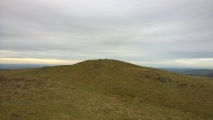
Nearby Images from Flickr
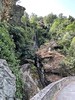
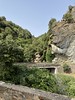
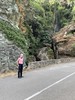
The above images may not be of the site on this page, but were taken nearby. They are loaded from Flickr so please click on them for image credits.
Click here to see more info for this site
Nearby sites
Click here to view sites on an interactive map of the areaKey: Red: member's photo, Blue: 3rd party photo, Yellow: other image, Green: no photo - please go there and take one, Grey: site destroyed
Download sites to:
KML (Google Earth)
GPX (GPS waypoints)
CSV (Garmin/Navman)
CSV (Excel)
To unlock full downloads you need to sign up as a Contributory Member. Otherwise downloads are limited to 50 sites.
Turn off the page maps and other distractions
Nearby sites listing. In the following links * = Image available
111m N 0° Pivanso coffre Burial Chamber or Dolmen
138m NW 324° Aghiola coffre Burial Chamber or Dolmen
164m W 270° Aghiola stone circle Stone Circle
3.5km SE 135° Buccentone menhir Sculptured Stone
3.5km SE 134° Murello menhir* Sculptured Stone
3.5km SE 136° Piève statues-menhirs* Sculptured Stone
3.5km SE 136° Murello coffre Burial Chamber or Dolmen
3.6km SE 133° Murtola menhir Sculptured Stone
3.6km SE 135° Plan di Natu coffres Burial Chamber or Dolmen
3.8km ESE 114° E Laure Burial Chamber or Dolmen
5.9km WNW 293° U Zitellu statue-menhir Sculptured Stone
7.2km N 3° Village Néolithique de Cima di Suarelle Ancient Village or Settlement
7.2km N 4° Dolmen de la Casa di l'Urca Burial Chamber or Dolmen
7.3km N 2° Menhir de Celluccia Standing Stone (Menhir)
7.3km N 2° Dolmen de Celluccia Burial Chamber or Dolmen
7.4km N 0° Cists de la Casa di l'Urcu Cist
7.4km N 0° Casa di l'Urcu Alignement Stone Row / Alignment
7.4km N 0° Dolmen de la Casa di l'Urcu* Burial Chamber or Dolmen
7.5km N 0° Monte Revincu stone circle Stone Circle
7.8km WSW 246° E Culonne menhirs Standing Stones
12.9km NE 47° U Nativu statue-menhir 2 Sculptured Stone
13.5km NE 39° U Nativu statue-menhir* Sculptured Stone
15.1km SSE 159° Campu di Buono coffres Burial Chamber or Dolmen
20.8km NNE 22° Grotta Scritta Rock Art
21.3km WSW 246° Dolmens d'Olmi-Cappella Burial Chamber or Dolmen
View more nearby sites and additional images


 We would like to know more about this location. Please feel free to add a brief description and any relevant information in your own language.
 Wir möchten mehr über diese Stätte erfahren. Bitte zögern Sie nicht, eine kurze Beschreibung und relevante Informationen in Deutsch hinzuzufügen.
 Nous aimerions en savoir encore un peu sur les lieux. S'il vous plaît n'hesitez pas à ajouter une courte description et tous les renseignements pertinents dans votre propre langue.
 Quisieramos informarnos un poco más de las lugares. No dude en añadir una breve descripción y otros datos relevantes en su propio idioma.