


<< Our Photo Pages >> Jellinge Rundhøj - Round Barrow(s) in Denmark in Syddanmark
Submitted by Podovsky on Saturday, 24 August 2019 Page Views: 454
Neolithic and Bronze AgeSite Name: Jellinge RundhøjCountry: Denmark
NOTE: This site is 9.817 km away from the location you searched for.
County: Syddanmark Type: Round Barrow(s)
Nearest Town: Vejle Nearest Village: Jelling
Latitude: 55.748362N Longitude: 9.412807E
Condition:
| 5 | Perfect |
| 4 | Almost Perfect |
| 3 | Reasonable but with some damage |
| 2 | Ruined but still recognisable as an ancient site |
| 1 | Pretty much destroyed, possibly visible as crop marks |
| 0 | No data. |
| -1 | Completely destroyed |
| 5 | Superb |
| 4 | Good |
| 3 | Ordinary |
| 2 | Not Good |
| 1 | Awful |
| 0 | No data. |
| 5 | Can be driven to, probably with disabled access |
| 4 | Short walk on a footpath |
| 3 | Requiring a bit more of a walk |
| 2 | A long walk |
| 1 | In the middle of nowhere, a nightmare to find |
| 0 | No data. |
| 5 | co-ordinates taken by GPS or official recorded co-ordinates |
| 4 | co-ordinates scaled from a detailed map |
| 3 | co-ordinates scaled from a bad map |
| 2 | co-ordinates of the nearest village |
| 1 | co-ordinates of the nearest town |
| 0 | no data |
Internal Links:
External Links:
I have visited· I would like to visit
Podovsky saw from a distance on 24th Aug 2019 - their rating: Cond: 5 Access: 4
")
Danish registry 170904-26
You may be viewing yesterday's version of this page. To see the most up to date information please register for a free account.
Do not use the above information on other web sites or publications without permission of the contributor.
Nearby Images from Flickr
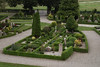
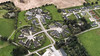
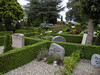
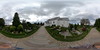
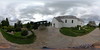
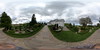
The above images may not be of the site on this page, but were taken nearby. They are loaded from Flickr so please click on them for image credits.
Click here to see more info for this site
Nearby sites
Click here to view sites on an interactive map of the areaKey: Red: member's photo, Blue: 3rd party photo, Yellow: other image, Green: no photo - please go there and take one, Grey: site destroyed
Download sites to:
KML (Google Earth)
GPX (GPS waypoints)
CSV (Garmin/Navman)
CSV (Excel)
To unlock full downloads you need to sign up as a Contributory Member. Otherwise downloads are limited to 50 sites.
Turn off the page maps and other distractions
Nearby sites listing. In the following links * = Image available
496m S 177° Faarup Rundhøj* Round Barrow(s)
944m NNE 25° Jelling Rundhøj 2* Round Barrow(s)
983m NNE 31° Jelling - 1913 Commemorative Monument* Modern Stone Circle etc
1.0km NNE 25° Jelling Runesten* Carving
1.0km NNE 19° Kongernes Jelling Museum* Museum
1.1km NNE 25° Jelling Rundhøj 1* Round Barrow(s)
1.2km NNE 25° Jelling Skibssætning* Stone Circle
3.6km SSE 167° Haraldshøj Rundhøj* Round Barrow(s)
11.2km ESE 112° Bredballe Nørreskov Runddysse Burial Chamber or Dolmen
15.8km ESE 103° Assendrup Jættestue Passage Grave
16.1km SW 231° Store Rygbjerg Runesten* Carving
16.3km SSW 206° Egtved Girl Barrow* Barrow Cemetery
19.4km ESE 103° Daugård Jættestue Passage Grave
19.5km ESE 118° Brejning Trindhøj Round Barrow(s)
20.6km E 98° Daugård Langdysse Long Barrow
21.2km ESE 107° Ullerup Skov Stenkiste Cist
24.0km WSW 241° Vorbasse Nørresøgård Langdysse* Long Barrow
24.3km ESE 107° Stouby Runddysse Burial Chamber or Dolmen
24.5km SW 222° Hamborggårdstenen* Natural Stone / Erratic / Other Natural Feature
24.8km SW 228° Bække Langdysse Long Barrow
25.0km ENE 73° Oens Skov Runddysse Burial Chamber or Dolmen
25.0km SW 222° Bække Skibssætning* Stone Circle
25.7km SSE 163° Eltang Sletteskov Langdysse Long Barrow
25.9km SW 230° Vorbasse Langdysse* Long Barrow
26.2km SW 230° Vorbasse Runddysse* Burial Chamber or Dolmen
View more nearby sites and additional images


 We would like to know more about this location. Please feel free to add a brief description and any relevant information in your own language.
 Wir möchten mehr über diese Stätte erfahren. Bitte zögern Sie nicht, eine kurze Beschreibung und relevante Informationen in Deutsch hinzuzufügen.
 Nous aimerions en savoir encore un peu sur les lieux. S'il vous plaît n'hesitez pas à ajouter une courte description et tous les renseignements pertinents dans votre propre langue.
 Quisieramos informarnos un poco más de las lugares. No dude en añadir una breve descripción y otros datos relevantes en su propio idioma.