


<< Our Photo Pages >> Ura 'e Sole Nuraghe - Broch or Nuraghe in Italy in Sardinia (Sardegna)
Submitted by SolarMegalith on Sunday, 23 October 2022 Page Views: 367
Neolithic and Bronze AgeSite Name: Ura 'e Sole Nuraghe Alternative Name: Nuraghe Bruncu NuraxiCountry: Italy
NOTE: This site is 2.595 km away from the location you searched for.
Region: Sardinia (Sardegna) Type: Broch or Nuraghe
Nearest Town: Desulo
Latitude: 40.027681N Longitude: 9.238111E
Condition:
| 5 | Perfect |
| 4 | Almost Perfect |
| 3 | Reasonable but with some damage |
| 2 | Ruined but still recognisable as an ancient site |
| 1 | Pretty much destroyed, possibly visible as crop marks |
| 0 | No data. |
| -1 | Completely destroyed |
| 5 | Superb |
| 4 | Good |
| 3 | Ordinary |
| 2 | Not Good |
| 1 | Awful |
| 0 | No data. |
| 5 | Can be driven to, probably with disabled access |
| 4 | Short walk on a footpath |
| 3 | Requiring a bit more of a walk |
| 2 | A long walk |
| 1 | In the middle of nowhere, a nightmare to find |
| 0 | No data. |
| 5 | co-ordinates taken by GPS or official recorded co-ordinates |
| 4 | co-ordinates scaled from a detailed map |
| 3 | co-ordinates scaled from a bad map |
| 2 | co-ordinates of the nearest village |
| 1 | co-ordinates of the nearest town |
| 0 | no data |
Internal Links:
External Links:
I have visited· I would like to visit
SolarMegalith visited on 23rd Sep 2022 - their rating: Cond: 2 Amb: 4 Access: 5
")
Nuraghe Ura 'e Sole (known also as Bruncu Nuraxi) is the highest-located nuraghe in Sardinia (1331m of altitude). The structure survived in very poor condition, currently it is visible as a mound of debris with scarcely visible remains of walling. The size of the mound indicates it could have been a complex nuraghe.
You may be viewing yesterday's version of this page. To see the most up to date information please register for a free account.
")
")
")
Do not use the above information on other web sites or publications without permission of the contributor.
Nearby Images from Flickr
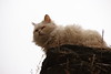

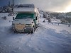
The above images may not be of the site on this page, but were taken nearby. They are loaded from Flickr so please click on them for image credits.
Click here to see more info for this site
Nearby sites
Click here to view sites on an interactive map of the areaKey: Red: member's photo, Blue: 3rd party photo, Yellow: other image, Green: no photo - please go there and take one, Grey: site destroyed
Download sites to:
KML (Google Earth)
GPX (GPS waypoints)
CSV (Garmin/Navman)
CSV (Excel)
To unlock full downloads you need to sign up as a Contributory Member. Otherwise downloads are limited to 50 sites.
Turn off the page maps and other distractions
Nearby sites listing. In the following links * = Image available
7.3km SSE 151° Sa Tanchitta Tomba di Giganti* Chambered Tomb
7.4km SSE 152° Girgini Nuraghe* Broch or Nuraghe
8.1km NNW 345° Perdas Fittas* Standing Stones
8.6km NNW 331° S'Abba Bogada Domus de Janas* Rock Cut Tomb
8.9km SW 226° Lagosu Domus de Janas* Rock Cut Tomb
9.5km SW 234° Nadalia Domus de Janas* Rock Cut Tomb
9.5km NNE 15° Biacceddu Nuraghe* Broch or Nuraghe
9.8km SW 215° Antonitzo Domus de Janas* Rock Cut Tomb
10.6km NW 311° Mancosu Domus de Janas* Rock Cut Tomb
10.7km N 356° Orrui Menhir* Standing Stone (Menhir)
10.7km S 179° Seilatzu Domus de Janas* Rock Cut Tomb
11.0km N 10° Flumene de Bidda Domus de Janas* Rock Cut Tomb
11.1km NNE 12° Gariunele Domus de Janas* Rock Cut Tomb
11.3km NNW 345° Littoleri Nuraghe* Broch or Nuraghe
11.8km N 355° San Michele* Holed Stone
11.9km N 11° Dronnoro Domus de Janas* Rock Cut Tomb
11.9km NNE 11° Dronnoro Nuraghe* Broch or Nuraghe
12.0km NNE 11° Dronnoro Tomba di Giganti* Chambered Tomb
12.4km NE 44° Gremanu Complesso Nuragico* Ancient Temple
12.6km NNW 341° Gusana* Standing Stone (Menhir)
12.7km N 7° Tramassunele Standing Stones
13.0km N 358° Su Gardosu Tomba di Giganti* Chambered Tomb
13.0km NE 38° Madau IV Tomba di Giganti* Chambered Tomb
13.0km NE 37° Madau II Tomba di Giganti* Chambered Tomb
13.0km NE 38° Madau I Tomba di Giganti* Chambered Tomb
View more nearby sites and additional images


 We would like to know more about this location. Please feel free to add a brief description and any relevant information in your own language.
 Wir möchten mehr über diese Stätte erfahren. Bitte zögern Sie nicht, eine kurze Beschreibung und relevante Informationen in Deutsch hinzuzufügen.
 Nous aimerions en savoir encore un peu sur les lieux. S'il vous plaît n'hesitez pas à ajouter une courte description et tous les renseignements pertinents dans votre propre langue.
 Quisieramos informarnos un poco más de las lugares. No dude en añadir una breve descripción y otros datos relevantes en su propio idioma.