


<< Text Pages >> Crap de Tiranns - Rock Art in Switzerland in Graubünden
Submitted by AlexHunger on Saturday, 18 February 2006 Page Views: 2976
Rock ArtSite Name: Crap de Tiranns Alternative Name: TyrannensteinCountry: Switzerland
NOTE: This site is 0.227 km away from the location you searched for.
Canton: Graubünden Type: Rock Art
Nearest Town: Luzern Nearest Village: Ruschein
Latitude: 46.783130N Longitude: 9.186300E
Condition:
| 5 | Perfect |
| 4 | Almost Perfect |
| 3 | Reasonable but with some damage |
| 2 | Ruined but still recognisable as an ancient site |
| 1 | Pretty much destroyed, possibly visible as crop marks |
| 0 | No data. |
| -1 | Completely destroyed |
| 5 | Superb |
| 4 | Good |
| 3 | Ordinary |
| 2 | Not Good |
| 1 | Awful |
| 0 | No data. |
| 5 | Can be driven to, probably with disabled access |
| 4 | Short walk on a footpath |
| 3 | Requiring a bit more of a walk |
| 2 | A long walk |
| 1 | In the middle of nowhere, a nightmare to find |
| 0 | No data. |
| 5 | co-ordinates taken by GPS or official recorded co-ordinates |
| 4 | co-ordinates scaled from a detailed map |
| 3 | co-ordinates scaled from a bad map |
| 2 | co-ordinates of the nearest village |
| 1 | co-ordinates of the nearest town |
| 0 | no data |
Internal Links:
External Links:
Cuphole stone in Graubünden
Positional co-ordinates scaled from a map source. Natural stone with cup holes on Collina Prehistorica Plontabuora
You may be viewing yesterday's version of this page. To see the most up to date information please register for a free account.
Do not use the above information on other web sites or publications without permission of the contributor.
Nearby Images from Flickr
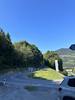
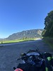
The above images may not be of the site on this page, but were taken nearby. They are loaded from Flickr so please click on them for image credits.
Click here to see more info for this site
Nearby sites
Click here to view sites on an interactive map of the areaKey: Red: member's photo, Blue: 3rd party photo, Yellow: other image, Green: no photo - please go there and take one, Grey: site destroyed
Download sites to:
KML (Google Earth)
GPX (GPS waypoints)
CSV (Garmin/Navman)
CSV (Excel)
To unlock full downloads you need to sign up as a Contributory Member. Otherwise downloads are limited to 50 sites.
Turn off the page maps and other distractions
Nearby sites listing. In the following links * = Image available
316m ENE 69° Ruschein Schalenstein Rock Art
322m ENE 74° Crest la Cuppa Rock Art
3.1km ENE 75° Crap de Pops Natural Stone / Erratic / Other Natural Feature
4.2km ENE 65° Falera Vorgeschichtliche Siedlung* Ancient Village or Settlement
4.2km ENE 64° Falera Menhirfeld* Stone Row / Alignment
18.8km ESE 107° Cazis Petrushügel* Ancient Village or Settlement
23.1km ESE 115° Carschenna* Rock Art
27.4km ENE 75° Rätisches Museum Museum
27.4km ENE 75° Präz Lepontische Stele Sculptured Stone
27.4km ENE 75° Sietschen Lepontische Stele* Sculptured Stone
27.4km ENE 75° Davesco-Soragno Lepontische Stelen* Sculptured Stone
27.4km ENE 75° Urmein Schalensteine* Rock Art
27.4km ENE 75° Stabio Lepontische Stelen Sculptured Stone
27.4km ENE 75° Mesocco-Benabbia Lepontische Stele* Sculptured Stone
28.0km SE 139° Anselmo Gadola Collection* Museum
31.5km W 260° Fuorcla da Strem Sut* Ancient Mine, Quarry or other Industry
32.0km ENE 56° Untervaz Druidenstein Rock Art
33.4km N 8° Seebenalp Hinkelstein * Standing Stone (Menhir)
35.8km NNE 32° Oberprod Schalenstein Rock Art
37.3km SSE 158° La Corte* Rock Art
39.1km SSE 158° Val Sterla* Rock Art
39.2km ESE 122° Tinizong Senslas Rock Art
39.4km NE 37° Gutenberg Prehistoric Settlements* Ancient Village or Settlement
39.9km SSE 161° I sassi del Camanin* Rock Art
41.0km SSE 162° Sass del Pariuliin* Rock Art
View more nearby sites and additional images


 We would like to know more about this location. Please feel free to add a brief description and any relevant information in your own language.
 Wir möchten mehr über diese Stätte erfahren. Bitte zögern Sie nicht, eine kurze Beschreibung und relevante Informationen in Deutsch hinzuzufügen.
 Nous aimerions en savoir encore un peu sur les lieux. S'il vous plaît n'hesitez pas à ajouter une courte description et tous les renseignements pertinents dans votre propre langue.
 Quisieramos informarnos un poco más de las lugares. No dude en añadir una breve descripción y otros datos relevantes en su propio idioma.