

<< Text Pages >> Mammughine Nuraghe - Broch or Nuraghe in Italy in Sardinia (Sardegna)
Submitted by SolarMegalith on Sunday, 28 October 2012 Page Views: 1345
Neolithic and Bronze AgeSite Name: Mammughine NuragheCountry: Italy
NOTE: This site is 2.294 km away from the location you searched for.
Region: Sardinia (Sardegna) Type: Broch or Nuraghe
Nearest Village: Lodine
Latitude: 40.155788N Longitude: 9.220429E
Condition:
| 5 | Perfect |
| 4 | Almost Perfect |
| 3 | Reasonable but with some damage |
| 2 | Ruined but still recognisable as an ancient site |
| 1 | Pretty much destroyed, possibly visible as crop marks |
| 0 | No data. |
| -1 | Completely destroyed |
| 5 | Superb |
| 4 | Good |
| 3 | Ordinary |
| 2 | Not Good |
| 1 | Awful |
| 0 | No data. |
| 5 | Can be driven to, probably with disabled access |
| 4 | Short walk on a footpath |
| 3 | Requiring a bit more of a walk |
| 2 | A long walk |
| 1 | In the middle of nowhere, a nightmare to find |
| 0 | No data. |
| 5 | co-ordinates taken by GPS or official recorded co-ordinates |
| 4 | co-ordinates scaled from a detailed map |
| 3 | co-ordinates scaled from a bad map |
| 2 | co-ordinates of the nearest village |
| 1 | co-ordinates of the nearest town |
| 0 | no data |
Internal Links:
External Links:
Nuraghe in Sardinia (Sardegna)
Nuraghe Mammughine is located near a farmstead, about 1 km north of Lodine.
You may be viewing yesterday's version of this page. To see the most up to date information please register for a free account.
Do not use the above information on other web sites or publications without permission of the contributor.
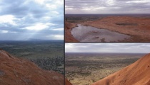
Nearby Images from Flickr
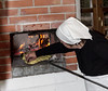
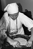

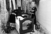
The above images may not be of the site on this page, but were taken nearby. They are loaded from Flickr so please click on them for image credits.
Click here to see more info for this site
Nearby sites
Click here to view sites on an interactive map of the areaKey: Red: member's photo, Blue: 3rd party photo, Yellow: other image, Green: no photo - please go there and take one, Grey: site destroyed
Download sites to:
KML (Google Earth)
GPX (GPS waypoints)
CSV (Garmin/Navman)
CSV (Excel)
To unlock full downloads you need to sign up as a Contributory Member. Otherwise downloads are limited to 50 sites.
Turn off the page maps and other distractions
Nearby sites listing. In the following links * = Image available
1.7km SE 142° Su Gardosu Tomba di Giganti* Chambered Tomb
2.5km S 171° San Michele* Holed Stone
2.8km ENE 76° Castrulongu Protonuraghe Broch or Nuraghe
3.2km NE 36° Talaighe Nuraghe* Broch or Nuraghe
3.5km SW 228° Gusana* Standing Stone (Menhir)
3.5km ESE 118° Tramassunele Standing Stones
3.6km SSW 203° Littoleri Nuraghe* Broch or Nuraghe
3.7km SSE 168° Orrui Menhir* Standing Stone (Menhir)
3.9km ENE 72° Sa Perda'e s'Itria Menhir* Standing Stone (Menhir)
4.5km SE 124° Dronnoro Domus de Janas* Rock Cut Tomb
4.5km E 92° Bidistili Tomba di Giganti* Chambered Tomb
4.6km ESE 123° Dronnoro Tomba di Giganti* Chambered Tomb
4.6km ESE 123° Dronnoro Nuraghe* Broch or Nuraghe
4.9km SE 135° Flumene de Bidda Domus de Janas* Rock Cut Tomb
5.1km SE 132° Gariunele Domus de Janas* Rock Cut Tomb
6.4km SE 142° Biacceddu Nuraghe* Broch or Nuraghe
6.5km NNE 20° Monte Giuradu Nuraghe* Broch or Nuraghe
6.5km S 185° Perdas Fittas* Standing Stones
7.2km SSW 201° S'Abba Bogada Domus de Janas* Rock Cut Tomb
7.3km NNE 21° Monte Juradu menhir* Standing Stone (Menhir)
7.4km NE 55° Istevene Domus de Janas Rock Cut Tomb
7.5km NE 41° Badu Carru Menhirs* Standing Stones
8.1km NE 37° S'Eredadu Menhir* Standing Stone (Menhir)
8.1km NE 37° S'Eredadu Domus de Janas* Rock Cut Tomb
8.1km NW 308° Ludurioe Nuraghe Broch or Nuraghe
View more nearby sites and additional images


 We would like to know more about this location. Please feel free to add a brief description and any relevant information in your own language.
 Wir möchten mehr über diese Stätte erfahren. Bitte zögern Sie nicht, eine kurze Beschreibung und relevante Informationen in Deutsch hinzuzufügen.
 Nous aimerions en savoir encore un peu sur les lieux. S'il vous plaît n'hesitez pas à ajouter une courte description et tous les renseignements pertinents dans votre propre langue.
 Quisieramos informarnos un poco más de las lugares. No dude en añadir una breve descripción y otros datos relevantes en su propio idioma.