


<< Our Photo Pages >> Ringwall Altenburg Römersberg - Hillfort in Germany in Hesse
Submitted by KaiHofmann on Thursday, 04 January 2018 Page Views: 901
Iron Age and Later PrehistorySite Name: Ringwall Altenburg RömersbergCountry: Germany Land: Hesse Type: Hillfort
Nearest Town: Borken Nearest Village: Römersberg
Latitude: 51.044782N Longitude: 9.211079E
Condition:
| 5 | Perfect |
| 4 | Almost Perfect |
| 3 | Reasonable but with some damage |
| 2 | Ruined but still recognisable as an ancient site |
| 1 | Pretty much destroyed, possibly visible as crop marks |
| 0 | No data. |
| -1 | Completely destroyed |
| 5 | Superb |
| 4 | Good |
| 3 | Ordinary |
| 2 | Not Good |
| 1 | Awful |
| 0 | No data. |
| 5 | Can be driven to, probably with disabled access |
| 4 | Short walk on a footpath |
| 3 | Requiring a bit more of a walk |
| 2 | A long walk |
| 1 | In the middle of nowhere, a nightmare to find |
| 0 | No data. |
| 5 | co-ordinates taken by GPS or official recorded co-ordinates |
| 4 | co-ordinates scaled from a detailed map |
| 3 | co-ordinates scaled from a bad map |
| 2 | co-ordinates of the nearest village |
| 1 | co-ordinates of the nearest town |
| 0 | no data |
Internal Links:
External Links:
")
500m to 200m tall Hallstatt age hillfort (700 BCE). Many iron age artifacts has been found.
You may be viewing yesterday's version of this page. To see the most up to date information please register for a free account.
")
")
Do not use the above information on other web sites or publications without permission of the contributor.
Nearby Images from Flickr
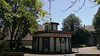

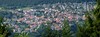
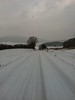
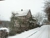

The above images may not be of the site on this page, but were taken nearby. They are loaded from Flickr so please click on them for image credits.
Click here to see more info for this site
Nearby sites
Click here to view sites on an interactive map of the areaKey: Red: member's photo, Blue: 3rd party photo, Yellow: other image, Green: no photo - please go there and take one, Grey: site destroyed
Download sites to:
KML (Google Earth)
GPX (GPS waypoints)
CSV (Garmin/Navman)
CSV (Excel)
To unlock full downloads you need to sign up as a Contributory Member. Otherwise downloads are limited to 50 sites.
Turn off the page maps and other distractions
Nearby sites listing. In the following links * = Image available
13.7km NNE 29° Hilgenstein (Werkel)* Standing Stone (Menhir)
14.5km N 8° Züschen Galeriegrab* Chambered Tomb
14.6km N 7° Züschen (2) Passage Grave
15.1km NNE 18° Flur Wehrengrab Passage Grave
16.7km N 7° Ringwall Hinterberg* Hillfort
16.9km N 0° Riesenstein (Heiligenberg)* Rock Outcrop
17.2km NNE 24° Gleichen Passage Grave
17.3km NE 40° Wodanstein in Maden* Standing Stone (Menhir)
17.6km NNE 22° Wartberg Hillfort
18.3km N 358° Altendorf Passage Grave
19.7km SSW 193° Hügelgrab von Wiera* Round Barrow(s)
20.7km NW 313° Wellen Menhir* Standing Stone (Menhir)
20.8km NNE 28° Lautariusgrab* Chambered Tomb
22.2km NE 44° Haldorf Hügelgräber Barrow Cemetery
22.6km S 174° Wippchensteine Natural Stone / Erratic / Other Natural Feature
22.7km NW 311° Huenselburg* Hillfort
22.9km SSE 165° Metzenberg* Hillfort
23.0km NE 42° Haldorf Menhir* Standing Stone (Menhir)
23.1km NE 45° Riesenstein von Wolfershausen* Standing Stone (Menhir)
23.2km NNE 14° Grüne Platte Hillfort
24.9km NNE 25° Burgberg Hillfort Hillfort
25.1km NNE 33° Hertingshausen Menhir* Standing Stone (Menhir)
26.3km NNE 29° Hünstein Grossenritte* Standing Stone (Menhir)
26.7km NE 40° Guntershausen Riesenstein Standing Stone (Menhir)
29.5km SW 217° Langenstein in Langenstein* Standing Stone (Menhir)
View more nearby sites and additional images


 We would like to know more about this location. Please feel free to add a brief description and any relevant information in your own language.
 Wir möchten mehr über diese Stätte erfahren. Bitte zögern Sie nicht, eine kurze Beschreibung und relevante Informationen in Deutsch hinzuzufügen.
 Nous aimerions en savoir encore un peu sur les lieux. S'il vous plaît n'hesitez pas à ajouter une courte description et tous les renseignements pertinents dans votre propre langue.
 Quisieramos informarnos un poco más de las lugares. No dude en añadir una breve descripción y otros datos relevantes en su propio idioma.