


<< Text Pages >> Capèla dèla Riva - Rock Art in Switzerland in Graubünden
Submitted by AlexHunger on Saturday, 18 February 2006 Page Views: 3010
Rock ArtSite Name: Capèla dèla RivaCountry: Switzerland
NOTE: This site is 0.503 km away from the location you searched for.
Canton: Graubünden Type: Rock Art
Nearest Town: Luzern Nearest Village: Verdabbio
Latitude: 46.268440N Longitude: 9.160650E
Condition:
| 5 | Perfect |
| 4 | Almost Perfect |
| 3 | Reasonable but with some damage |
| 2 | Ruined but still recognisable as an ancient site |
| 1 | Pretty much destroyed, possibly visible as crop marks |
| 0 | No data. |
| -1 | Completely destroyed |
| 5 | Superb |
| 4 | Good |
| 3 | Ordinary |
| 2 | Not Good |
| 1 | Awful |
| 0 | No data. |
| 5 | Can be driven to, probably with disabled access |
| 4 | Short walk on a footpath |
| 3 | Requiring a bit more of a walk |
| 2 | A long walk |
| 1 | In the middle of nowhere, a nightmare to find |
| 0 | No data. |
| 5 | co-ordinates taken by GPS or official recorded co-ordinates |
| 4 | co-ordinates scaled from a detailed map |
| 3 | co-ordinates scaled from a bad map |
| 2 | co-ordinates of the nearest village |
| 1 | co-ordinates of the nearest town |
| 0 | no data |
Internal Links:
External Links:
I have visited· I would like to visit
Megalithic89 visited on 23rd May 2022 - their rating: Cond: 4 Amb: 4 Access: 4
You may be viewing yesterday's version of this page. To see the most up to date information please register for a free account.
")
")
Do not use the above information on other web sites or publications without permission of the contributor.
Nearby Images from Flickr

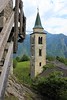
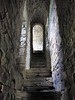
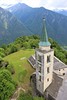
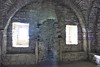
The above images may not be of the site on this page, but were taken nearby. They are loaded from Flickr so please click on them for image credits.
Click here to see more info for this site
Nearby sites
Click here to view sites on an interactive map of the areaKey: Red: member's photo, Blue: 3rd party photo, Yellow: other image, Green: no photo - please go there and take one, Grey: site destroyed
Download sites to:
KML (Google Earth)
GPX (GPS waypoints)
CSV (Garmin/Navman)
CSV (Excel)
To unlock full downloads you need to sign up as a Contributory Member. Otherwise downloads are limited to 50 sites.
Turn off the page maps and other distractions
Nearby sites listing. In the following links * = Image available
367m WNW 297° Sass de l'Orch Wackelstein Rock Art
594m WNW 296° Verdabbio Schalensteingebiet* Rock Art
1.8km SSE 165° Sass Pagan (Pagan stone)* Rock Art
3.9km SW 221° Carasole San Rocco* Rock Art
11.0km W 264° Claro sito preistorico Standing Stone (Menhir)
15.0km NNE 21° Mesocco-Andergia Lepontische Stele Sculptured Stone
20.4km ENE 72° Parco Marmitte dei Giganti* Ancient Mine, Quarry or other Industry
22.6km ENE 70° Dasile* Rock Art
23.2km NE 38° Sass del Pariuliin* Rock Art
24.5km NE 37° I sassi del Camanin* Rock Art
25.1km E 84° Cairns at St Moritz* Cairn
26.8km NE 38° Val Sterla* Rock Art
26.9km WSW 253° Sass di Cent Cros Rock Art
27.1km WSW 240° Ragno massi cuppellari* Rock Art
27.4km SW 223° Mezzovico-Vira Lepontische Stele* Sculptured Stone
27.5km SSW 209° Dino Lepontische Stele Sculptured Stone
28.0km NE 35° La Corte* Rock Art
28.1km SW 215° Ponte Capriasca Lepontische Stele Sculptured Stone
28.4km WSW 240° Vira Gambarogno Lepontische Stele* Sculptured Stone
29.9km ENE 72° Sasc di Pè (Foot soles slab)* Rock Art
30.1km SW 216° San Zenone Schalenstein* Rock Art
30.3km WSW 249° Mezzovico-Vira Lepontische Stelen Sculptured Stone
30.4km SSW 208° Pregassona Lepontische Stele Sculptured Stone
31.3km WSW 250° Locarno Schalenstein Rock Art
32.2km SSW 204° Sasso della Predescia Rock Art
View more nearby sites and additional images


 We would like to know more about this location. Please feel free to add a brief description and any relevant information in your own language.
 Wir möchten mehr über diese Stätte erfahren. Bitte zögern Sie nicht, eine kurze Beschreibung und relevante Informationen in Deutsch hinzuzufügen.
 Nous aimerions en savoir encore un peu sur les lieux. S'il vous plaît n'hesitez pas à ajouter une courte description et tous les renseignements pertinents dans votre propre langue.
 Quisieramos informarnos un poco más de las lugares. No dude en añadir una breve descripción y otros datos relevantes en su propio idioma.