


<< Text Pages >> Monte Acuto Dolmen - Burial Chamber or Dolmen in Italy in Sardinia (Sardegna)
Submitted by SolarMegalith on Monday, 20 September 2010 Page Views: 2323
Neolithic and Bronze AgeSite Name: Monte Acuto DolmenCountry: Italy
NOTE: This site is 2.727 km away from the location you searched for.
Region: Sardinia (Sardegna) Type: Burial Chamber or Dolmen
Nearest Town: Berchidda
Latitude: 40.775860N Longitude: 9.135820E
Condition:
| 5 | Perfect |
| 4 | Almost Perfect |
| 3 | Reasonable but with some damage |
| 2 | Ruined but still recognisable as an ancient site |
| 1 | Pretty much destroyed, possibly visible as crop marks |
| 0 | No data. |
| -1 | Completely destroyed |
| 5 | Superb |
| 4 | Good |
| 3 | Ordinary |
| 2 | Not Good |
| 1 | Awful |
| 0 | No data. |
| 5 | Can be driven to, probably with disabled access |
| 4 | Short walk on a footpath |
| 3 | Requiring a bit more of a walk |
| 2 | A long walk |
| 1 | In the middle of nowhere, a nightmare to find |
| 0 | No data. |
| 5 | co-ordinates taken by GPS or official recorded co-ordinates |
| 4 | co-ordinates scaled from a detailed map |
| 3 | co-ordinates scaled from a bad map |
| 2 | co-ordinates of the nearest village |
| 1 | co-ordinates of the nearest town |
| 0 | no data |
Internal Links:
External Links:
Dolmen di Monte Acuto is not in perfect state anymore, however large upright stones are still impressive.
It's a Neolithic monument connected with Ozieri culture, the main Neolithic culture of Sardinia.
You may be viewing yesterday's version of this page. To see the most up to date information please register for a free account.
Do not use the above information on other web sites or publications without permission of the contributor.
Nearby Images from Flickr
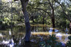
The above images may not be of the site on this page, but were taken nearby. They are loaded from Flickr so please click on them for image credits.
Click here to see more info for this site
Nearby sites
Click here to view sites on an interactive map of the areaKey: Red: member's photo, Blue: 3rd party photo, Yellow: other image, Green: no photo - please go there and take one, Grey: site destroyed
Download sites to:
KML (Google Earth)
GPX (GPS waypoints)
CSV (Garmin/Navman)
CSV (Excel)
To unlock full downloads you need to sign up as a Contributory Member. Otherwise downloads are limited to 50 sites.
Turn off the page maps and other distractions
Nearby sites listing. In the following links * = Image available
4.8km SE 142° S'Arroccu Nuraghe Broch or Nuraghe
4.9km SSE 147° Malghesi Domus de Janas* Rock Cut Tomb
7.3km SSW 194° Lugheria Nuraghe Broch or Nuraghe
7.4km SW 214° Alvaro Musca Nuraghe Broch or Nuraghe
8.2km SSW 195° Mastru Franziscu Nuraghe Broch or Nuraghe
10.0km SSW 199° Sinnadolzos Nuraghe Broch or Nuraghe
11.4km SW 226° San Simeone Nuraghe* Broch or Nuraghe
11.7km WSW 239° Pigalva Nuraghe* Broch or Nuraghe
12.1km SSW 207° Baccas Alvas Nuraghe* Broch or Nuraghe
13.9km N 359° Cacchioni Nuraghe Broch or Nuraghe
13.9km N 11° Monte di Deu Altura Fortificata* Stone Fort or Dun
14.3km NNE 12° Li Paladini Fonte Nuragica* Holy Well or Sacred Spring
14.5km N 10° Agnu Dolmen* Burial Chamber or Dolmen
14.5km N 11° Agnu Protonuraghe* Broch or Nuraghe
15.1km NNE 12° Pascaredda Tomba di Giganti* Chambered Tomb
15.1km N 5° Budas Protonuraghe* Broch or Nuraghe
16.1km NNW 342° Naracheddu Protonuraghe* Broch or Nuraghe
16.3km NNW 348° Maiori Nuraghe* Broch or Nuraghe
16.3km WNW 286° Majore Nuraghe* Broch or Nuraghe
16.5km WNW 290° Casteddu Petrusu Nuraghe* Broch or Nuraghe
17.3km WNW 284° Filiziu Protonuraghe* Broch or Nuraghe
17.6km WSW 245° Montiju Coronas Dolmen* Burial Chamber or Dolmen
17.6km ESE 123° Sos Nurattolos Temple Ancient Temple
17.6km ESE 123° Sos Nurattolos Settlement Ancient Village or Settlement
17.7km W 275° Pubattu Nuraghe* Broch or Nuraghe
View more nearby sites and additional images


 We would like to know more about this location. Please feel free to add a brief description and any relevant information in your own language.
 Wir möchten mehr über diese Stätte erfahren. Bitte zögern Sie nicht, eine kurze Beschreibung und relevante Informationen in Deutsch hinzuzufügen.
 Nous aimerions en savoir encore un peu sur les lieux. S'il vous plaît n'hesitez pas à ajouter une courte description et tous les renseignements pertinents dans votre propre langue.
 Quisieramos informarnos un poco más de las lugares. No dude en añadir una breve descripción y otros datos relevantes en su propio idioma.