


<< Text Pages >> Ludurioe Nuraghe - Broch or Nuraghe in Italy in Sardinia (Sardegna)
Submitted by SolarMegalith on Sunday, 30 September 2012 Page Views: 969
Neolithic and Bronze AgeSite Name: Ludurioe NuragheCountry: Italy
NOTE: This site is 4.027 km away from the location you searched for.
Region: Sardinia (Sardegna) Type: Broch or Nuraghe
Nearest Town: Olzai
Latitude: 40.200803N Longitude: 9.145812E
Condition:
| 5 | Perfect |
| 4 | Almost Perfect |
| 3 | Reasonable but with some damage |
| 2 | Ruined but still recognisable as an ancient site |
| 1 | Pretty much destroyed, possibly visible as crop marks |
| 0 | No data. |
| -1 | Completely destroyed |
| 5 | Superb |
| 4 | Good |
| 3 | Ordinary |
| 2 | Not Good |
| 1 | Awful |
| 0 | No data. |
| 5 | Can be driven to, probably with disabled access |
| 4 | Short walk on a footpath |
| 3 | Requiring a bit more of a walk |
| 2 | A long walk |
| 1 | In the middle of nowhere, a nightmare to find |
| 0 | No data. |
| 5 | co-ordinates taken by GPS or official recorded co-ordinates |
| 4 | co-ordinates scaled from a detailed map |
| 3 | co-ordinates scaled from a bad map |
| 2 | co-ordinates of the nearest village |
| 1 | co-ordinates of the nearest town |
| 0 | no data |
Internal Links:
External Links:
Nuraghe in Sardinia (Sardegna)
Nuraghe Ludurioe is located in NE part of Olzai commune.
You may be viewing yesterday's version of this page. To see the most up to date information please register for a free account.
Do not use the above information on other web sites or publications without permission of the contributor.
Nearby Images from Flickr
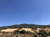
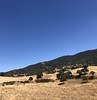
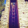
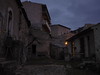
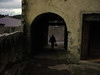
The above images may not be of the site on this page, but were taken nearby. They are loaded from Flickr so please click on them for image credits.
Click here to see more info for this site
Nearby sites
Click here to view sites on an interactive map of the areaKey: Red: member's photo, Blue: 3rd party photo, Yellow: other image, Green: no photo - please go there and take one, Grey: site destroyed
Download sites to:
KML (Google Earth)
GPX (GPS waypoints)
CSV (Garmin/Navman)
CSV (Excel)
To unlock full downloads you need to sign up as a Contributory Member. Otherwise downloads are limited to 50 sites.
Turn off the page maps and other distractions
Nearby sites listing. In the following links * = Image available
2.2km W 272° S'Ena'e Vacca Dolmen Burial Chamber or Dolmen
2.9km NW 311° S'Altare de Logula Tomba di Giganti* Chambered Tomb
4.0km WNW 303° Dospanilo Nuraghe* Broch or Nuraghe
8.0km WNW 293° Bisolio Protonuraghe* Broch or Nuraghe
8.1km SE 128° Mammughine Nuraghe Broch or Nuraghe
8.2km SSE 153° Gusana* Standing Stone (Menhir)
8.4km N 7° Moddorocco Nuraghe Broch or Nuraghe
8.6km ESE 106° Talaighe Nuraghe* Broch or Nuraghe
8.6km E 83° Monte Giuradu Nuraghe* Broch or Nuraghe
9.0km SE 141° S'Iscrithola Domus de Janas* Rock Cut Tomb
9.2km E 79° Monte Juradu menhir* Standing Stone (Menhir)
9.6km SSE 149° Littoleri Nuraghe* Broch or Nuraghe
9.7km SE 131° Su Gardosu Tomba di Giganti* Chambered Tomb
10.0km ESE 116° Castrulongu Protonuraghe Broch or Nuraghe
10.1km SE 138° San Michele* Holed Stone
10.1km ENE 76° S'Aspiddariu menhir* Standing Stone (Menhir)
10.1km NNE 12° Sas Concas Domus de Janas* Rock Cut Tomb
10.2km ENE 70° Foddigheddu Menhirs* Standing Stones
10.3km NNE 15° Corodda Nuraghe* Broch or Nuraghe
10.6km NNE 17° Murtas Nuraghe (Oniferi)* Broch or Nuraghe
10.7km ESE 111° Sa Perda'e s'Itria Menhir* Standing Stone (Menhir)
11.2km SE 140° Orrui Menhir* Standing Stone (Menhir)
11.3km E 80° Sa Perda Pinta Menhir* Sculptured Stone
11.3km E 87° Badu Carru Menhirs* Standing Stones
11.3km E 83° S'Eredadu Menhir* Standing Stone (Menhir)
View more nearby sites and additional images


 We would like to know more about this location. Please feel free to add a brief description and any relevant information in your own language.
 Wir möchten mehr über diese Stätte erfahren. Bitte zögern Sie nicht, eine kurze Beschreibung und relevante Informationen in Deutsch hinzuzufügen.
 Nous aimerions en savoir encore un peu sur les lieux. S'il vous plaît n'hesitez pas à ajouter une courte description et tous les renseignements pertinents dans votre propre langue.
 Quisieramos informarnos un poco más de las lugares. No dude en añadir una breve descripción y otros datos relevantes en su propio idioma.