


<< Our Photo Pages >> Natureum Niederelbe - Museum in Germany in Lower Saxony, Bremen
Submitted by Harald_Platta on Wednesday, 02 August 2017 Page Views: 847
MuseumsSite Name: Natureum NiederelbeCountry: Germany
NOTE: This site is 8.137 km away from the location you searched for.
Land: Lower Saxony, Bremen Type: Museum
Nearest Town: Balje
Latitude: 53.822370N Longitude: 9.035290E
Condition:
| 5 | Perfect |
| 4 | Almost Perfect |
| 3 | Reasonable but with some damage |
| 2 | Ruined but still recognisable as an ancient site |
| 1 | Pretty much destroyed, possibly visible as crop marks |
| 0 | No data. |
| -1 | Completely destroyed |
| 5 | Superb |
| 4 | Good |
| 3 | Ordinary |
| 2 | Not Good |
| 1 | Awful |
| 0 | No data. |
| 5 | Can be driven to, probably with disabled access |
| 4 | Short walk on a footpath |
| 3 | Requiring a bit more of a walk |
| 2 | A long walk |
| 1 | In the middle of nowhere, a nightmare to find |
| 0 | No data. |
| 5 | co-ordinates taken by GPS or official recorded co-ordinates |
| 4 | co-ordinates scaled from a detailed map |
| 3 | co-ordinates scaled from a bad map |
| 2 | co-ordinates of the nearest village |
| 1 | co-ordinates of the nearest town |
| 0 | no data |
Internal Links:
External Links:
I have visited· I would like to visit
Harald_Platta visited on 24th Jul 2017 - their rating: Access: 5
")
The exhibition deals mainly with the biology and geology of the mouth of the Elbe river in the North Sea. One station of the museum deals with the early history of this area and presents a reconstruction of a stone age house. There are activities for children, like archery or sculpturing nepheline stones (please look at the calendar on the homepage for the corresponding activity).
Homepage: Natureum Niederelbe
You may be viewing yesterday's version of this page. To see the most up to date information please register for a free account.
")
Do not use the above information on other web sites or publications without permission of the contributor.
Nearby Images from Flickr
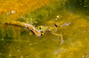


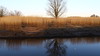
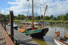
The above images may not be of the site on this page, but were taken nearby. They are loaded from Flickr so please click on them for image credits.
Click here to see more info for this site
Nearby sites
Click here to view sites on an interactive map of the areaKey: Red: member's photo, Blue: 3rd party photo, Yellow: other image, Green: no photo - please go there and take one, Grey: site destroyed
Download sites to:
KML (Google Earth)
GPX (GPS waypoints)
CSV (Garmin/Navman)
CSV (Excel)
To unlock full downloads you need to sign up as a Contributory Member. Otherwise downloads are limited to 50 sites.
Turn off the page maps and other distractions
Nearby sites listing. In the following links * = Image available
9.9km SSE 167° Hügelgräber in der Wingst (3-4)* Round Barrow(s)
10.6km SSE 168° Wingst Steingrab* Chambered Tomb
11.0km S 169° Hügelgräber in der Wingst (1-2)* Round Barrow(s)
13.9km WSW 255° Seewurt - Lüdingworth-Osterende II Ancient Village or Settlement
15.2km WSW 257° Seewurt - Lüdingworth-Osterende I Ancient Village or Settlement
17.6km W 260° Seewurt II -Lüdingworth-Ortsrand Ancient Village or Settlement
17.7km S 170° Lamstedt Steenaben* Chambered Tomb
17.8km WSW 240° Wanna Steingrab (11b)* Chambered Tomb
18.1km S 172° Steingarten Lamstedt* Modern Stone Circle etc
18.2km W 262° Seewurt I -Lüdingworth-Ortskern Ancient Village or Settlement
18.7km NNE 23° Hopen Huegelgrab* Round Barrow(s)
19.0km WSW 242° Heimatmuseum Wanna* Museum
19.2km WSW 244° Graeberfeld von Westerwanna* Barrow Cemetery
19.2km WSW 244° Wanna Gravenberg* Round Barrow(s)
19.6km NNE 24° Hopen Grabhuegelfeld* Round Barrow(s)
19.6km NNE 23° St. Michaelisdonn Huegelgrab 1* Round Barrow(s)
19.8km NNE 27° Kuden Huegelgrab 2* Round Barrow(s)
20.2km SW 230° Wanna Steingrab (10)* Chambered Tomb
20.2km WSW 244° Wanna Huegelgrab 6* Round Barrow(s)
20.3km SW 230° Wanna Steingrab (11)* Chambered Tomb
20.3km WSW 244° Wanna Huegelgrab 5* Round Barrow(s)
20.4km SW 232° Wanna Steingrab (9)* Chambered Tomb
20.4km SW 232° Grabhügelgruppe Am Hohen Kopf* Barrow Cemetery
20.5km SW 232° Wanna Steingrab (8)* Chambered Tomb
20.5km WSW 245° Wanna Huegelgrab (7) Round Barrow(s)
View more nearby sites and additional images


 We would like to know more about this location. Please feel free to add a brief description and any relevant information in your own language.
 Wir möchten mehr über diese Stätte erfahren. Bitte zögern Sie nicht, eine kurze Beschreibung und relevante Informationen in Deutsch hinzuzufügen.
 Nous aimerions en savoir encore un peu sur les lieux. S'il vous plaît n'hesitez pas à ajouter une courte description et tous les renseignements pertinents dans votre propre langue.
 Quisieramos informarnos un poco más de las lugares. No dude en añadir una breve descripción y otros datos relevantes en su propio idioma.