 with our Megalithic Portal iPhone app")


<< Our Photo Pages >> Nuraceddeu Nuraghe - Broch or Nuraghe in Italy in Sardinia (Sardegna)
Submitted by SolarMegalith on Thursday, 29 September 2011 Page Views: 2492
Neolithic and Bronze AgeSite Name: Nuraceddeu Nuraghe Alternative Name: Nuraghe NuraceddeuCountry: Italy
NOTE: This site is 1.543 km away from the location you searched for.
Region: Sardinia (Sardegna) Type: Broch or Nuraghe
Nearest Town: Gesturi
Latitude: 39.720062N Longitude: 9.021941E
Condition:
| 5 | Perfect |
| 4 | Almost Perfect |
| 3 | Reasonable but with some damage |
| 2 | Ruined but still recognisable as an ancient site |
| 1 | Pretty much destroyed, possibly visible as crop marks |
| 0 | No data. |
| -1 | Completely destroyed |
| 5 | Superb |
| 4 | Good |
| 3 | Ordinary |
| 2 | Not Good |
| 1 | Awful |
| 0 | No data. |
| 5 | Can be driven to, probably with disabled access |
| 4 | Short walk on a footpath |
| 3 | Requiring a bit more of a walk |
| 2 | A long walk |
| 1 | In the middle of nowhere, a nightmare to find |
| 0 | No data. |
| 5 | co-ordinates taken by GPS or official recorded co-ordinates |
| 4 | co-ordinates scaled from a detailed map |
| 3 | co-ordinates scaled from a bad map |
| 2 | co-ordinates of the nearest village |
| 1 | co-ordinates of the nearest town |
| 0 | no data |
Internal Links:
External Links:
I have visited· I would like to visit
SolarMegalith visited on 7th Sep 2011 - their rating: Cond: 3 Amb: 5 Access: 3
")
Ruins of Nuraghe Nuraceddeu are located on the top of a hill west of SS 197 road, south of Gesturi. The tholos chamber is buried under the mound and filled with debris, but its top part is visible. A large wall in the SW part of the nuraghe, which is visible from the distance, is probably part of a bastion which might be a later addition.
The site is visible from SS 197 road, but there is no footpath leading to it - you have to make your way through the bushes.
You may be viewing yesterday's version of this page. To see the most up to date information please register for a free account.
")
")
")
Do not use the above information on other web sites or publications without permission of the contributor.
Nearby Images from Flickr
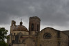


The above images may not be of the site on this page, but were taken nearby. They are loaded from Flickr so please click on them for image credits.
Click here to see more info for this site
Nearby sites
Click here to view sites on an interactive map of the areaKey: Red: member's photo, Blue: 3rd party photo, Yellow: other image, Green: no photo - please go there and take one, Grey: site destroyed
Download sites to:
KML (Google Earth)
GPX (GPS waypoints)
CSV (Garmin/Navman)
CSV (Excel)
To unlock full downloads you need to sign up as a Contributory Member. Otherwise downloads are limited to 50 sites.
Turn off the page maps and other distractions
Nearby sites listing. In the following links * = Image available
2.4km WNW 300° Bruncu Madugui Protonuraghe* Broch or Nuraghe
2.7km SW 225° Nuraxi 'e Cresia Nuraghe* Broch or Nuraghe
2.9km W 263° Perdu Meloni Nuraghe* Broch or Nuraghe
3.1km WSW 239° Barumini Nuraghe* Broch or Nuraghe
3.6km N 359° Bruncu Peppi Pinna Nuraghe Broch or Nuraghe
5.3km SSW 199° Passiali Nuraghe* Broch or Nuraghe
5.3km SSE 165° Sa Zeppara Nuraghe* Broch or Nuraghe
5.4km S 189° Perdedu Nuraghe* Broch or Nuraghe
5.8km SSW 195° Bruncu 'e Forru Nuraghe* Broch or Nuraghe
5.9km S 181° Salamai Nuraghe* Broch or Nuraghe
6.0km SSW 200° Mariga Nuraghe* Broch or Nuraghe
6.3km SSW 203° Ruinali Meseda Tomba di Giganti* Chambered Tomb
6.9km NNE 26° Santu Millanu Nuraghe* Broch or Nuraghe
7.0km S 173° Paberi Nuraghe* Broch or Nuraghe
7.1km NNE 24° Coni Pozzo Sacro* Holy Well or Sacred Spring
7.1km S 181° Trattasi Nuraghe* Broch or Nuraghe
7.1km WSW 246° Su Sensu Nuraghe* Broch or Nuraghe
7.2km SSE 168° Sa Barracca de Is Dragonis Nuraghe* Broch or Nuraghe
7.5km NE 40° Aiodda Tomba di Giganti* Chambered Tomb
7.6km NNE 22° Valenza Nuraghe* Broch or Nuraghe
8.0km ENE 66° Is Paras Nuraghe* Broch or Nuraghe
8.0km S 176° Tuppedili Nuraghe* Broch or Nuraghe
8.2km SSE 165° Ruinali Sa Figu Nuraghe* Broch or Nuraghe
8.4km E 97° Mogurus Nuraghe* Broch or Nuraghe
8.9km NE 34° Pranu Fas Nuraghe* Broch or Nuraghe
View more nearby sites and additional images


 We would like to know more about this location. Please feel free to add a brief description and any relevant information in your own language.
 Wir möchten mehr über diese Stätte erfahren. Bitte zögern Sie nicht, eine kurze Beschreibung und relevante Informationen in Deutsch hinzuzufügen.
 Nous aimerions en savoir encore un peu sur les lieux. S'il vous plaît n'hesitez pas à ajouter une courte description et tous les renseignements pertinents dans votre propre langue.
 Quisieramos informarnos un poco más de las lugares. No dude en añadir una breve descripción y otros datos relevantes en su propio idioma.