Featured: How and why the ancients enchanted Great Britain and Brittany

How and why the ancients enchanted Great Britain and Brittany

Random Image


Hatch-a-way

Megaliths, Stones of Memory

Megaliths, Stones of Memory

Who's Online

There are currently, 196 guests and 1 members online.

You are a guest. To join in, please register for free by clicking here

Sponsors

<< Our Photo Pages >> Tuekta kurgan - Artificial Mound in Russia

Submitted by Andy B on Monday, 17 October 2011  Page Views: 8865

Multi-periodSite Name: Tuekta kurgan
Country: Russia
NOTE: This site is 107.704 km away from the location you searched for.

Type: Artificial Mound
Nearest Town: Tuekta
Latitude: 50.839100N  Longitude: 85.882000E
Condition:
5Perfect
4Almost Perfect
3Reasonable but with some damage
2Ruined but still recognisable as an ancient site
1Pretty much destroyed, possibly visible as crop marks
0No data.
-1Completely destroyed
3 Ambience:
5Superb
4Good
3Ordinary
2Not Good
1Awful
0No data.
no data Access:
5Can be driven to, probably with disabled access
4Short walk on a footpath
3Requiring a bit more of a walk
2A long walk
1In the middle of nowhere, a nightmare to find
0No data.
no data Accuracy:
5co-ordinates taken by GPS or official recorded co-ordinates
4co-ordinates scaled from a detailed map
3co-ordinates scaled from a bad map
2co-ordinates of the nearest village
1co-ordinates of the nearest town
0no data
1

Internal Links:
External Links:

I have visited· I would like to visit

DrewParsons would like to visit

Andy B has visited here

Tuekta kurgan
Tuekta kurgan submitted by Andy B : A 3D model of Tuekta kurgan, a Scythian burial mound based on images captured by a micro-drone. Credit: Marijn Hendrickx, University of Ghent Site in Russia (Vote or comment on this photo)
Tuekta is in the Altai Mountains where Russia, China, Kazakhstan and Mongolia come together. Researchers there have discovered burial mounds 2,300 to 2,800 years old and up to 250 feet (76 meters) wide.

These burial mounds, called "kurgans", probably belonged to chiefs or princes among the Scythians, a nomadic people known for their horsemanship, who once had a rich, powerful empire. Excavations of some of these have revealed extraordinary treasures of gold and other artifacts well-preserved by permafrost.

Nearly 200 burial mounds were discovered in Tuekta, situated along the River Ursul. The site's heart appears to once have been a row of five monumental Scythian burial mounds with diameters between 140 and 250 feet (42 and 76 m). Regretfully, "in this study area, most of the burial mounds are destroyed," researcher Hendrickx said.

Source: Live Science
You may be viewing yesterday's version of this page. To see the most up to date information please register for a free account.


Do not use the above information on other web sites or publications without permission of the contributor.

Nearby Images from Flickr
Wildcampen
2017-08-03 11.05.03
Altai-0333-20120928.jpg
2017-08-03 11.04.58

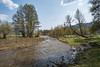
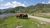
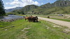
The above images may not be of the site on this page, but were taken nearby. They are loaded from Flickr so please click on them for image credits.


Click here to see more info for this site

Nearby sites

Click here to view sites on an interactive map of the area

Key: Red: member's photo, Blue: 3rd party photo, Yellow: other image, Green: no photo - please go there and take one, Grey: site destroyed

Download sites to:
KML (Google Earth)
GPX (GPS waypoints)
CSV (Garmin/Navman)
CSV (Excel)

To unlock full downloads you need to sign up as a Contributory Member. Otherwise downloads are limited to 50 sites.


Turn off the page maps and other distractions

Nearby sites listing. In the following links * = Image available
 53.2km NNW 336° Tavdinsky Caves Cave or Rock Shelter
 69.0km SE 131° Inya Deer Stones* Standing Stone (Menhir)
 82.1km SE 126° Kalbak-Tash* Rock Art
 84.9km SE 124° Chuya Deer Stone* Standing Stone (Menhir)
 104.6km NW 307° Denisova* Cave or Rock Shelter
 115.3km NW 308° Karama - Paleolithic settlement* Ancient Village or Settlement
 117.3km N 4° Oldest settlement Ulalinka* Ancient Village or Settlement
 124.3km N 2° Anokhin Museum* Museum
 131.3km N 1° Mayma VI Barrow Cemetery
 169.8km SSE 168° Berel Burial Mounds* Barrow Cemetery
 218.7km ESE 121° Tarhatinsky megalithic site* Standing Stones
 256.9km SE 138° Shiveet Mountain Petroglyphs* Rock Art
 261.1km SE 137° Mt. Shiveet altar stone with petroglyphs* Rock Art
 300.0km SE 143° Lake Hoton Petroglyphs* Rock Art
 304.4km SE 143° Lake Hoton Round Barrow Round Barrow(s)
 305.0km WSW 257° Seleutas Mountain Sphinx* Natural Stone / Erratic / Other Natural Feature
 317.5km SE 143° Lake Hoton Standing Grave Stones* Standing Stones
 419.5km SSW 194° Shilikty Burial Mounds Barrow Cemetery
 463.3km NNE 30° Paleolithic settlement Small Syya* Ancient Village or Settlement
 463.8km ENE 77° Ancient sanctuary Chaa-Holl* Rock Cut Tomb
 474.9km NE 42° Great Salbyk Kurgan* Pyramid / Mastaba
 475.8km SW 217° Eleke Sazy Burial Mounds* Barrow Cemetery
 481.7km NNE 33° Tuim Cromlech* Stone Circle
 495.1km NE 48° Museum Kyzlasov L.R.* Museum
 501.7km NNE 30° Complex Sunduki* Natural Stone / Erratic / Other Natural Feature
View more nearby sites and additional images

<< Megalith near Eleshnitza, Razlog region

Ōhinehou >>

Please add your thoughts on this site

Cornwall in Prehistory

Cornwall in Prehistory

Sponsors

Auto-Translation (Google)

Translate from English into:

"Tuekta kurgan" | Login/Create an Account | 6 News and Comments
  
Go back to top of page    Comments are owned by the poster. We aren't responsible for their content.
Re: Tuekta kurgan by Anonymous on Wednesday, 19 October 2011
For the viewpoint of an Altai indigenous elder/steward, see http://www.altaimir.org/WhatIsKurgan.pdf
[ Reply to This ]

Re: Tuekta kurgan by Anonymous on Wednesday, 19 October 2011
The excavation of those kurgans is a violation of Mother Earth and a violation of the local cultures. I thought the Altai people had managed to get a moratorium on the excavation of kurgans. Guess not. The kurgans are sophisticated instruments for channeling cosmic energy into the Earth. Modern instruments are finally able to detect the flow of energy, so there is no excuse for destroying them. The gold is a conductor (duh), and actually, so are the mummies they find. And the kurgans have been destroyed BY THE ARCHEOLOGISTS, who keep destroying them!!! It is just horrific.
[ Reply to This ]
    Re: Tuekta kurgan by Andy B on Wednesday, 19 October 2011
    (User Info | Send a Message)
    Thanks for the link, however there is no excavation being discussed here, just non intrusive photographic survey. "The 3-D model we created gives us the possibility to calculate the volume of the kurgan," Hendrickx told LiveScience. "With this volume and its precise dimensions, the original shape of the kurgan can be reconstructed."
    [ Reply to This ]

Chronology of Eurasian Scythian Antiquities by Andy B on Monday, 17 October 2011
(User Info | Send a Message)
The paper compares chronology of the Scythian Epoch monuments located in the east and west of the Eurasian steppe zone comparing archaeological and radiocarbon data. The lists of 14C dates for the monuments located in different parts of Eurasia are presented according to the periods of their existence. Generally, C-14 dates confirm archaeological dating, and allowing to compare chronological position of the European and Asian Scythian monuments on a unified C-14 time scale.

Includes a distribution map and description of the monuments in the region
http://s155239215.onlinehome.us/turkic/btn_Archeology/ScythianC14En.htm


Other important kurgans are Bashadar Kurgan, the Pazyryk Kurgans and Yustyd Kurgans (Source: Antiquity)
[ Reply to This ]

Pazyryk Kurgans by Andy B on Monday, 17 October 2011
(User Info | Send a Message)
The Pazyryk kurgans contain the graves of family or tribal chieftains and were constructed for the most part in the fifth and fourth centuries B.C.; some researchers believe they were constructed later, in the third century B.C. The kurgans were excavated by M. P. Griaznov and S. I. Rudenko in 1929 and by S. I. Rudenko from 1947 to 1949.

The excavations uncovered rectangular pits up to 4 m deep, with areas of about 50 sq m, containing burial chambers (log frameworks) up to 2 m high. Each chamber had a floor, double walls, and a double ceiling and was covered with birch bark, shrubbery, and a layer of logs that extended to the edges of the pit. A mound of earth was raised upon the logs and then covered by stones. Because of the considerable elevation of Pazyryk valley, the climate, and the mode of construction of the kurgans, a layer of permafrost formed beneath the kurgans shortly after they were erected, assuring the excellent preservation of the contents.

Source: The Great Soviet Encyclopedia, 3rd Edition (1970-1979) via
http://encyclopedia2.thefreedictionary.com/Pazyryk+Kurgans
[ Reply to This ]

A miniature airborne drone helps create a 3-D model of ancient burial mound in Russia by Andy B on Monday, 17 October 2011
(User Info | Send a Message)
Archaeological sites are often in remote and rugged areas. As such, it can be hard to reach and map them with the limited budgets archaeologists typically have. Scientists are now using drones to extend their view into these hard-to-reach spots.

"There are a lot possibilities with this method," said researcher Marijn Hendrickx, a geographer at the University of Ghent in Belgium.

The machine tested in a remote area in Russia called Tuekta was a four-propeller "quadrocopter": the battery-powered Microdrone md4-200. The fact it is small ? the axis of its rotors is about 27 inches (70 cm) ? and weighs about 35 ounces (1,000 grams) made it easy to transport, and researchers said it was very easy to fly, stabilizing itself constantly and keeping at a given height and position unless ordered to do otherwise.

The scientists detailed their findings in the November issue of the Journal of Archaeological Science.

More at
http://www.livescience.com/16443-micro-drone-archaeology-burial-sites.html
the drones are modified for use for mapping by Orbit GIS
http://www.orbitgis.com/store/product/microdrone-uav
[ Reply to This ]

Your Name: Anonymous [ Register Now ]
Subject:


Add your comment or contribution to this page. Spam or offensive posts are deleted immediately, don't even bother

<<< What is five plus one as a number? (Please type the answer to this question in the little box on the left)
You can also embed videos and other things. For Youtube please copy and paste the 'embed code'.
For Google Street View please include Street View in the text.
Create a web link like this: <a href="https://www.megalithic.co.uk">This is a link</a>  

Allowed HTML is:
<p> <b> <i> <a> <img> <em> <br> <strong> <blockquote> <tt> <li> <ol> <ul> <object> <param> <embed> <iframe>

We would like to know more about this location. Please feel free to add a brief description and any relevant information in your own language.
Wir möchten mehr über diese Stätte erfahren. Bitte zögern Sie nicht, eine kurze Beschreibung und relevante Informationen in Deutsch hinzuzufügen.
Nous aimerions en savoir encore un peu sur les lieux. S'il vous plaît n'hesitez pas à ajouter une courte description et tous les renseignements pertinents dans votre propre langue.
Quisieramos informarnos un poco más de las lugares. No dude en añadir una breve descripción y otros datos relevantes en su propio idioma.