


<< Text Pages >> Ravana Ella Cave - Cave or Rock Shelter in Sri Lanka
Submitted by KaiHofmann on Monday, 29 June 2015 Page Views: 1365
Natural PlacesSite Name: Ravana Ella CaveCountry: Sri Lanka
NOTE: This site is 1.662 km away from the location you searched for.
Type: Cave or Rock Shelter
Nearest Town: Ella
Latitude: 6.864030N Longitude: 81.048245E
Condition:
| 5 | Perfect |
| 4 | Almost Perfect |
| 3 | Reasonable but with some damage |
| 2 | Ruined but still recognisable as an ancient site |
| 1 | Pretty much destroyed, possibly visible as crop marks |
| 0 | No data. |
| -1 | Completely destroyed |
| 5 | Superb |
| 4 | Good |
| 3 | Ordinary |
| 2 | Not Good |
| 1 | Awful |
| 0 | No data. |
| 5 | Can be driven to, probably with disabled access |
| 4 | Short walk on a footpath |
| 3 | Requiring a bit more of a walk |
| 2 | A long walk |
| 1 | In the middle of nowhere, a nightmare to find |
| 0 | No data. |
| 5 | co-ordinates taken by GPS or official recorded co-ordinates |
| 4 | co-ordinates scaled from a detailed map |
| 3 | co-ordinates scaled from a bad map |
| 2 | co-ordinates of the nearest village |
| 1 | co-ordinates of the nearest town |
| 0 | no data |
Internal Links:
External Links:
Cave in Sri Lanka
The Ravana cave near Ella lies east of the Little Adam's Peak. Excavations in the cave uncovered evidence of human occupation from 25.000 years BCE.
You may be viewing yesterday's version of this page. To see the most up to date information please register for a free account.
Do not use the above information on other web sites or publications without permission of the contributor.
Nearby Images from Flickr

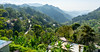
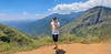

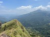
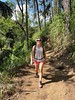
The above images may not be of the site on this page, but were taken nearby. They are loaded from Flickr so please click on them for image credits.
Click here to see more info for this site
Nearby sites
Click here to view sites on an interactive map of the areaKey: Red: member's photo, Blue: 3rd party photo, Yellow: other image, Green: no photo - please go there and take one, Grey: site destroyed
Download sites to:
KML (Google Earth)
GPX (GPS waypoints)
CSV (Garmin/Navman)
CSV (Excel)
To unlock full downloads you need to sign up as a Contributory Member. Otherwise downloads are limited to 50 sites.
Turn off the page maps and other distractions
Nearby sites listing. In the following links * = Image available
3.0km WSW 253° Dowa Rajamaha Viharaya Ancient Temple
19.8km SSE 166° Weherayaya Dagoba* Ancient Temple
20.0km S 170° Buduruvagala* Sculptured Stone
27.3km WNW 286° Seetha Amman Temple* Modern Stone Circle etc
29.2km ESE 115° Dematamal Viharaya* Ancient Temple
36.8km ESE 114° Maligawila standing Buddha* Sculptured Stone
37.4km ESE 114° Dhambegoda Bodhisathwa Statue* Sculptured Stone
52.4km E 88° Wattumbegoda cave Rock Art
60.8km W 264° Adam's Peak* Natural Stone / Erratic / Other Natural Feature
68.9km SSE 159° Galkanumandiya Ruins* Ancient Temple
69.1km SSE 159° Yatala Dagoba* Ancient Temple
69.2km SE 140° Sithulpauwa* Ancient Temple
69.8km S 184° Karabagala Aranya Senasanaya Cave or Rock Shelter
70.3km SSE 158° Tissamaharama Raja Maha Vihara Ancient Temple
70.4km SSE 157° Tissa Sandagiri Vihara Ancient Temple
70.6km SSE 158° Building of the Silapassa Parivena Ancient Temple
72.7km W 262° Batadomba Lena Cave Cave or Rock Shelter
76.0km E 90° Magul Maha Viharaya Ancient Temple
77.8km E 89° Kotawehera Raja Maha Viharaya Ancient Temple
79.0km SSE 156° Kirinda Temple* Ancient Temple
79.8km ESE 105° Kudumbigala Monastery Complex Ancient Temple
83.9km S 180° Gothapabbata Vihara* Ancient Temple
85.1km SSW 198° Kasagala Vihara* Ancient Temple
85.4km S 185° Ussangoda* Natural Stone / Erratic / Other Natural Feature
87.3km E 90° Muhudu Maha Viharaya Ancient Temple
View more nearby sites and additional images


 We would like to know more about this location. Please feel free to add a brief description and any relevant information in your own language.
 Wir möchten mehr über diese Stätte erfahren. Bitte zögern Sie nicht, eine kurze Beschreibung und relevante Informationen in Deutsch hinzuzufügen.
 Nous aimerions en savoir encore un peu sur les lieux. S'il vous plaît n'hesitez pas à ajouter une courte description et tous les renseignements pertinents dans votre propre langue.
 Quisieramos informarnos un poco más de las lugares. No dude en añadir una breve descripción y otros datos relevantes en su propio idioma.