

<< Our Photo Pages >> Sigiriya - Hillfort in Sri Lanka
Submitted by KaiHofmann on Tuesday, 25 September 2012 Page Views: 4404
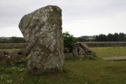
Iron Age and Later PrehistorySite Name: Sigiriya Alternative Name: Siha Giri, Lion's Rock, SihigiriyaCountry: Sri Lanka Type: Hillfort
Nearest Town: Sigiriya
Latitude: 7.956728N Longitude: 80.759984E
Condition:
| 5 | Perfect |
| 4 | Almost Perfect |
| 3 | Reasonable but with some damage |
| 2 | Ruined but still recognisable as an ancient site |
| 1 | Pretty much destroyed, possibly visible as crop marks |
| 0 | No data. |
| -1 | Completely destroyed |
| 5 | Superb |
| 4 | Good |
| 3 | Ordinary |
| 2 | Not Good |
| 1 | Awful |
| 0 | No data. |
| 5 | Can be driven to, probably with disabled access |
| 4 | Short walk on a footpath |
| 3 | Requiring a bit more of a walk |
| 2 | A long walk |
| 1 | In the middle of nowhere, a nightmare to find |
| 0 | No data. |
| 5 | co-ordinates taken by GPS or official recorded co-ordinates |
| 4 | co-ordinates scaled from a detailed map |
| 3 | co-ordinates scaled from a bad map |
| 2 | co-ordinates of the nearest village |
| 1 | co-ordinates of the nearest town |
| 0 | no data |
Internal Links:
External Links:
I have visited· I would like to visit
PAB has visited here
")
The site is an UNESCO world heritage.
You may be viewing yesterday's version of this page. To see the most up to date information please register for a free account.
")
")
")
")
")
")
")
")
")
")
")
")
")
")
")
")
")
")
")
")
")
")
")
")
")
These are just the first 25 photos of Sigiriya. If you log in with a free user account you will be able to see our entire collection.
Do not use the above information on other web sites or publications without permission of the contributor.
Click here to see more info for this site
Nearby sites
Click here to view sites on an interactive map of the areaKey: Red: member's photo, Blue: 3rd party photo, Yellow: other image, Green: no photo - please go there and take one, Grey: site destroyed
Download sites to:
KML (Google Earth)
GPX (GPS waypoints)
CSV (Garmin/Navman)
CSV (Excel)
To unlock full downloads you need to sign up as a Contributory Member. Otherwise downloads are limited to 50 sites.
Turn off the page maps and other distractions
Nearby sites listing. In the following links * = Image available
16.6km SW 228° Dambula Cave temple* Cave or Rock Shelter
19.5km SW 227° Ibbankatuwa Megalithic Cemetery Cist
19.7km NNW 328° Ritigala Ancient Temple
26.6km E 92° Polonnaruwa* Ancient Village or Settlement
27.8km WNW 282° Aukana Buddha* Sculptured Stone
34.2km NE 50° Mandalagiri Vihara Ancient Temple
34.3km SSW 202° Nalanda Gedige* Ancient Temple
38.0km W 276° Sasseruwa* Sculptured Stone
51.5km NNW 329° Mihintale Temple* Ancient Temple
58.9km NW 318° Anuradhapura* Ancient Village or Settlement
76.9km NE 53° Seruvila Mangala Raja Maha Viharaya* Ancient Temple
81.0km SSW 212° Gal Messa of Padavigampola* Burial Chamber or Dolmen
87.7km NE 37° Koneswaram Kovil* Ancient Temple
88.2km NW 321° Tantirimale Ancient Temple
89.0km NNE 31° Velgam Vehera Ancient Temple
105.2km NNE 15° Girihandu Seya Ancient Temple
107.7km ESE 119° Rajagala Kanda Ancient Temple
114.0km S 177° Seetha Amman Temple* Modern Stone Circle etc
125.6km SSE 165° Ravana Ella Cave Cave or Rock Shelter
125.7km SSE 167° Dowa Rajamaha Viharaya Ancient Temple
130.9km SSW 193° Adam's Peak* Natural Stone / Erratic / Other Natural Feature
135.7km ESE 123° Deegavapi Dagoba Ancient Temple
137.3km SSW 197° Batadomba Lena Cave Cave or Rock Shelter
145.4km SSE 165° Weherayaya Dagoba* Ancient Temple
145.5km SSE 166° Buduruvagala* Sculptured Stone
View more nearby sites and additional images


 We would like to know more about this location. Please feel free to add a brief description and any relevant information in your own language.
 Wir möchten mehr über diese Stätte erfahren. Bitte zögern Sie nicht, eine kurze Beschreibung und relevante Informationen in Deutsch hinzuzufügen.
 Nous aimerions en savoir encore un peu sur les lieux. S'il vous plaît n'hesitez pas à ajouter une courte description et tous les renseignements pertinents dans votre propre langue.
 Quisieramos informarnos un poco más de las lugares. No dude en añadir una breve descripción y otros datos relevantes en su propio idioma.