 with our Megalithic Portal iPhone app")

<< Our Photo Pages >> Nalanda Gedige - Ancient Temple in Sri Lanka
Submitted by KaiHofmann on Saturday, 18 April 2015 Page Views: 2293
Multi-periodSite Name: Nalanda GedigeCountry: Sri Lanka Type: Ancient Temple
Nearest Town: Matale
Latitude: 7.669722N Longitude: 80.645556E
Condition:
| 5 | Perfect |
| 4 | Almost Perfect |
| 3 | Reasonable but with some damage |
| 2 | Ruined but still recognisable as an ancient site |
| 1 | Pretty much destroyed, possibly visible as crop marks |
| 0 | No data. |
| -1 | Completely destroyed |
| 5 | Superb |
| 4 | Good |
| 3 | Ordinary |
| 2 | Not Good |
| 1 | Awful |
| 0 | No data. |
| 5 | Can be driven to, probably with disabled access |
| 4 | Short walk on a footpath |
| 3 | Requiring a bit more of a walk |
| 2 | A long walk |
| 1 | In the middle of nowhere, a nightmare to find |
| 0 | No data. |
| 5 | co-ordinates taken by GPS or official recorded co-ordinates |
| 4 | co-ordinates scaled from a detailed map |
| 3 | co-ordinates scaled from a bad map |
| 2 | co-ordinates of the nearest village |
| 1 | co-ordinates of the nearest town |
| 0 | no data |
Internal Links:
External Links:
")
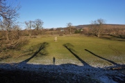
The Nalanda Gedige temple was initial built as a Hindu temple in the 8th-10th century CE. Later it was used by Buddhists. Very interesting Dravidian temple architecture.
You may be viewing yesterday's version of this page. To see the most up to date information please register for a free account.
")
")
")
")
")
")
")
")
")
")
")
")
")
")
")
")
")
")
")
")
")
")
")
")
These are just the first 25 photos of Nalanda Gedige. If you log in with a free user account you will be able to see our entire collection.
Do not use the above information on other web sites or publications without permission of the contributor.
Click here to see more info for this site
Nearby sites
Click here to view sites on an interactive map of the areaKey: Red: member's photo, Blue: 3rd party photo, Yellow: other image, Green: no photo - please go there and take one, Grey: site destroyed
Download sites to:
KML (Google Earth)
GPX (GPS waypoints)
CSV (Garmin/Navman)
CSV (Excel)
To unlock full downloads you need to sign up as a Contributory Member. Otherwise downloads are limited to 50 sites.
Turn off the page maps and other distractions
Nearby sites listing. In the following links * = Image available
18.7km N 355° Ibbankatuwa Megalithic Cemetery Cist
20.8km N 1° Dambula Cave temple* Cave or Rock Shelter
34.3km NNE 22° Sigiriya* Hillfort
40.6km NNW 339° Aukana Buddha* Sculptured Stone
44.0km NW 325° Sasseruwa* Sculptured Stone
47.7km SW 220° Gal Messa of Padavigampola* Burial Chamber or Dolmen
48.7km N 3° Ritigala Ancient Temple
49.9km NE 52° Polonnaruwa* Ancient Village or Settlement
66.5km NE 35° Mandalagiri Vihara Ancient Temple
77.2km N 349° Mihintale Temple* Ancient Temple
80.4km NNW 341° Anuradhapura* Ancient Village or Settlement
83.9km SSE 167° Seetha Amman Temple* Modern Stone Circle etc
97.1km S 190° Adam's Peak* Natural Stone / Erratic / Other Natural Feature
99.5km SSE 155° Dowa Rajamaha Viharaya Ancient Temple
100.0km SSE 154° Ravana Ella Cave Cave or Rock Shelter
103.2km SSW 196° Batadomba Lena Cave Cave or Rock Shelter
107.7km NE 44° Seruvila Mangala Raja Maha Viharaya* Ancient Temple
108.9km E 100° Rajagala Kanda Ancient Temple
109.3km NNW 337° Tantirimale Ancient Temple
119.3km SSE 156° Buduruvagala* Sculptured Stone
119.4km SSE 156° Weherayaya Dagoba* Ancient Temple
121.1km NNE 33° Koneswaram Kovil* Ancient Temple
123.0km NNE 28° Velgam Vehera Ancient Temple
123.0km SSW 203° Pahiyangala, Sri Lanka Cave or Rock Shelter
124.1km SE 145° Dematamal Viharaya* Ancient Temple
View more nearby sites and additional images


 We would like to know more about this location. Please feel free to add a brief description and any relevant information in your own language.
 Wir möchten mehr über diese Stätte erfahren. Bitte zögern Sie nicht, eine kurze Beschreibung und relevante Informationen in Deutsch hinzuzufügen.
 Nous aimerions en savoir encore un peu sur les lieux. S'il vous plaît n'hesitez pas à ajouter une courte description et tous les renseignements pertinents dans votre propre langue.
 Quisieramos informarnos un poco más de las lugares. No dude en añadir una breve descripción y otros datos relevantes en su propio idioma.