 with our Megalithic Portal iPhone app")


<< Text Pages >> Tanca Noa Nuraghe (Bottidda) - Broch or Nuraghe in Italy in Sardinia (Sardegna)
Submitted by SolarMegalith on Tuesday, 05 June 2012 Page Views: 1481
Neolithic and Bronze AgeSite Name: Tanca Noa Nuraghe (Bottidda)Country: Italy
NOTE: This site is 2.814 km away from the location you searched for.
Region: Sardinia (Sardegna) Type: Broch or Nuraghe
Nearest Village: Bottidda
Latitude: 40.399044N Longitude: 9.017070E
Condition:
| 5 | Perfect |
| 4 | Almost Perfect |
| 3 | Reasonable but with some damage |
| 2 | Ruined but still recognisable as an ancient site |
| 1 | Pretty much destroyed, possibly visible as crop marks |
| 0 | No data. |
| -1 | Completely destroyed |
| 5 | Superb |
| 4 | Good |
| 3 | Ordinary |
| 2 | Not Good |
| 1 | Awful |
| 0 | No data. |
| 5 | Can be driven to, probably with disabled access |
| 4 | Short walk on a footpath |
| 3 | Requiring a bit more of a walk |
| 2 | A long walk |
| 1 | In the middle of nowhere, a nightmare to find |
| 0 | No data. |
| 5 | co-ordinates taken by GPS or official recorded co-ordinates |
| 4 | co-ordinates scaled from a detailed map |
| 3 | co-ordinates scaled from a bad map |
| 2 | co-ordinates of the nearest village |
| 1 | co-ordinates of the nearest town |
| 0 | no data |
Internal Links:
External Links:
Nuraghe in Sardinia (Sardegna)
Remains of a Bronze Age nuraghe located NE of Bottidda.
You may be viewing yesterday's version of this page. To see the most up to date information please register for a free account.
Do not use the above information on other web sites or publications without permission of the contributor.
Nearby Images from Flickr
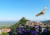
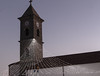

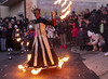
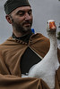
The above images may not be of the site on this page, but were taken nearby. They are loaded from Flickr so please click on them for image credits.
Click here to see more info for this site
Nearby sites
Click here to view sites on an interactive map of the areaKey: Red: member's photo, Blue: 3rd party photo, Yellow: other image, Green: no photo - please go there and take one, Grey: site destroyed
Download sites to:
KML (Google Earth)
GPX (GPS waypoints)
CSV (Garmin/Navman)
CSV (Excel)
To unlock full downloads you need to sign up as a Contributory Member. Otherwise downloads are limited to 50 sites.
Turn off the page maps and other distractions
Nearby sites listing. In the following links * = Image available
5.2km W 275° Erismanzanu Nuraghe* Broch or Nuraghe
5.9km SW 214° Mannuri Nuraghe Broch or Nuraghe
7.4km S 174° Lucche Nuraghe* Broch or Nuraghe
7.6km WNW 293° Nuraghe Sa Reggia* Broch or Nuraghe
7.8km SSW 209° Mascarida Tomba di Giganti Chambered Tomb
7.8km ENE 70° Merenda Ona Tomba di Giganti Chambered Tomb
8.1km SSW 196° Tuvu Oe Nuraghe Broch or Nuraghe
8.2km W 263° Pattada 'e Chelvos Nuraghe* Broch or Nuraghe
8.7km NE 34° Ainas Nuraghe Broch or Nuraghe
8.9km W 261° Iscretti Nuraghe* Broch or Nuraghe
8.9km WSW 237° Nodu de Sales Nuraghe Broch or Nuraghe
9.0km NNE 18° Tilariga Nuraghe* Broch or Nuraghe
9.1km ENE 72° San Saturnino Nuraghe* Broch or Nuraghe
9.3km NE 36° Gurzu Nuraghe Broch or Nuraghe
10.7km SSW 202° Mannu Nuraghe (Bolotana)* Broch or Nuraghe
10.9km WSW 239° Ortachis Nuraghe Broch or Nuraghe
10.9km WSW 240° Ortachis Circoli Megalitici* Stone Circle
10.9km W 267° Funtana Su Lidone Nuraghe Broch or Nuraghe
11.0km ESE 115° Aeddos Nuraghe* Broch or Nuraghe
11.3km NE 44° Nurchidda Nuraghe Broch or Nuraghe
11.6km SW 217° Santu Asili Tomba Megalitica Chambered Tomb
11.6km SW 215° Gazza Protonuraghe Broch or Nuraghe
12.5km SSE 168° Athetu Nuraghe Broch or Nuraghe
13.0km NE 54° Ena'e Sedina Nuraghe Broch or Nuraghe
13.0km ENE 59° S'Aspru Nuraghe Broch or Nuraghe
View more nearby sites and additional images


 We would like to know more about this location. Please feel free to add a brief description and any relevant information in your own language.
 Wir möchten mehr über diese Stätte erfahren. Bitte zögern Sie nicht, eine kurze Beschreibung und relevante Informationen in Deutsch hinzuzufügen.
 Nous aimerions en savoir encore un peu sur les lieux. S'il vous plaît n'hesitez pas à ajouter une courte description et tous les renseignements pertinents dans votre propre langue.
 Quisieramos informarnos un poco más de las lugares. No dude en añadir una breve descripción y otros datos relevantes en su propio idioma.