


<< Our Photo Pages >> Passiali Nuraghe - Broch or Nuraghe in Italy in Sardinia (Sardegna)
Submitted by SolarMegalith on Friday, 12 October 2018 Page Views: 908
Neolithic and Bronze AgeSite Name: Passiali NuragheCountry: Italy
NOTE: This site is 1.865 km away from the location you searched for.
Region: Sardinia (Sardegna) Type: Broch or Nuraghe
Nearest Town: Las Plassas
Latitude: 39.674895N Longitude: 9.002162E
Condition:
| 5 | Perfect |
| 4 | Almost Perfect |
| 3 | Reasonable but with some damage |
| 2 | Ruined but still recognisable as an ancient site |
| 1 | Pretty much destroyed, possibly visible as crop marks |
| 0 | No data. |
| -1 | Completely destroyed |
| 5 | Superb |
| 4 | Good |
| 3 | Ordinary |
| 2 | Not Good |
| 1 | Awful |
| 0 | No data. |
| 5 | Can be driven to, probably with disabled access |
| 4 | Short walk on a footpath |
| 3 | Requiring a bit more of a walk |
| 2 | A long walk |
| 1 | In the middle of nowhere, a nightmare to find |
| 0 | No data. |
| 5 | co-ordinates taken by GPS or official recorded co-ordinates |
| 4 | co-ordinates scaled from a detailed map |
| 3 | co-ordinates scaled from a bad map |
| 2 | co-ordinates of the nearest village |
| 1 | co-ordinates of the nearest town |
| 0 | no data |
Internal Links:
External Links:
I have visited· I would like to visit
SolarMegalith visited on 16th Jun 2018 - their rating: Cond: 2 Amb: 3 Access: 2
")
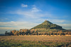
Remains of this single-towered nuraghe are located between Barumini and Villanovafranca and are difficult to access. The outline of the tower is best preserved in its northern part. There is a modern drystone structure erected over the monument.
You may be viewing yesterday's version of this page. To see the most up to date information please register for a free account.
")
")
")
Do not use the above information on other web sites or publications without permission of the contributor.
Nearby Images from Flickr
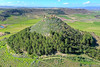
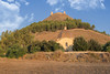

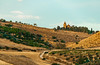
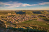
The above images may not be of the site on this page, but were taken nearby. They are loaded from Flickr so please click on them for image credits.
Click here to see more info for this site
Nearby sites
Click here to view sites on an interactive map of the areaKey: Red: member's photo, Blue: 3rd party photo, Yellow: other image, Green: no photo - please go there and take one, Grey: site destroyed
Download sites to:
KML (Google Earth)
GPX (GPS waypoints)
CSV (Garmin/Navman)
CSV (Excel)
To unlock full downloads you need to sign up as a Contributory Member. Otherwise downloads are limited to 50 sites.
Turn off the page maps and other distractions
Nearby sites listing. In the following links * = Image available
619m SSE 158° Bruncu 'e Forru Nuraghe* Broch or Nuraghe
676m SSW 207° Mariga Nuraghe* Broch or Nuraghe
946m ESE 112° Perdedu Nuraghe* Broch or Nuraghe
1.1km SW 225° Ruinali Meseda Tomba di Giganti* Chambered Tomb
1.8km ESE 117° Salamai Nuraghe* Broch or Nuraghe
2.6km SE 144° Trattasi Nuraghe* Broch or Nuraghe
3.1km E 92° Sa Zeppara Nuraghe* Broch or Nuraghe
3.1km N 356° Nuraxi 'e Cresia Nuraghe* Broch or Nuraghe
3.2km SE 127° Paberi Nuraghe* Broch or Nuraghe
3.6km NNW 345° Barumini Nuraghe* Broch or Nuraghe
3.8km SE 142° Tuppedili Nuraghe* Broch or Nuraghe
3.8km ESE 122° Sa Barracca de Is Dragonis Nuraghe* Broch or Nuraghe
4.5km SW 224° Moru Pintau Nuraghe* Broch or Nuraghe
4.6km S 189° Su Mulinu Complesso Nuragico* Broch or Nuraghe
4.8km SE 128° Ruinali Sa Figu Nuraghe* Broch or Nuraghe
4.8km NNW 346° Perdu Meloni Nuraghe* Broch or Nuraghe
5.1km SSW 210° Santu Croxiu Nuraghe* Broch or Nuraghe
5.2km WNW 294° Su Sensu Nuraghe* Broch or Nuraghe
5.3km NNE 19° Nuraceddeu Nuraghe* Broch or Nuraghe
5.3km S 171° Perdu Atzeni Nuraghe* Broch or Nuraghe
5.4km SSE 162° Bruncu Friarosu Nuraghe* Broch or Nuraghe
6.1km S 184° Cuccuru de Casteddu* Ancient Village or Settlement
6.2km N 356° Bruncu Madugui Protonuraghe* Broch or Nuraghe
6.9km S 172° Nureci Nuraghe* Broch or Nuraghe
7.4km WNW 286° Cabonu Nuraghe* Broch or Nuraghe
View more nearby sites and additional images


 We would like to know more about this location. Please feel free to add a brief description and any relevant information in your own language.
 Wir möchten mehr über diese Stätte erfahren. Bitte zögern Sie nicht, eine kurze Beschreibung und relevante Informationen in Deutsch hinzuzufügen.
 Nous aimerions en savoir encore un peu sur les lieux. S'il vous plaît n'hesitez pas à ajouter une courte description et tous les renseignements pertinents dans votre propre langue.
 Quisieramos informarnos un poco más de las lugares. No dude en añadir una breve descripción y otros datos relevantes en su propio idioma.