


<< Our Photo Pages >> Site Mégalithique de Settiva - Burial Chamber or Dolmen in France in Corsica:Corse-Sud (2A)
Submitted by AlexHunger on Thursday, 10 February 2005 Page Views: 7494
Neolithic and Bronze AgeSite Name: Site Mégalithique de Settiva Alternative Name: Calzola-Castellucciu Protohistorique Site, Dolmen de SettivaCountry: France Département: Corsica:Corse-Sud (2A) Type: Burial Chamber or Dolmen
Nearest Town: Petreto-Bicchisano Nearest Village: Bicchisano
Latitude: 41.781470N Longitude: 8.968640E
Condition:
| 5 | Perfect |
| 4 | Almost Perfect |
| 3 | Reasonable but with some damage |
| 2 | Ruined but still recognisable as an ancient site |
| 1 | Pretty much destroyed, possibly visible as crop marks |
| 0 | No data. |
| -1 | Completely destroyed |
| 5 | Superb |
| 4 | Good |
| 3 | Ordinary |
| 2 | Not Good |
| 1 | Awful |
| 0 | No data. |
| 5 | Can be driven to, probably with disabled access |
| 4 | Short walk on a footpath |
| 3 | Requiring a bit more of a walk |
| 2 | A long walk |
| 1 | In the middle of nowhere, a nightmare to find |
| 0 | No data. |
| 5 | co-ordinates taken by GPS or official recorded co-ordinates |
| 4 | co-ordinates scaled from a detailed map |
| 3 | co-ordinates scaled from a bad map |
| 2 | co-ordinates of the nearest village |
| 1 | co-ordinates of the nearest town |
| 0 | no data |
Internal Links:
External Links:
I have visited· I would like to visit
bishop_pam visited on 28th Dec 2016 - their rating: Cond: 4 Amb: 4 Access: 3 This site is not signposted and is difficult to find.
")
Well preserved dolmen surrounded by kerb stones and a tall menhir in front of it.
Location Source: T4T35.fr
You may be viewing yesterday's version of this page. To see the most up to date information please register for a free account.
")
Do not use the above information on other web sites or publications without permission of the contributor.
Nearby Images from Flickr
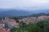
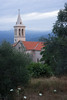
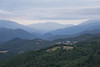
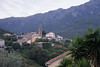
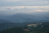
The above images may not be of the site on this page, but were taken nearby. They are loaded from Flickr so please click on them for image credits.
Click here to see more info for this site
Nearby sites
Click here to view sites on an interactive map of the areaKey: Red: member's photo, Blue: 3rd party photo, Yellow: other image, Green: no photo - please go there and take one, Grey: site destroyed
Download sites to:
KML (Google Earth)
GPX (GPS waypoints)
CSV (Garmin/Navman)
CSV (Excel)
To unlock full downloads you need to sign up as a Contributory Member. Otherwise downloads are limited to 50 sites.
Turn off the page maps and other distractions
Nearby sites listing. In the following links * = Image available
1.5km NE 39° Petreto-Bicchisano* Modern Stone Circle etc
6.4km NW 308° U Cantonu statues-menhirs* Sculptured Stone
6.9km NE 41° Torre de Foce Stone Fort or Dun
7.6km SW 229° Musolo statue-menhir Sculptured Stone
8.3km SSW 210° Scalsa Murta statue-menhir* Sculptured Stone
8.9km WSW 248° Tappa statue-menhir 2* Sculptured Stone
8.9km WSW 245° Filitosa Central Monument* Cairn
8.9km WSW 245° Filitosa Statue-Menhir (6)* Sculptured Stone
8.9km WSW 245° Filitosa Statues-Menhirs* Sculptured Stone
9.0km WSW 246° Filitosa Statue-Menhir (2) Standing Stone (Menhir)
9.0km WSW 246° Tappa Statue-Menhir (1)* Sculptured Stone
9.0km WSW 246° Filitosa Statue-Menhir (1)* Standing Stone (Menhir)
9.0km WSW 246° Filitosa Statue-Menhir (4)* Standing Stone (Menhir)
9.0km WSW 246° Filitosa Statue-Menhir (3)* Standing Stone (Menhir)
9.0km WSW 244° Filitosa Statue-Menhir (5)* Sculptured Stone
9.0km WSW 240° Murato statue-menhir Sculptured Stone
9.1km WSW 244° Filitosa Museum* Museum
9.1km SW 234° Parata statue-menhir Sculptured Stone
10.3km SSW 207° Santa Naria statue-menhir I* Sculptured Stone
10.4km SSW 207° Santa Naria menhir 2 Sculptured Stone
11.1km WSW 240° I Calanche / Sapar'Alta* Ancient Village or Settlement
11.3km WSW 243° Isula statue-menhir Sculptured Stone
11.4km SW 223° Albitretu standing stones* Standing Stones
12.2km SW 225° Castellu di Cuntorba* Ancient Village or Settlement
12.5km WSW 240° Taravo statues-menhirs Sculptured Stone
View more nearby sites and additional images


 We would like to know more about this location. Please feel free to add a brief description and any relevant information in your own language.
 Wir möchten mehr über diese Stätte erfahren. Bitte zögern Sie nicht, eine kurze Beschreibung und relevante Informationen in Deutsch hinzuzufügen.
 Nous aimerions en savoir encore un peu sur les lieux. S'il vous plaît n'hesitez pas à ajouter une courte description et tous les renseignements pertinents dans votre propre langue.
 Quisieramos informarnos un poco más de las lugares. No dude en añadir una breve descripción y otros datos relevantes en su propio idioma.