


<< Other Photo Pages >> Grabhügelgruppe Haiberg - Barrow Cemetery in Germany in North Rhine-Westphalia
Submitted by Harald_Platta on Thursday, 21 January 2016 Page Views: 1086
Iron Age and Later PrehistorySite Name: Grabhügelgruppe Haiberg Alternative Name: Grabhügel Kalldorf, Grabhügel KalletalCountry: Germany
NOTE: This site is 3.568 km away from the location you searched for.
Land: North Rhine-Westphalia Type: Barrow Cemetery
Nearest Town: Kalletal
Latitude: 52.148576N Longitude: 8.944236E
Condition:
| 5 | Perfect |
| 4 | Almost Perfect |
| 3 | Reasonable but with some damage |
| 2 | Ruined but still recognisable as an ancient site |
| 1 | Pretty much destroyed, possibly visible as crop marks |
| 0 | No data. |
| -1 | Completely destroyed |
| 5 | Superb |
| 4 | Good |
| 3 | Ordinary |
| 2 | Not Good |
| 1 | Awful |
| 0 | No data. |
| 5 | Can be driven to, probably with disabled access |
| 4 | Short walk on a footpath |
| 3 | Requiring a bit more of a walk |
| 2 | A long walk |
| 1 | In the middle of nowhere, a nightmare to find |
| 0 | No data. |
| 5 | co-ordinates taken by GPS or official recorded co-ordinates |
| 4 | co-ordinates scaled from a detailed map |
| 3 | co-ordinates scaled from a bad map |
| 2 | co-ordinates of the nearest village |
| 1 | co-ordinates of the nearest town |
| 0 | no data |
Internal Links:
External Links:
")
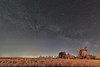
The barrows date from the early Iron Age. Many of them exhibit a crater at their top, which most likely stems from grave robbers. This fits with reports from the 18th and 19th century, where the prevailing grave robbery caused the baronal Fürstlich Lippische Regierung to ban these actions in 1821.
Today, several grave mounds are still visible.
Literature:
[01] Hohenschwert, F.: Grabhügelgruppe auf dem Haiberg bei Langenholzhausen. In: Führer zu archäologischen Denkmälern in Deutschland Bd. 10/11 (1985).
[02] Naturwissenschaftlicher Verein für das Land Lippe, Geschichtliche Abteilung (Hrsg.): Mitteilungen aus der lippischen Geschichte und Landeskunde. Band 10–13, Meyersche Hofbuchhandlung Verlag (1914).
You may be viewing yesterday's version of this page. To see the most up to date information please register for a free account.
Do not use the above information on other web sites or publications without permission of the contributor.
Nearby Images from Flickr
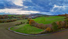
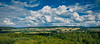
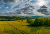
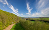

The above images may not be of the site on this page, but were taken nearby. They are loaded from Flickr so please click on them for image credits.
Click here to see more info for this site
Nearby sites
Click here to view sites on an interactive map of the areaKey: Red: member's photo, Blue: 3rd party photo, Yellow: other image, Green: no photo - please go there and take one, Grey: site destroyed
Download sites to:
KML (Google Earth)
GPX (GPS waypoints)
CSV (Garmin/Navman)
CSV (Excel)
To unlock full downloads you need to sign up as a Contributory Member. Otherwise downloads are limited to 50 sites.
Turn off the page maps and other distractions
Nearby sites listing. In the following links * = Image available
4.3km ENE 71° Schäferstein Stemmen* Standing Stone (Menhir)
8.9km ESE 122° Summstein Extertal Modern Stone Circle etc
9.5km WSW 252° Hünengrab Schalks Busch Round Barrow(s)
9.9km ESE 120° Grabhügel Almena Round Barrow(s)
10.2km ESE 124° Grabhügel Lückenberg Round Barrow(s)
10.3km N 8° Wallburg Nammer Lager* Hillfort
10.5km ESE 110° Evastein* Natural Stone / Erratic / Other Natural Feature
11.5km SSE 166° Wallburg Amelungsburg (Lipper Bergland)* Hillfort
11.8km NNW 340° Wallburg Wittekindsburg (Barkhausen)* Hillfort
11.8km S 172° Wallburg Piepenkopf* Hillfort
11.8km NNW 339° Wittekindsquelle (Porta Westfalica)* Holy Well or Sacred Spring
12.0km ESE 115° Grabhügel am Gersiek Round Barrow(s)
12.1km WSW 238° Opferstein Vierenberg* Natural Stone / Erratic / Other Natural Feature
12.3km NNW 333° Wallburg Dehmer Burg* Hillfort
13.6km WNW 303° Werste Steinkammergrab* Passage Grave
14.3km NNE 30° Summstein Bückeburg* Modern Stone Circle etc
17.7km NW 319° Wittekindsquelle Bergkirchen* Holy Well or Sacred Spring
21.0km SSW 206° Johannissteine bei Lage* Natural Stone / Erratic / Other Natural Feature
21.6km S 186° Grabhügel Schlingenbusch Round Barrow(s)
21.8km SSW 194° Eselstein* Natural Stone / Erratic / Other Natural Feature
21.8km SSW 195° Siedlungsplatz der älteren Steinzeit Mesche Ancient Village or Settlement
21.9km NW 324° Moorfundplatz Unterlübbe Ancient Trackway
23.1km SE 143° Grabhügelgruppe Barntrup Barrow Cemetery
23.9km S 191° Lippisches Landesmuseum* Museum
24.6km S 178° Leistruper Wald Opferstein I Natural Stone / Erratic / Other Natural Feature
View more nearby sites and additional images


 We would like to know more about this location. Please feel free to add a brief description and any relevant information in your own language.
 Wir möchten mehr über diese Stätte erfahren. Bitte zögern Sie nicht, eine kurze Beschreibung und relevante Informationen in Deutsch hinzuzufügen.
 Nous aimerions en savoir encore un peu sur les lieux. S'il vous plaît n'hesitez pas à ajouter une courte description et tous les renseignements pertinents dans votre propre langue.
 Quisieramos informarnos un poco más de las lugares. No dude en añadir una breve descripción y otros datos relevantes en su propio idioma.