


<< Other Photo Pages >> Kilchberg Grabstele - Standing Stone (Menhir) in Germany in Baden-Wuerttemberg
Submitted by KaiHofmann on Monday, 04 November 2013 Page Views: 1901
Neolithic and Bronze AgeSite Name: Kilchberg GrabsteleCountry: Germany
NOTE: This site is 6.484 km away from the location you searched for.
Land: Baden-Wuerttemberg Type: Standing Stone (Menhir)
Nearest Town: Tübingen Nearest Village: Kilchberg
Latitude: 48.491319N Longitude: 9.019812E
Condition:
| 5 | Perfect |
| 4 | Almost Perfect |
| 3 | Reasonable but with some damage |
| 2 | Ruined but still recognisable as an ancient site |
| 1 | Pretty much destroyed, possibly visible as crop marks |
| 0 | No data. |
| -1 | Completely destroyed |
| 5 | Superb |
| 4 | Good |
| 3 | Ordinary |
| 2 | Not Good |
| 1 | Awful |
| 0 | No data. |
| 5 | Can be driven to, probably with disabled access |
| 4 | Short walk on a footpath |
| 3 | Requiring a bit more of a walk |
| 2 | A long walk |
| 1 | In the middle of nowhere, a nightmare to find |
| 0 | No data. |
| 5 | co-ordinates taken by GPS or official recorded co-ordinates |
| 4 | co-ordinates scaled from a detailed map |
| 3 | co-ordinates scaled from a bad map |
| 2 | co-ordinates of the nearest village |
| 1 | co-ordinates of the nearest town |
| 0 | no data |
Internal Links:
External Links:
")
Reconstructed burial mound with an copy of an anthropomorphical burial stele (1.2m tall). The original is located in the Landesmuseum Stuttgart.
You may be viewing yesterday's version of this page. To see the most up to date information please register for a free account.
")
Do not use the above information on other web sites or publications without permission of the contributor.
Nearby Images from Flickr
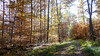
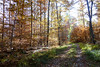
The above images may not be of the site on this page, but were taken nearby. They are loaded from Flickr so please click on them for image credits.
Click here to see more info for this site
Nearby sites
Click here to view sites on an interactive map of the areaKey: Red: member's photo, Blue: 3rd party photo, Yellow: other image, Green: no photo - please go there and take one, Grey: site destroyed
Download sites to:
KML (Google Earth)
GPX (GPS waypoints)
CSV (Garmin/Navman)
CSV (Excel)
To unlock full downloads you need to sign up as a Contributory Member. Otherwise downloads are limited to 50 sites.
Turn off the page maps and other distractions
Nearby sites listing. In the following links * = Image available
5m ENE 61° Keltengrab Artificial Mound
813m ENE 79° Weilheim Menhir* Standing Stone (Menhir)
3.9km NE 35° Museum Alte Kulturen* Museum
4.0km ESE 109° Hechelhart Wald Grabhügelfeld* Barrow Cemetery
5.3km SE 140° Eichbuckel Grabhügel Artificial Mound
9.4km NW 307° Kirchberg (Ammerbuch) Hillfort
11.8km NE 49° Rübgarten Keltische Viereckschanze Ancient Village or Settlement
11.9km NE 49° Rübgarten Grabhügelgruppe Round Barrow(s)
13.8km E 92° Summstein Pomologie Modern Stone Circle etc
15.6km NNE 29° Benzenberg Keltische Viereckschanze Ancient Village or Settlement
16.7km W 275° Baisingen Fürstengrabhügel Artificial Mound
19.3km NW 307° Kuppingen Grabhügelfeld Barrow Cemetery
19.4km N 355° Böblingen Grabhügelfeld Barrow Cemetery
20.5km NE 51° Lebenbühl GrossGrabhügel Artificial Mound
20.8km WNW 295° Oberjettingen Grabhügel Artificial Mound
20.9km WNW 295° Oberjettingen Keltische Viereckschanze Ancient Village or Settlement
21.5km NE 34° Weillerhau Grabhügelfeld Barrow Cemetery
22.7km NNE 23° Grabhügel und Götterstelen am Geschichtlichen Lehrpfad Leinfelden-Echterdingen* Barrow Cemetery
22.9km NNE 24° Federlesmahd Grabhügelgruppe* Barrow Cemetery
23.0km NNE 23° Federlesmahd Keltische Viereckschanze* Ancient Village or Settlement
23.3km W 266° Bildechingen Keltische Viereckschanze Ancient Village or Settlement
23.6km WNW 287° Krautbühl Artificial Mound
25.5km E 94° Runder Berg, Urach* Ancient Village or Settlement
26.1km ENE 64° Rossdorfer Keltenweg Keltische Viereckschanze Ancient Village or Settlement
26.5km W 262° Horb am Neckar Grabhügel Artificial Mound
View more nearby sites and additional images


 We would like to know more about this location. Please feel free to add a brief description and any relevant information in your own language.
 Wir möchten mehr über diese Stätte erfahren. Bitte zögern Sie nicht, eine kurze Beschreibung und relevante Informationen in Deutsch hinzuzufügen.
 Nous aimerions en savoir encore un peu sur les lieux. S'il vous plaît n'hesitez pas à ajouter une courte description et tous les renseignements pertinents dans votre propre langue.
 Quisieramos informarnos un poco más de las lugares. No dude en añadir una breve descripción y otros datos relevantes en su propio idioma.