 with our Megalithic Portal iPhone app")


<< Text Pages >> Sa Cirra Nuraghe - Broch or Nuraghe in Italy in Sardinia (Sardegna)
Submitted by SolarMegalith on Sunday, 10 November 2013 Page Views: 1197
Neolithic and Bronze AgeSite Name: Sa Cirra NuragheCountry: Italy
NOTE: This site is 1.822 km away from the location you searched for.
Region: Sardinia (Sardegna) Type: Broch or Nuraghe
Nearest Town: Assolo
Latitude: 39.800326N Longitude: 8.918164E
Condition:
| 5 | Perfect |
| 4 | Almost Perfect |
| 3 | Reasonable but with some damage |
| 2 | Ruined but still recognisable as an ancient site |
| 1 | Pretty much destroyed, possibly visible as crop marks |
| 0 | No data. |
| -1 | Completely destroyed |
| 5 | Superb |
| 4 | Good |
| 3 | Ordinary |
| 2 | Not Good |
| 1 | Awful |
| 0 | No data. |
| 5 | Can be driven to, probably with disabled access |
| 4 | Short walk on a footpath |
| 3 | Requiring a bit more of a walk |
| 2 | A long walk |
| 1 | In the middle of nowhere, a nightmare to find |
| 0 | No data. |
| 5 | co-ordinates taken by GPS or official recorded co-ordinates |
| 4 | co-ordinates scaled from a detailed map |
| 3 | co-ordinates scaled from a bad map |
| 2 | co-ordinates of the nearest village |
| 1 | co-ordinates of the nearest town |
| 0 | no data |
Internal Links:
External Links:
Nuraghe in Sardinia (Sardegna)
Remains of Nuraghe Sa Cirra are located circa 1km south of Assolo.
You may be viewing yesterday's version of this page. To see the most up to date information please register for a free account.
Do not use the above information on other web sites or publications without permission of the contributor.
Nearby Images from Flickr
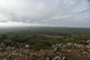
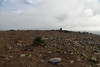
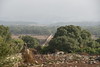

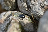

The above images may not be of the site on this page, but were taken nearby. They are loaded from Flickr so please click on them for image credits.
Click here to see more info for this site
Nearby sites
Click here to view sites on an interactive map of the areaKey: Red: member's photo, Blue: 3rd party photo, Yellow: other image, Green: no photo - please go there and take one, Grey: site destroyed
Download sites to:
KML (Google Earth)
GPX (GPS waypoints)
CSV (Garmin/Navman)
CSV (Excel)
To unlock full downloads you need to sign up as a Contributory Member. Otherwise downloads are limited to 50 sites.
Turn off the page maps and other distractions
Nearby sites listing. In the following links * = Image available
2.8km ENE 66° Maria Turri Nuraghe Broch or Nuraghe
4.3km WSW 250° Corona Arrubia Santuario Nuragico Ancient Temple
4.5km N 354° Su Moguru Nuraghe* Broch or Nuraghe
5.3km N 349° Caiu Nuraghe* Broch or Nuraghe
5.6km N 350° Genna Salixi Domus de Janas* Rock Cut Tomb
6.9km NNE 30° Is Cirquittus Stone row* Stone Row / Alignment
7.2km NNE 29° Is Cirquittus Circoli Megalitici* Stone Circle
7.4km NNE 25° Asuni Menhir* Standing Stones
7.5km ENE 75° Addori Nuraghe Broch or Nuraghe
7.8km N 357° Cara Bassa* Stone Row / Alignment
8.3km N 359° Brentoni* Stone Row / Alignment
8.5km N 350° Curru Tundu* Standing Stones
8.5km N 351° Is Forrus Domus de Janas* Rock Cut Tomb
8.6km NNW 346° Tuttiricchiu* Standing Stone (Menhir)
9.2km NNW 338° Friarosu Protonuraghe* Broch or Nuraghe
9.2km NNW 345° Baduggiana Standing Stone (Menhir)
9.4km NNW 334° Bioranu Nuraghe* Broch or Nuraghe
10.3km WSW 242° Barumele* Ancient Village or Settlement
10.3km ESE 121° Bruncu Peppi Pinna Nuraghe Broch or Nuraghe
10.3km SE 139° Bruncu Madugui Protonuraghe* Broch or Nuraghe
11.0km SSE 147° Perdu Meloni Nuraghe* Broch or Nuraghe
11.4km WSW 240° Mandonis Nuraghe* Broch or Nuraghe
11.7km WSW 241° Prabanta Menhir* Standing Stone (Menhir)
11.9km S 180° Cabonu Nuraghe* Broch or Nuraghe
11.9km E 99° Valenza Nuraghe* Broch or Nuraghe
View more nearby sites and additional images


 We would like to know more about this location. Please feel free to add a brief description and any relevant information in your own language.
 Wir möchten mehr über diese Stätte erfahren. Bitte zögern Sie nicht, eine kurze Beschreibung und relevante Informationen in Deutsch hinzuzufügen.
 Nous aimerions en savoir encore un peu sur les lieux. S'il vous plaît n'hesitez pas à ajouter une courte description et tous les renseignements pertinents dans votre propre langue.
 Quisieramos informarnos un poco más de las lugares. No dude en añadir una breve descripción y otros datos relevantes en su propio idioma.