


<< Text Pages >> Arasseda Nuraghe - Broch or Nuraghe in Italy in Sardinia (Sardegna)
Submitted by SolarMegalith on Thursday, 29 September 2011 Page Views: 1759
Neolithic and Bronze AgeSite Name: Arasseda NuragheCountry: Italy
NOTE: This site is 2.295 km away from the location you searched for.
Region: Sardinia (Sardegna) Type: Broch or Nuraghe
Nearest Town: Allai
Latitude: 39.970278N Longitude: 8.871667E
Condition:
| 5 | Perfect |
| 4 | Almost Perfect |
| 3 | Reasonable but with some damage |
| 2 | Ruined but still recognisable as an ancient site |
| 1 | Pretty much destroyed, possibly visible as crop marks |
| 0 | No data. |
| -1 | Completely destroyed |
| 5 | Superb |
| 4 | Good |
| 3 | Ordinary |
| 2 | Not Good |
| 1 | Awful |
| 0 | No data. |
| 5 | Can be driven to, probably with disabled access |
| 4 | Short walk on a footpath |
| 3 | Requiring a bit more of a walk |
| 2 | A long walk |
| 1 | In the middle of nowhere, a nightmare to find |
| 0 | No data. |
| 5 | co-ordinates taken by GPS or official recorded co-ordinates |
| 4 | co-ordinates scaled from a detailed map |
| 3 | co-ordinates scaled from a bad map |
| 2 | co-ordinates of the nearest village |
| 1 | co-ordinates of the nearest town |
| 0 | no data |
Internal Links:
External Links:
Nuraghe in Sardinia (Sardegna)
Remains of a Bronze Age nuraghe (probably tholos-style) located 2km NE of Allai.
You may be viewing yesterday's version of this page. To see the most up to date information please register for a free account.
Do not use the above information on other web sites or publications without permission of the contributor.
Nearby Images from Flickr

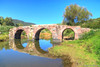
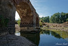
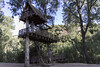
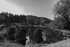
The above images may not be of the site on this page, but were taken nearby. They are loaded from Flickr so please click on them for image credits.
Click here to see more info for this site
Nearby sites
Click here to view sites on an interactive map of the areaKey: Red: member's photo, Blue: 3rd party photo, Yellow: other image, Green: no photo - please go there and take one, Grey: site destroyed
Download sites to:
KML (Google Earth)
GPX (GPS waypoints)
CSV (Garmin/Navman)
CSV (Excel)
To unlock full downloads you need to sign up as a Contributory Member. Otherwise downloads are limited to 50 sites.
Turn off the page maps and other distractions
Nearby sites listing. In the following links * = Image available
2.5km ESE 116° Sa Mura Nuraghe (Samugheo) Broch or Nuraghe
5.0km NW 318° Putzola Protonuraghe Broch or Nuraghe
5.1km WNW 289° Is Domigheddas Domus de Janas Rock Cut Tomb
5.9km N 11° Sa Giacca Protonuraghe Broch or Nuraghe
6.1km NNE 16° Marapela Nuraghe Broch or Nuraghe
6.3km ESE 112° Cuccuru e Lai* Sculptured Stone
6.6km SSE 163° Mesadda Domus de Janas* Rock Cut Tomb
9.5km WNW 295° Pischina Andria Nuraghe* Broch or Nuraghe
10.1km WNW 286° Ruinas Nuraghe* Broch or Nuraghe
10.1km S 171° Baduggiana Standing Stone (Menhir)
10.3km NE 53° Pira 'e Zuri Nuraghe Broch or Nuraghe
10.4km S 177° Friarosu Protonuraghe* Broch or Nuraghe
10.5km S 181° Bioranu Nuraghe* Broch or Nuraghe
10.6km NW 321° Mura Olia Nuraghe* Broch or Nuraghe
10.7km WNW 292° Dominigu Porru Nuraghe* Broch or Nuraghe
10.7km S 170° Tuttiricchiu* Standing Stone (Menhir)
10.7km WNW 290° Su Crabu Nuraghe* Broch or Nuraghe
10.8km SSE 166° Is Forrus Domus de Janas* Rock Cut Tomb
10.9km SSE 167° Curru Tundu* Standing Stones
10.9km WNW 288° San Gemiliano Nuraghe* Broch or Nuraghe
11.1km NE 56° Su Linnari Nuraghe Broch or Nuraghe
11.2km W 267° Serra Laccus Nuraghe Broch or Nuraghe
11.2km WNW 293° Zoppianu Nuraghe* Broch or Nuraghe
11.3km SSE 160° Brentoni* Stone Row / Alignment
11.6km SSE 162° Cara Bassa* Stone Row / Alignment
View more nearby sites and additional images


 We would like to know more about this location. Please feel free to add a brief description and any relevant information in your own language.
 Wir möchten mehr über diese Stätte erfahren. Bitte zögern Sie nicht, eine kurze Beschreibung und relevante Informationen in Deutsch hinzuzufügen.
 Nous aimerions en savoir encore un peu sur les lieux. S'il vous plaît n'hesitez pas à ajouter une courte description et tous les renseignements pertinents dans votre propre langue.
 Quisieramos informarnos un poco más de las lugares. No dude en añadir una breve descripción y otros datos relevantes en su propio idioma.