


<< Our Photo Pages >> Bioranu Nuraghe - Broch or Nuraghe in Italy in Sardinia (Sardegna)
Submitted by SolarMegalith on Tuesday, 27 September 2011 Page Views: 2047
Neolithic and Bronze AgeSite Name: Bioranu NuragheCountry: Italy
NOTE: This site is 1.095 km away from the location you searched for.
Region: Sardinia (Sardegna) Type: Broch or Nuraghe
Nearest Town: Mogorella
Latitude: 39.876299N Longitude: 8.869323E
Condition:
| 5 | Perfect |
| 4 | Almost Perfect |
| 3 | Reasonable but with some damage |
| 2 | Ruined but still recognisable as an ancient site |
| 1 | Pretty much destroyed, possibly visible as crop marks |
| 0 | No data. |
| -1 | Completely destroyed |
| 5 | Superb |
| 4 | Good |
| 3 | Ordinary |
| 2 | Not Good |
| 1 | Awful |
| 0 | No data. |
| 5 | Can be driven to, probably with disabled access |
| 4 | Short walk on a footpath |
| 3 | Requiring a bit more of a walk |
| 2 | A long walk |
| 1 | In the middle of nowhere, a nightmare to find |
| 0 | No data. |
| 5 | co-ordinates taken by GPS or official recorded co-ordinates |
| 4 | co-ordinates scaled from a detailed map |
| 3 | co-ordinates scaled from a bad map |
| 2 | co-ordinates of the nearest village |
| 1 | co-ordinates of the nearest town |
| 0 | no data |
Internal Links:
External Links:
I have visited· I would like to visit
SolarMegalith saw from a distance on 7th Sep 2011 - their rating: Cond: 2 Amb: 3
")
Remains of the Bronze Age nuraghe (probably a tholos-style one) located on top of the hill NE from Mogorella.
You may be viewing yesterday's version of this page. To see the most up to date information please register for a free account.
Do not use the above information on other web sites or publications without permission of the contributor.
Nearby Images from Flickr


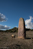
The above images may not be of the site on this page, but were taken nearby. They are loaded from Flickr so please click on them for image credits.
Click here to see more info for this site
Nearby sites
Click here to view sites on an interactive map of the areaKey: Red: member's photo, Blue: 3rd party photo, Yellow: other image, Green: no photo - please go there and take one, Grey: site destroyed
Download sites to:
KML (Google Earth)
GPX (GPS waypoints)
CSV (Garmin/Navman)
CSV (Excel)
To unlock full downloads you need to sign up as a Contributory Member. Otherwise downloads are limited to 50 sites.
Turn off the page maps and other distractions
Nearby sites listing. In the following links * = Image available
699m E 87° Friarosu Protonuraghe* Broch or Nuraghe
1.9km ENE 77° Baduggiana Standing Stone (Menhir)
2.0km E 93° Tuttiricchiu* Standing Stone (Menhir)
2.7km E 92° Curru Tundu* Standing Stones
2.8km E 91° Is Forrus Domus de Janas* Rock Cut Tomb
3.8km E 99° Cara Bassa* Stone Row / Alignment
4.1km E 93° Brentoni* Stone Row / Alignment
4.4km SE 133° Genna Salixi Domus de Janas* Rock Cut Tomb
4.5km SE 135° Caiu Nuraghe* Broch or Nuraghe
4.7km NNE 27° Mesadda Domus de Janas* Rock Cut Tomb
5.4km SE 137° Su Moguru Nuraghe* Broch or Nuraghe
7.4km ESE 104° Asuni Menhir* Standing Stones
8.0km ESE 106° Is Cirquittus Circoli Megalitici* Stone Circle
8.0km ESE 108° Is Cirquittus Stone row* Stone Row / Alignment
9.4km SSE 154° Sa Cirra Nuraghe Broch or Nuraghe
9.7km NNE 15° Sa Mura Nuraghe (Samugheo) Broch or Nuraghe
9.9km S 179° Corona Arrubia Santuario Nuragico Ancient Temple
9.9km SE 137° Maria Turri Nuraghe Broch or Nuraghe
10.1km NE 36° Cuccuru e Lai* Sculptured Stone
10.5km N 1° Arasseda Nuraghe Broch or Nuraghe
11.3km WNW 291° Paba de Soli Nuraghe* Broch or Nuraghe
11.5km SW 226° Sennixeddu Stazione Preistorica Ancient Mine, Quarry or other Industry
11.5km ENE 77° Orrubiu Nuraghe Broch or Nuraghe
12.5km E 80° Masone Perdu* Chambered Tomb
12.6km ENE 77° Genna Corte Nuraghe* Broch or Nuraghe
View more nearby sites and additional images


 We would like to know more about this location. Please feel free to add a brief description and any relevant information in your own language.
 Wir möchten mehr über diese Stätte erfahren. Bitte zögern Sie nicht, eine kurze Beschreibung und relevante Informationen in Deutsch hinzuzufügen.
 Nous aimerions en savoir encore un peu sur les lieux. S'il vous plaît n'hesitez pas à ajouter une courte description et tous les renseignements pertinents dans votre propre langue.
 Quisieramos informarnos un poco más de las lugares. No dude en añadir una breve descripción y otros datos relevantes en su propio idioma.