


<< Other Photo Pages >> Odins Auge - Holy Well or Sacred Spring in Germany in North Rhine-Westphalia
Submitted by Harald_Platta on Wednesday, 18 May 2016 Page Views: 2250
Springs and Holy WellsSite Name: Odins Auge Alternative Name: LippequelleCountry: Germany
NOTE: This site is 0.434 km away from the location you searched for.
Land: North Rhine-Westphalia Type: Holy Well or Sacred Spring
Nearest Town: Bad Lippspringe
Latitude: 51.781489N Longitude: 8.822225E
Condition:
| 5 | Perfect |
| 4 | Almost Perfect |
| 3 | Reasonable but with some damage |
| 2 | Ruined but still recognisable as an ancient site |
| 1 | Pretty much destroyed, possibly visible as crop marks |
| 0 | No data. |
| -1 | Completely destroyed |
| 5 | Superb |
| 4 | Good |
| 3 | Ordinary |
| 2 | Not Good |
| 1 | Awful |
| 0 | No data. |
| 5 | Can be driven to, probably with disabled access |
| 4 | Short walk on a footpath |
| 3 | Requiring a bit more of a walk |
| 2 | A long walk |
| 1 | In the middle of nowhere, a nightmare to find |
| 0 | No data. |
| 5 | co-ordinates taken by GPS or official recorded co-ordinates |
| 4 | co-ordinates scaled from a detailed map |
| 3 | co-ordinates scaled from a bad map |
| 2 | co-ordinates of the nearest village |
| 1 | co-ordinates of the nearest town |
| 0 | no data |
Internal Links:
External Links:
")
According to a local legend, the well occured when Odin threw his eye on the dry ground in order to make the soil fertile.
Literature:
[01] Sondermann, D: Odins Age. In: Lippesagen (2013).
You may be viewing yesterday's version of this page. To see the most up to date information please register for a free account.
Do not use the above information on other web sites or publications without permission of the contributor.
Nearby Images from Flickr
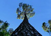
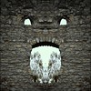
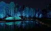
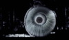
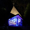
The above images may not be of the site on this page, but were taken nearby. They are loaded from Flickr so please click on them for image credits.
Click here to see more info for this site
Nearby sites
Click here to view sites on an interactive map of the areaKey: Red: member's photo, Blue: 3rd party photo, Yellow: other image, Green: no photo - please go there and take one, Grey: site destroyed
Download sites to:
KML (Google Earth)
GPX (GPS waypoints)
CSV (Garmin/Navman)
CSV (Excel)
To unlock full downloads you need to sign up as a Contributory Member. Otherwise downloads are limited to 50 sites.
Turn off the page maps and other distractions
Nearby sites listing. In the following links * = Image available
106m S 191° Liborius Quelle* Holy Well or Sacred Spring
4.5km ENE 72° Grabhügelgruppe Steinbeke Barrow Cemetery
4.9km NNE 17° Kohlstaedt Huegelgraeberfeld* Barrow Cemetery
5.6km ENE 65° Grabhügelgruppe Brocksschlucht Barrow Cemetery
6.6km N 11° Oesterholz Huegelgraeberfeld* Barrow Cemetery
6.7km ENE 70° Grabhügelfeld Egge-Nord Barrow Cemetery
7.5km WSW 237° Schloß Neuhaus Galeriegrab (1) Chambered Tomb
8.1km ENE 63° Lukenloch* Cave or Rock Shelter
8.1km WSW 241° Schloß Neuhaus Galeriegrab (2) Chambered Tomb
8.2km SSW 212° Paderborn Iron Age Settlements Ancient Village or Settlement
8.5km SW 215° Augenquelle Paderborn Holy Well or Sacred Spring
9.5km ESE 103° Bollerborn* Holy Well or Sacred Spring
11.0km NNE 17° Grabhügel Berlebecker Heide Round Barrow(s)
11.2km NE 54° Steinlabyrinth Velmerstot* Turf Maze
11.7km NNE 34° Externsteine* Rock Outcrop
13.8km NNE 15° Grabhügelgruppe Recke Round Barrow(s)
13.9km NNE 21° Grabhügel Im Wallberge Round Barrow(s)
14.1km N 10° Grabhügelgruppe In der Steinbreite Barrow Cemetery
14.6km SSW 204° Storchenkolk* Holy Well or Sacred Spring
14.6km N 5° Wallburg Großer Hünenring* Hillfort
14.7km NNE 16° Siedlungsplatz der mittleren Steinzeit Im Niedernkampe Ancient Village or Settlement
14.9km N 3° Grabhügel Oberes Martsiek Round Barrow(s)
14.9km NNE 27° Grabhügel Auf dem Osterberge Round Barrow(s)
15.0km NNE 18° Grabhügel Großer Stenderbusch Round Barrow(s)
15.4km NNE 21° Grabhügelgruppe Großer Schneiderbusch Round Barrow(s)
View more nearby sites and additional images


 We would like to know more about this location. Please feel free to add a brief description and any relevant information in your own language.
 Wir möchten mehr über diese Stätte erfahren. Bitte zögern Sie nicht, eine kurze Beschreibung und relevante Informationen in Deutsch hinzuzufügen.
 Nous aimerions en savoir encore un peu sur les lieux. S'il vous plaît n'hesitez pas à ajouter une courte description et tous les renseignements pertinents dans votre propre langue.
 Quisieramos informarnos un poco más de las lugares. No dude en añadir una breve descripción y otros datos relevantes en su propio idioma.