


<< Text Pages >> Bolentari Nuraghe - Broch or Nuraghe in Italy in Sardinia (Sardegna)
Submitted by SolarMegalith on Tuesday, 28 September 2010 Page Views: 1468
Neolithic and Bronze AgeSite Name: Bolentari NuragheCountry: Italy
NOTE: This site is 1.713 km away from the location you searched for.
Region: Sardinia (Sardegna) Type: Broch or Nuraghe
Nearest Town: Martis
Latitude: 40.789494N Longitude: 8.794588E
Condition:
| 5 | Perfect |
| 4 | Almost Perfect |
| 3 | Reasonable but with some damage |
| 2 | Ruined but still recognisable as an ancient site |
| 1 | Pretty much destroyed, possibly visible as crop marks |
| 0 | No data. |
| -1 | Completely destroyed |
| 5 | Superb |
| 4 | Good |
| 3 | Ordinary |
| 2 | Not Good |
| 1 | Awful |
| 0 | No data. |
| 5 | Can be driven to, probably with disabled access |
| 4 | Short walk on a footpath |
| 3 | Requiring a bit more of a walk |
| 2 | A long walk |
| 1 | In the middle of nowhere, a nightmare to find |
| 0 | No data. |
| 5 | co-ordinates taken by GPS or official recorded co-ordinates |
| 4 | co-ordinates scaled from a detailed map |
| 3 | co-ordinates scaled from a bad map |
| 2 | co-ordinates of the nearest village |
| 1 | co-ordinates of the nearest town |
| 0 | no data |
Internal Links:
External Links:
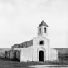
Heavily damaged remains of a nuraghe located west from Martis.
You may be viewing yesterday's version of this page. To see the most up to date information please register for a free account.
Do not use the above information on other web sites or publications without permission of the contributor.
Nearby Images from Flickr

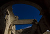
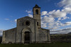
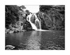
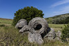
The above images may not be of the site on this page, but were taken nearby. They are loaded from Flickr so please click on them for image credits.
Click here to see more info for this site
Nearby sites
Click here to view sites on an interactive map of the areaKey: Red: member's photo, Blue: 3rd party photo, Yellow: other image, Green: no photo - please go there and take one, Grey: site destroyed
Download sites to:
KML (Google Earth)
GPX (GPS waypoints)
CSV (Garmin/Navman)
CSV (Excel)
To unlock full downloads you need to sign up as a Contributory Member. Otherwise downloads are limited to 50 sites.
Turn off the page maps and other distractions
Nearby sites listing. In the following links * = Image available
755m ENE 56° Monte Ruina Nuraghe Broch or Nuraghe
1.3km NW 321° Pedra Fulcada Nuraghe Broch or Nuraghe
2.6km ENE 77° Monte Rughe Nuraghe Broch or Nuraghe
3.9km E 83° Santu Poltolu Nuraghe Broch or Nuraghe
4.0km SSW 197° Sambinzos Domus de Janas Rock Cut Tomb
4.4km SE 139° Mesu de Montes Nuraghe* Broch or Nuraghe
4.6km S 182° Badde Cheja Nuraghe* Broch or Nuraghe
4.6km SE 144° Sas Piras Domus de Janas* Rock Cut Tomb
4.8km SE 145° Alvu de Santa Caderina Nuraghe* Broch or Nuraghe
4.8km S 184° Peruchi Domus de Janas Rock Cut Tomb
4.9km SE 145° Santa Caterina Ipogeo* Rock Cut Tomb
5.0km NW 313° Monte Elva Nuraghe* Broch or Nuraghe
5.2km SE 137° Paules Nuraghe* Broch or Nuraghe
5.3km NW 312° Monte Su Furru Nuraghe* Broch or Nuraghe
5.3km ESE 111° Sanu Nuraghe (Chiaramonti)* Broch or Nuraghe
5.3km SW 226° Ara Nuraghe (Nulvi) Broch or Nuraghe
5.3km SE 126° Furros Nuraghe* Broch or Nuraghe
5.5km ESE 109° Longu Nuraghe (Chiaramonti)* Broch or Nuraghe
5.6km NW 325° Alvu Nuraghe (Nulvi)* Broch or Nuraghe
5.7km NNE 18° Lu Padru Nuraghe* Broch or Nuraghe
5.8km NW 313° Su Paladino Nuraghe* Broch or Nuraghe
5.8km NW 323° Boinalzu Nuraghe* Broch or Nuraghe
5.8km SE 132° Ruiu Nuraghe* Broch or Nuraghe
6.0km NE 47° Monte Ultana Pozzo Sacro* Holy Well or Sacred Spring
6.1km NE 47° Monte Ultana Nuraghe* Broch or Nuraghe
View more nearby sites and additional images


 We would like to know more about this location. Please feel free to add a brief description and any relevant information in your own language.
 Wir möchten mehr über diese Stätte erfahren. Bitte zögern Sie nicht, eine kurze Beschreibung und relevante Informationen in Deutsch hinzuzufügen.
 Nous aimerions en savoir encore un peu sur les lieux. S'il vous plaît n'hesitez pas à ajouter une courte description et tous les renseignements pertinents dans votre propre langue.
 Quisieramos informarnos un poco más de las lugares. No dude en añadir una breve descripción y otros datos relevantes en su propio idioma.