


<< Text Pages >> Bòsc di Sàss - Rock Art in Italy
Submitted by Andy B on Wednesday, 01 February 2023 Page Views: 473
Rock ArtSite Name: Bòsc di SàssCountry: Italy
NOTE: This site is 15.387 km away from the location you searched for.
Type: Rock Art
Latitude: 45.753011N Longitude: 8.800553E
Condition:
| 5 | Perfect |
| 4 | Almost Perfect |
| 3 | Reasonable but with some damage |
| 2 | Ruined but still recognisable as an ancient site |
| 1 | Pretty much destroyed, possibly visible as crop marks |
| 0 | No data. |
| -1 | Completely destroyed |
| 5 | Superb |
| 4 | Good |
| 3 | Ordinary |
| 2 | Not Good |
| 1 | Awful |
| 0 | No data. |
| 5 | Can be driven to, probably with disabled access |
| 4 | Short walk on a footpath |
| 3 | Requiring a bit more of a walk |
| 2 | A long walk |
| 1 | In the middle of nowhere, a nightmare to find |
| 0 | No data. |
| 5 | co-ordinates taken by GPS or official recorded co-ordinates |
| 4 | co-ordinates scaled from a detailed map |
| 3 | co-ordinates scaled from a bad map |
| 2 | co-ordinates of the nearest village |
| 1 | co-ordinates of the nearest town |
| 0 | no data |
Be the first person to rate this site - see the 'Contribute!' box in the right hand menu.
Internal Links:
External Links:
Three erratic boulders bearing cup marks and non figurative incisions were found.
Two of the boulders were situated at Bòsc di Sàss (toponym derived from the great abundance of cobbles on the ground), at circa 330m a.s.l. in a wooded area not far from the Arno torrent. The first boulder has an elongated form (3 × 5.50m) with “double slope” with the longest side orientated on a NW-SE alignment. It is formed by a more consistent nucleus and by a slab-like part which has an artificial hollow in a central position.
The incisions form a large linear-geometric image on the east side, which looks roughly like a cross flanked by a transverse groove. The second boulder is oval (1.20m x 0.60m) and stands at circa 25m NE of the first, on a slope facing towards the Arno torrent. It has two small cup marks (diam. 2cm, depth 0.5-0.8cm).
The third boulder is situated at the boundary between the territory of Castronno (locality of S. Alessandro) with that of Sumirago (locality of Caidate), along a mule track which crosses a small water course nearby. It is sub-circular in shape, with the main axis on an E-W alignment (0.85 × 0.60m), and has a single cup mark (diam. 4cm; max. depth 1.5cm)
Source: https://www.fastionline.org/excavation/micro_view.php?fst_cd=AIAC_883&curcol=sea_cd-AIAC_1000
You may be viewing yesterday's version of this page. To see the most up to date information please register for a free account.
Do not use the above information on other web sites or publications without permission of the contributor.
Nearby Images from Flickr
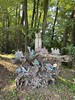
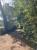
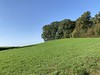
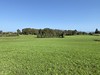
The above images may not be of the site on this page, but were taken nearby. They are loaded from Flickr so please click on them for image credits.
Click here to see more info for this site
Nearby sites
Click here to view sites on an interactive map of the areaKey: Red: member's photo, Blue: 3rd party photo, Yellow: other image, Green: no photo - please go there and take one, Grey: site destroyed
Download sites to:
KML (Google Earth)
GPX (GPS waypoints)
CSV (Garmin/Navman)
CSV (Excel)
To unlock full downloads you need to sign up as a Contributory Member. Otherwise downloads are limited to 50 sites.
Turn off the page maps and other distractions
Nearby sites listing. In the following links * = Image available
9.5km WSW 238° Garzonera cromlech* Stone Circle
10.6km NE 36° Velmaio* Rock Art
11.7km WSW 246° Golasecca's Necropolis* Long Barrow
13.6km W 262° Preja Buja Natural Stone / Erratic / Other Natural Feature
15.8km NE 42° Stabio Lepontische Stelen Sculptured Stone
17.5km W 277° Museo Archeologico di Angera Museum
19.5km ENE 77° Cerchio di Como Stone Circle
19.7km NNE 26° The Ceresio Valley Natural Stone / Erratic / Other Natural Feature
20.1km W 264° Necropoli Golasecchiana di Motto Lagone Long Barrow
21.0km ENE 75° Roccione di Prestino Rock Art
21.7km WNW 301° Masso coppellato San Paolo Rock Art
22.3km WNW 297° Masso Coppellato Brovello Rock Art
25.1km N 355° Pineta Alta carved stone* Carving
28.4km N 6° Bedigliora Capèla dala Barèla* Rock Art
28.8km N 7° Novaggio Lepontische Inschrift* Sculptured Stone
28.8km N 7° Bedigliora (Banco) Lepontische Stele Sculptured Stone
28.8km NNE 29° Pugerna Schalenstein* Rock Art
30.0km N 10° Aranno Lepontische Stelen* Sculptured Stone
30.1km NNE 16° Bioggio Lepontische Stelen* Sculptured Stone
31.0km W 271° Preja Batizà* Rock Art
31.5km NNE 28° Sasso della Predescia Rock Art
32.4km W 277° Masso coppellato Pella Rock Art
33.3km NNE 24° Pregassona Lepontische Stele Sculptured Stone
34.1km WNW 291° Masso coppellato Bagnella Rock Art
34.5km NNE 17° San Zenone Schalenstein* Rock Art
View more nearby sites and additional images


 We would like to know more about this location. Please feel free to add a brief description and any relevant information in your own language.
 Wir möchten mehr über diese Stätte erfahren. Bitte zögern Sie nicht, eine kurze Beschreibung und relevante Informationen in Deutsch hinzuzufügen.
 Nous aimerions en savoir encore un peu sur les lieux. S'il vous plaît n'hesitez pas à ajouter une courte description et tous les renseignements pertinents dans votre propre langue.
 Quisieramos informarnos un poco más de las lugares. No dude en añadir una breve descripción y otros datos relevantes en su propio idioma.