


<< Our Photo Pages >> Boschetto Schalenstein2 - Rock Art in Switzerland in Tessin
Submitted by AlexHunger on Saturday, 18 February 2006 Page Views: 2910
Rock ArtSite Name: Boschetto Schalenstein2Country: Switzerland
NOTE: This site is 24.756 km away from the location you searched for.
Canton: Tessin Type: Rock Art
Nearest Town: Lugano Nearest Village: Boschetto
Latitude: 46.305720N Longitude: 8.605370E
Condition:
| 5 | Perfect |
| 4 | Almost Perfect |
| 3 | Reasonable but with some damage |
| 2 | Ruined but still recognisable as an ancient site |
| 1 | Pretty much destroyed, possibly visible as crop marks |
| 0 | No data. |
| -1 | Completely destroyed |
| 5 | Superb |
| 4 | Good |
| 3 | Ordinary |
| 2 | Not Good |
| 1 | Awful |
| 0 | No data. |
| 5 | Can be driven to, probably with disabled access |
| 4 | Short walk on a footpath |
| 3 | Requiring a bit more of a walk |
| 2 | A long walk |
| 1 | In the middle of nowhere, a nightmare to find |
| 0 | No data. |
| 5 | co-ordinates taken by GPS or official recorded co-ordinates |
| 4 | co-ordinates scaled from a detailed map |
| 3 | co-ordinates scaled from a bad map |
| 2 | co-ordinates of the nearest village |
| 1 | co-ordinates of the nearest town |
| 0 | no data |
Internal Links:
External Links:
I have visited· I would like to visit
WhiskyRiver would like to visit
Megalithic89 visited on 19th Apr 2023 - their rating: Cond: 3 Amb: 4 Access: 4
")
IMPORTANT NOTE: Position of site unknown, co-ordinates given for nearest village. Numerous cup hole stone scattered in pittoresque village.
You may be viewing yesterday's version of this page. To see the most up to date information please register for a free account.
")
")
")
Do not use the above information on other web sites or publications without permission of the contributor.
Nearby Images from Flickr

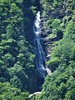
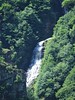
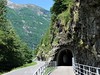
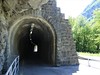
The above images may not be of the site on this page, but were taken nearby. They are loaded from Flickr so please click on them for image credits.
Click here to see more info for this site
Nearby sites
Click here to view sites on an interactive map of the areaKey: Red: member's photo, Blue: 3rd party photo, Yellow: other image, Green: no photo - please go there and take one, Grey: site destroyed
Download sites to:
KML (Google Earth)
GPX (GPS waypoints)
CSV (Garmin/Navman)
CSV (Excel)
To unlock full downloads you need to sign up as a Contributory Member. Otherwise downloads are limited to 50 sites.
Turn off the page maps and other distractions
Nearby sites listing. In the following links * = Image available
19.9km SE 138° Locarno Schalenstein Rock Art
20.2km SE 142° Losone Schalenstein Rock Art
21.0km SE 126° Sass di Cent Cros Rock Art
21.0km SE 136° Mezzovico-Vira Lepontische Stelen Sculptured Stone
21.6km WSW 251° Muro del Diavolo* Ancient Temple
22.5km WSW 256° Sasso Coppellato* Sculptured Stone
24.8km W 278° Montorfano* Sculptured Stone
24.9km SW 219° Coimo's cup stone* Rock Art
25.1km W 276° Crampiolo* Sculptured Stone
25.7km SE 135° Vira Gambarogno Lepontische Stele* Sculptured Stone
26.3km SE 133° Ragno massi cuppellari* Rock Art
27.6km WSW 239° Masso coppellato Alpe La Prasca* Sculptured Stone
30.6km SSE 148° Masso di Piero* Carving
32.2km E 99° Claro sito preistorico Standing Stone (Menhir)
34.3km SE 135° Mezzovico-Vira Lepontische Stele* Sculptured Stone
34.5km SSW 196° Masso coppellato Val Grande Rock Art
37.8km SSE 151° Bedigliora Capèla dala Barèla* Rock Art
37.9km SSE 150° Bedigliora (Banco) Lepontische Stele Sculptured Stone
37.9km SSE 150° Novaggio Lepontische Inschrift* Sculptured Stone
37.9km SSE 147° Aranno Lepontische Stelen* Sculptured Stone
38.0km SE 135° Ponte Capriasca Lepontische Stele Sculptured Stone
38.0km SE 138° San Zenone Schalenstein* Rock Art
38.7km SSE 160° Pineta Alta carved stone* Carving
39.9km SE 144° Bioggio Lepontische Stelen* Sculptured Stone
40.6km SE 134° Dino Lepontische Stele Sculptured Stone
View more nearby sites and additional images


 We would like to know more about this location. Please feel free to add a brief description and any relevant information in your own language.
 Wir möchten mehr über diese Stätte erfahren. Bitte zögern Sie nicht, eine kurze Beschreibung und relevante Informationen in Deutsch hinzuzufügen.
 Nous aimerions en savoir encore un peu sur les lieux. S'il vous plaît n'hesitez pas à ajouter une courte description et tous les renseignements pertinents dans votre propre langue.
 Quisieramos informarnos un poco más de las lugares. No dude en añadir una breve descripción y otros datos relevantes en su propio idioma.