

<< Text Pages >> Tola di U Turmento dolmen - Burial Chamber or Dolmen in France in Corsica:Corse-Sud (2A)
Submitted by TheCaptain on Wednesday, 08 September 2010 Page Views: 2311
Neolithic and Bronze AgeSite Name: Tola di U Turmento dolmenCountry: France
NOTE: This site is 5.485 km away from the location you searched for.
Département: Corsica:Corse-Sud (2A) Type: Burial Chamber or Dolmen
Nearest Town: Ajaccio Nearest Village: Serra-di-Ferro
Latitude: 41.728000N Longitude: 8.798000E
Condition:
| 5 | Perfect |
| 4 | Almost Perfect |
| 3 | Reasonable but with some damage |
| 2 | Ruined but still recognisable as an ancient site |
| 1 | Pretty much destroyed, possibly visible as crop marks |
| 0 | No data. |
| -1 | Completely destroyed |
| 5 | Superb |
| 4 | Good |
| 3 | Ordinary |
| 2 | Not Good |
| 1 | Awful |
| 0 | No data. |
| 5 | Can be driven to, probably with disabled access |
| 4 | Short walk on a footpath |
| 3 | Requiring a bit more of a walk |
| 2 | A long walk |
| 1 | In the middle of nowhere, a nightmare to find |
| 0 | No data. |
| 5 | co-ordinates taken by GPS or official recorded co-ordinates |
| 4 | co-ordinates scaled from a detailed map |
| 3 | co-ordinates scaled from a bad map |
| 2 | co-ordinates of the nearest village |
| 1 | co-ordinates of the nearest town |
| 0 | no data |
Be the first person to rate this site - see the 'Contribute!' box in the right hand menu.
Internal Links:
External Links:
dolmen in Corse:Corse-Sud (2A)
Tola di U Turmento dolmen is a dolmen in the community of Serra-di-Ferro, Departement of Corse du Sud, Region of Corse
You may be viewing yesterday's version of this page. To see the most up to date information please register for a free account.
Do not use the above information on other web sites or publications without permission of the contributor.
Nearby Images from Flickr

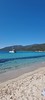
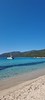
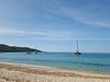
The above images may not be of the site on this page, but were taken nearby. They are loaded from Flickr so please click on them for image credits.
Click here to see more info for this site
Nearby sites
Click here to view sites on an interactive map of the areaKey: Red: member's photo, Blue: 3rd party photo, Yellow: other image, Green: no photo - please go there and take one, Grey: site destroyed
Download sites to:
KML (Google Earth)
GPX (GPS waypoints)
CSV (Garmin/Navman)
CSV (Excel)
To unlock full downloads you need to sign up as a Contributory Member. Otherwise downloads are limited to 50 sites.
Turn off the page maps and other distractions
Nearby sites listing. In the following links * = Image available
1m E 90° Tramezzu statue-menhir Sculptured Stone
83m E 90° Iesjola statue-menhir Sculptured Stone
2.7km ENE 65° Pietra Rossa Dolmen* Burial Chamber or Dolmen
2.9km E 83° U Paladinu statue-menhir* Sculptured Stone
3.2km E 96° Taravo dolmen Burial Chamber or Dolmen
3.3km E 96° Taravo statues-menhirs Sculptured Stone
3.7km SE 125° Micalona statue-menhir 1 Sculptured Stone
3.7km SE 125° Micalona statue-menhir 2* Sculptured Stone
4.2km E 80° Isula statue-menhir Sculptured Stone
4.5km E 85° I Calanche / Sapar'Alta* Ancient Village or Settlement
4.8km SE 127° Dolmen dit Figa la Sarra Burial Chamber or Dolmen
6.1km ESE 116° Castellu di Cuntorba* Ancient Village or Settlement
6.3km ENE 72° Filitosa Museum* Museum
6.4km ENE 69° Filitosa Statue-Menhir (3)* Standing Stone (Menhir)
6.4km ENE 70° Filitosa Statue-Menhir (4)* Standing Stone (Menhir)
6.4km ENE 70° Filitosa Statue-Menhir (1)* Standing Stone (Menhir)
6.4km ENE 72° Filitosa Statue-Menhir (5)* Sculptured Stone
6.4km ENE 70° Tappa Statue-Menhir (1)* Sculptured Stone
6.4km ENE 70° Filitosa Statue-Menhir (2) Standing Stone (Menhir)
6.5km ENE 70° Filitosa Statues-Menhirs* Sculptured Stone
6.5km ENE 71° Filitosa Statue-Menhir (6)* Sculptured Stone
6.5km ENE 71° Filitosa Central Monument* Cairn
6.5km ENE 67° Tappa statue-menhir 2* Sculptured Stone
6.5km ENE 77° Murato statue-menhir Sculptured Stone
6.8km ESE 111° Albitretu standing stones* Standing Stones
View more nearby sites and additional images


 We would like to know more about this location. Please feel free to add a brief description and any relevant information in your own language.
 Wir möchten mehr über diese Stätte erfahren. Bitte zögern Sie nicht, eine kurze Beschreibung und relevante Informationen in Deutsch hinzuzufügen.
 Nous aimerions en savoir encore un peu sur les lieux. S'il vous plaît n'hesitez pas à ajouter une courte description et tous les renseignements pertinents dans votre propre langue.
 Quisieramos informarnos un poco más de las lugares. No dude en añadir una breve descripción y otros datos relevantes en su propio idioma.