


<< Text Pages >> Elies Nuraghe - Broch or Nuraghe in Italy in Sardinia (Sardegna)
Submitted by SolarMegalith on Friday, 17 September 2010 Page Views: 1854
Neolithic and Bronze AgeSite Name: Elies NuragheCountry: Italy
NOTE: This site is 0.906 km away from the location you searched for.
Region: Sardinia (Sardegna) Type: Broch or Nuraghe
Nearest Town: Bonnanaro
Latitude: 40.526060N Longitude: 8.766570E
Condition:
| 5 | Perfect |
| 4 | Almost Perfect |
| 3 | Reasonable but with some damage |
| 2 | Ruined but still recognisable as an ancient site |
| 1 | Pretty much destroyed, possibly visible as crop marks |
| 0 | No data. |
| -1 | Completely destroyed |
| 5 | Superb |
| 4 | Good |
| 3 | Ordinary |
| 2 | Not Good |
| 1 | Awful |
| 0 | No data. |
| 5 | Can be driven to, probably with disabled access |
| 4 | Short walk on a footpath |
| 3 | Requiring a bit more of a walk |
| 2 | A long walk |
| 1 | In the middle of nowhere, a nightmare to find |
| 0 | No data. |
| 5 | co-ordinates taken by GPS or official recorded co-ordinates |
| 4 | co-ordinates scaled from a detailed map |
| 3 | co-ordinates scaled from a bad map |
| 2 | co-ordinates of the nearest village |
| 1 | co-ordinates of the nearest town |
| 0 | no data |
Be the first person to rate this site - see the 'Contribute!' box in the right hand menu.
Internal Links:
External Links:
Nuraghe located South from town of Bonnanaro.
You may be viewing yesterday's version of this page. To see the most up to date information please register for a free account.
Do not use the above information on other web sites or publications without permission of the contributor.
Nearby Images from Flickr
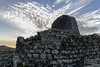
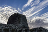
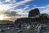
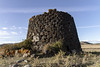
The above images may not be of the site on this page, but were taken nearby. They are loaded from Flickr so please click on them for image credits.
Click here to see more info for this site
Nearby sites
Click here to view sites on an interactive map of the areaKey: Red: member's photo, Blue: 3rd party photo, Yellow: other image, Green: no photo - please go there and take one, Grey: site destroyed
Download sites to:
KML (Google Earth)
GPX (GPS waypoints)
CSV (Garmin/Navman)
CSV (Excel)
To unlock full downloads you need to sign up as a Contributory Member. Otherwise downloads are limited to 50 sites.
Turn off the page maps and other distractions
Nearby sites listing. In the following links * = Image available
1.4km S 182° Torralba Museum* Museum
1.4km ENE 64° Cultu Nuraghe (Bonnanaro)* Broch or Nuraghe
1.5km ESE 102° Corona Moltana Domus de Janas* Rock Cut Tomb
1.7km ENE 72° Sorroi Domus de Janas* Rock Cut Tomb
2.6km W 277° Mura 'e Sai Insediamento Nuragico* Ancient Village or Settlement
2.6km W 275° Mura 'e Sai Protonuraghe* Broch or Nuraghe
2.8km WSW 246° Sa Tanca Noa Nuraghe* Broch or Nuraghe
4.1km WSW 247° Coroneddu Nuraghe Broch or Nuraghe
4.3km SSE 161° Culzu Nuraghe* Broch or Nuraghe
4.4km S 176° Santu Antine Villaggio Nuragico* Ancient Village or Settlement
4.4km S 176° Santu Antine Nuraghe* Broch or Nuraghe
4.5km SSE 161° Longu Nuraghe (Torralba)* Broch or Nuraghe
4.7km SSE 164° Fraigas Nuraghe* Broch or Nuraghe
5.0km S 171° Oes Nuraghe* Broch or Nuraghe
5.1km WNW 291° Larista Nuraghe Broch or Nuraghe
5.3km S 183° Mura Coloras Nuraghe* Broch or Nuraghe
5.5km SSW 214° Moseddu Domus de Janas* Rock Cut Tomb
5.8km SSW 212° Branca Domus de Janas* Rock Cut Tomb
6.6km SSE 148° Padru Nuraghe* Broch or Nuraghe
7.2km SE 128° Su Crastu Coveccadu Dolmen Burial Chamber or Dolmen
7.9km WNW 303° Sa Tanchitta Nuraghe Broch or Nuraghe
8.4km SSE 166° Campu de Olta Nuraghe Broch or Nuraghe
8.5km W 277° Fronte Mola Protonuraghe* Broch or Nuraghe
8.7km ESE 103° Sa Coveccada Dolmen* Burial Chamber or Dolmen
8.7km NNW 335° Ortolu Nuraghe* Broch or Nuraghe
View more nearby sites and additional images


 We would like to know more about this location. Please feel free to add a brief description and any relevant information in your own language.
 Wir möchten mehr über diese Stätte erfahren. Bitte zögern Sie nicht, eine kurze Beschreibung und relevante Informationen in Deutsch hinzuzufügen.
 Nous aimerions en savoir encore un peu sur les lieux. S'il vous plaît n'hesitez pas à ajouter une courte description et tous les renseignements pertinents dans votre propre langue.
 Quisieramos informarnos un poco más de las lugares. No dude en añadir una breve descripción y otros datos relevantes en su propio idioma.