 with our Megalithic Portal iPhone app")

<< Text Pages >> Bulla Regia - Ancient Village or Settlement in Tunisia
Submitted by AlexHunger on Saturday, 16 February 2008 Page Views: 2508
Multi-periodSite Name: Bulla RegiaCountry: Tunisia
NOTE: This site is 0.26 km away from the location you searched for.
Type: Ancient Village or Settlement
Nearest Town: Tunis Nearest Village: Jendouba
Latitude: 36.558119N Longitude: 8.751554E
Condition:
| 5 | Perfect |
| 4 | Almost Perfect |
| 3 | Reasonable but with some damage |
| 2 | Ruined but still recognisable as an ancient site |
| 1 | Pretty much destroyed, possibly visible as crop marks |
| 0 | No data. |
| -1 | Completely destroyed |
| 5 | Superb |
| 4 | Good |
| 3 | Ordinary |
| 2 | Not Good |
| 1 | Awful |
| 0 | No data. |
| 5 | Can be driven to, probably with disabled access |
| 4 | Short walk on a footpath |
| 3 | Requiring a bit more of a walk |
| 2 | A long walk |
| 1 | In the middle of nowhere, a nightmare to find |
| 0 | No data. |
| 5 | co-ordinates taken by GPS or official recorded co-ordinates |
| 4 | co-ordinates scaled from a detailed map |
| 3 | co-ordinates scaled from a bad map |
| 2 | co-ordinates of the nearest village |
| 1 | co-ordinates of the nearest town |
| 0 | no data |
Internal Links:
External Links:
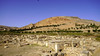
Ancient Village or Settlement in Tunisia
Semi Undeground Roman city
You may be viewing yesterday's version of this page. To see the most up to date information please register for a free account.
Do not use the above information on other web sites or publications without permission of the contributor.
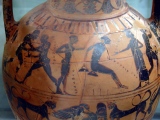
Nearby Images from Flickr
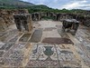


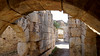
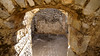
The above images may not be of the site on this page, but were taken nearby. They are loaded from Flickr so please click on them for image credits.
Click here to see more info for this site
Nearby sites
Click here to view sites on an interactive map of the areaKey: Red: member's photo, Blue: 3rd party photo, Yellow: other image, Green: no photo - please go there and take one, Grey: site destroyed
Download sites to:
KML (Google Earth)
GPX (GPS waypoints)
CSV (Garmin/Navman)
CSV (Excel)
To unlock full downloads you need to sign up as a Contributory Member. Otherwise downloads are limited to 50 sites.
Turn off the page maps and other distractions
Nearby sites listing. In the following links * = Image available
17.0km WSW 245° Shimithu King Micipsa Mausoleum* Ancient Temple
17.2km WSW 244° Chemtou Museum* Museum
17.4km WSW 245° Shimithu Numidian Tombs 1* Cairn
17.7km WSW 245° Simitthus* Ancient Village or Settlement
31.4km E 98° Djebel Gorra* Burial Chamber or Dolmen
44.2km ESE 109° Dougga Dolmen* Burial Chamber or Dolmen
44.4km ESE 110° Dougga* Ancient Village or Settlement
44.5km ESE 109° Dougga Temple Of Saturn* Ancient Temple
44.6km ESE 109° Dougga Numidian Tomb* Chambered Tomb
44.7km ESE 110° Mausoleum of Ateban* Marker Stone
44.7km ESE 110° Dougga Numidian Hypogium Rock Cut Tomb
46.0km ESE 104° Teboursukum* Ancient Village or Settlement
54.2km E 90° Thiganica Ancient Village or Settlement
74.5km SSE 155° Eles Megalithic tomb 16* Chambered Tomb
74.5km SSE 155° Eles Megalithic Tomb 29* Burial Chamber or Dolmen
74.5km SSE 155° Eles Megalithic Tomb 08* Burial Chamber or Dolmen
74.5km SSE 155° Eles Megalithic Tomb 04* Burial Chamber or Dolmen
74.5km SSE 155° Eles Megalithic Tomb 15* Burial Chamber or Dolmen
74.5km SSE 155° Eles Megalithic Tomb 02* Burial Chamber or Dolmen
74.5km SSE 155° Eles Megalithic Tomb 01* Burial Chamber or Dolmen
74.5km SSE 155° Eles Megalithic Tomb 09* Burial Chamber or Dolmen
74.5km SSE 155° Eles Megalithic Tomb 10* Burial Chamber or Dolmen
74.5km SSE 155° Eles Megalithic Tomb 03* Burial Chamber or Dolmen
74.6km SSE 155° Eles Megalithic Tomb 28* Burial Chamber or Dolmen
74.6km SSE 155° Eles Megalithic Tomb 11* Burial Chamber or Dolmen
View more nearby sites and additional images


 We would like to know more about this location. Please feel free to add a brief description and any relevant information in your own language.
 Wir möchten mehr über diese Stätte erfahren. Bitte zögern Sie nicht, eine kurze Beschreibung und relevante Informationen in Deutsch hinzuzufügen.
 Nous aimerions en savoir encore un peu sur les lieux. S'il vous plaît n'hesitez pas à ajouter une courte description et tous les renseignements pertinents dans votre propre langue.
 Quisieramos informarnos un poco más de las lugares. No dude en añadir una breve descripción y otros datos relevantes en su propio idioma.