

<< Text Pages >> Ara Nuraghe (Nulvi) - Broch or Nuraghe in Italy in Sardinia (Sardegna)
Submitted by SolarMegalith on Saturday, 03 February 2018 Page Views: 631
Neolithic and Bronze AgeSite Name: Ara Nuraghe (Nulvi)Country: Italy
NOTE: This site is 3.011 km away from the location you searched for.
Region: Sardinia (Sardegna) Type: Broch or Nuraghe
Nearest Town: Nulvi
Latitude: 40.756254N Longitude: 8.749863E
Condition:
| 5 | Perfect |
| 4 | Almost Perfect |
| 3 | Reasonable but with some damage |
| 2 | Ruined but still recognisable as an ancient site |
| 1 | Pretty much destroyed, possibly visible as crop marks |
| 0 | No data. |
| -1 | Completely destroyed |
| 5 | Superb |
| 4 | Good |
| 3 | Ordinary |
| 2 | Not Good |
| 1 | Awful |
| 0 | No data. |
| 5 | Can be driven to, probably with disabled access |
| 4 | Short walk on a footpath |
| 3 | Requiring a bit more of a walk |
| 2 | A long walk |
| 1 | In the middle of nowhere, a nightmare to find |
| 0 | No data. |
| 5 | co-ordinates taken by GPS or official recorded co-ordinates |
| 4 | co-ordinates scaled from a detailed map |
| 3 | co-ordinates scaled from a bad map |
| 2 | co-ordinates of the nearest village |
| 1 | co-ordinates of the nearest town |
| 0 | no data |
Internal Links:
External Links:
Nuraghe in Sardinia (Sardegna)
A complex nuraghe located 4km south of Nulvi. The structure consists of the main tower, at least two lateral towers and a courtyard.
Maxia, M. (2001). Un tesoro riscoperto: censimento dei nuraghi dell’Anglona, analisi delle relazioni ambientali e matematiche. Nuoro: Editrice Archivio Fotografico Sardo (p. 47).
You may be viewing yesterday's version of this page. To see the most up to date information please register for a free account.
Do not use the above information on other web sites or publications without permission of the contributor.
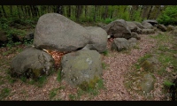
Nearby Images from Flickr

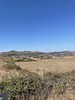
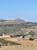

The above images may not be of the site on this page, but were taken nearby. They are loaded from Flickr so please click on them for image credits.
Click here to see more info for this site
Nearby sites
Click here to view sites on an interactive map of the areaKey: Red: member's photo, Blue: 3rd party photo, Yellow: other image, Green: no photo - please go there and take one, Grey: site destroyed
Download sites to:
KML (Google Earth)
GPX (GPS waypoints)
CSV (Garmin/Navman)
CSV (Excel)
To unlock full downloads you need to sign up as a Contributory Member. Otherwise downloads are limited to 50 sites.
Turn off the page maps and other distractions
Nearby sites listing. In the following links * = Image available
2.6km E 92° Sambinzos Domus de Janas Rock Cut Tomb
3.6km ESE 108° Peruchi Domus de Janas Rock Cut Tomb
3.7km WSW 240° Cantaroccheddu Nuraghe Broch or Nuraghe
3.7km ESE 104° Badde Cheja Nuraghe* Broch or Nuraghe
4.9km ESE 121° Giaganu Dominigu Nuraghe (1)* Broch or Nuraghe
5.0km SE 127° Giaganu Dominigu Nuraghe (3)* Broch or Nuraghe
5.0km ESE 122° Giaganu Dominigu Nuraghe (2)* Broch or Nuraghe
5.1km SE 135° Conca de Zuighe Nuraghe* Broch or Nuraghe
5.3km NE 46° Bolentari Nuraghe Broch or Nuraghe
5.3km SSW 198° Fontana Sa Rena Nuraghe Broch or Nuraghe
5.5km NNE 33° Pedra Fulcada Nuraghe Broch or Nuraghe
5.9km SSE 166° Monte Frusciu Nuraghe* Broch or Nuraghe
5.9km SW 218° Pireddu Nuraghe Broch or Nuraghe
6.0km SSE 161° Su Idighinzu Nuraghe* Broch or Nuraghe
6.0km ESE 118° Cacchile Tomba di Giganti Chambered Tomb
6.0km NE 47° Monte Ruina Nuraghe Broch or Nuraghe
6.3km SE 126° Tuvuleddu Nuraghe* Broch or Nuraghe
6.5km E 91° Sas Piras Domus de Janas* Rock Cut Tomb
6.5km SW 221° Pabale Nuraghe Broch or Nuraghe
6.6km E 92° Alvu de Santa Caderina Nuraghe* Broch or Nuraghe
6.6km E 93° Santa Caterina Ipogeo* Rock Cut Tomb
6.7km SE 127° Serra Pantaleo Nuraghe* Broch or Nuraghe
6.7km E 87° Mesu de Montes Nuraghe* Broch or Nuraghe
6.7km ESE 115° Rispidu Nuraghe* Broch or Nuraghe
6.8km ESE 110° S'Abba de Sa Pedra Nuraghe* Broch or Nuraghe
View more nearby sites and additional images


 We would like to know more about this location. Please feel free to add a brief description and any relevant information in your own language.
 Wir möchten mehr über diese Stätte erfahren. Bitte zögern Sie nicht, eine kurze Beschreibung und relevante Informationen in Deutsch hinzuzufügen.
 Nous aimerions en savoir encore un peu sur les lieux. S'il vous plaît n'hesitez pas à ajouter une courte description et tous les renseignements pertinents dans votre propre langue.
 Quisieramos informarnos un poco más de las lugares. No dude en añadir una breve descripción y otros datos relevantes en su propio idioma.