


<< Our Photo Pages >> Franzesu Nuraghe - Broch or Nuraghe in Italy in Sardinia (Sardegna)
Submitted by SolarMegalith on Thursday, 24 April 2014 Page Views: 1308
Neolithic and Bronze AgeSite Name: Franzesu NuragheCountry: Italy
NOTE: This site is 2.127 km away from the location you searched for.
Region: Sardinia (Sardegna) Type: Broch or Nuraghe
Nearest Town: Castelsardo
Latitude: 40.895487N Longitude: 8.721439E
Condition:
| 5 | Perfect |
| 4 | Almost Perfect |
| 3 | Reasonable but with some damage |
| 2 | Ruined but still recognisable as an ancient site |
| 1 | Pretty much destroyed, possibly visible as crop marks |
| 0 | No data. |
| -1 | Completely destroyed |
| 5 | Superb |
| 4 | Good |
| 3 | Ordinary |
| 2 | Not Good |
| 1 | Awful |
| 0 | No data. |
| 5 | Can be driven to, probably with disabled access |
| 4 | Short walk on a footpath |
| 3 | Requiring a bit more of a walk |
| 2 | A long walk |
| 1 | In the middle of nowhere, a nightmare to find |
| 0 | No data. |
| 5 | co-ordinates taken by GPS or official recorded co-ordinates |
| 4 | co-ordinates scaled from a detailed map |
| 3 | co-ordinates scaled from a bad map |
| 2 | co-ordinates of the nearest village |
| 1 | co-ordinates of the nearest town |
| 0 | no data |
Internal Links:
External Links:
I have visited· I would like to visit
SolarMegalith saw from a distance on 1st Apr 2014 - their rating: Cond: 3
")
The Nuragic complex of Franzesu is located on the edge of a highland plateau south of Castelsardo. The main tower has 12.50m in diameter and reaches up to 4.70m of height.
You may be viewing yesterday's version of this page. To see the most up to date information please register for a free account.
Do not use the above information on other web sites or publications without permission of the contributor.
Nearby Images from Flickr
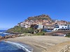
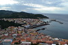
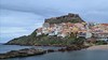
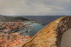
The above images may not be of the site on this page, but were taken nearby. They are loaded from Flickr so please click on them for image credits.
Click here to see more info for this site
Nearby sites
Click here to view sites on an interactive map of the areaKey: Red: member's photo, Blue: 3rd party photo, Yellow: other image, Green: no photo - please go there and take one, Grey: site destroyed
Download sites to:
KML (Google Earth)
GPX (GPS waypoints)
CSV (Garmin/Navman)
CSV (Excel)
To unlock full downloads you need to sign up as a Contributory Member. Otherwise downloads are limited to 50 sites.
Turn off the page maps and other distractions
Nearby sites listing. In the following links * = Image available
1.3km S 173° Fugoni Protonuraghe Broch or Nuraghe
1.9km W 272° Monti La Rodda Domus de Janas* Rock Cut Tomb
2.0km W 272° Monti La Rodda Nuraghe* Broch or Nuraghe
2.1km WSW 237° Tovaru Nuraghe* Broch or Nuraghe
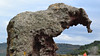
2.2km ESE 107° Domus de Janas Roccia dell'Elefante* Rock Cut Tomb
2.7km NE 39° Campulandru Nuraghe Broch or Nuraghe
2.9km E 95° Paddaggiu Nuraghe* Broch or Nuraghe
3.3km E 79° Tinteri Protonuraghe Broch or Nuraghe
4.4km ENE 77° Cuncali Nuraghe Broch or Nuraghe
5.5km SSW 208° Tudderi Nuraghe* Broch or Nuraghe
5.9km WSW 246° Araodda Nuraghe Broch or Nuraghe
7.6km SSE 160° Boinalzu Nuraghe* Broch or Nuraghe
7.8km SSE 158° Alvu Nuraghe (Nulvi)* Broch or Nuraghe
8.1km SSE 166° Su Paladino Nuraghe* Broch or Nuraghe
8.3km E 92° Montilongu Nuraghe* Broch or Nuraghe
8.5km E 97° Monti Fulcadu Nuraghe Broch or Nuraghe
8.5km E 100° S'Enaculadora Domus de Janas* Rock Cut Tomb
8.5km E 99° Tanca Fraddi Doro Domus de Janas* Rock Cut Tomb
8.5km E 100° Li Algasa Domus de Janas* Rock Cut Tomb
8.6km SSE 165° Monte Su Furru Nuraghe* Broch or Nuraghe
8.6km E 97° Monti Fulcadu Villaggio Nuragico e Romano Ancient Village or Settlement
8.6km E 90° Longu Nuraghe (Sedini)* Broch or Nuraghe
8.7km ESE 112° Sos Saraos Protonuraghe Broch or Nuraghe
8.7km SSE 163° Monte Elva Nuraghe* Broch or Nuraghe
9.7km ESE 123° Domus de Janas Della Rocca* Rock Cut Tomb
View more nearby sites and additional images


 We would like to know more about this location. Please feel free to add a brief description and any relevant information in your own language.
 Wir möchten mehr über diese Stätte erfahren. Bitte zögern Sie nicht, eine kurze Beschreibung und relevante Informationen in Deutsch hinzuzufügen.
 Nous aimerions en savoir encore un peu sur les lieux. S'il vous plaît n'hesitez pas à ajouter une courte description et tous les renseignements pertinents dans votre propre langue.
 Quisieramos informarnos un poco más de las lugares. No dude en añadir una breve descripción y otros datos relevantes en su propio idioma.