

<< Text Pages >> Tronza Protonuraghe - Broch or Nuraghe in Italy in Sardinia (Sardegna)
Submitted by SolarMegalith on Saturday, 30 March 2024 Page Views: 14
Neolithic and Bronze AgeSite Name: Tronza ProtonuragheCountry: Italy
NOTE: This site is 1.339 km away from the location you searched for.
Region: Sardinia (Sardegna) Type: Broch or Nuraghe
Nearest Town: Milis
Latitude: 40.056376N Longitude: 8.652076E
Condition:
| 5 | Perfect |
| 4 | Almost Perfect |
| 3 | Reasonable but with some damage |
| 2 | Ruined but still recognisable as an ancient site |
| 1 | Pretty much destroyed, possibly visible as crop marks |
| 0 | No data. |
| -1 | Completely destroyed |
| 5 | Superb |
| 4 | Good |
| 3 | Ordinary |
| 2 | Not Good |
| 1 | Awful |
| 0 | No data. |
| 5 | Can be driven to, probably with disabled access |
| 4 | Short walk on a footpath |
| 3 | Requiring a bit more of a walk |
| 2 | A long walk |
| 1 | In the middle of nowhere, a nightmare to find |
| 0 | No data. |
| 5 | co-ordinates taken by GPS or official recorded co-ordinates |
| 4 | co-ordinates scaled from a detailed map |
| 3 | co-ordinates scaled from a bad map |
| 2 | co-ordinates of the nearest village |
| 1 | co-ordinates of the nearest town |
| 0 | no data |
Internal Links:
External Links:
Protonuraghe in Sardinia (Sardegna)
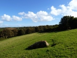
Protonuraghe Tronza is an example of a corridor nuraghe. The monument is located 1km NE of Milis, near the eastern bank of Riu Mannu. The walls survived up to 5m of height, the best preserved part of the structure is at the north.
Reference:
Maisola, G. 2012. Ricerche di archeologia dei paesaggi nell’alto Oristanense. Universita degli Studi di Sassari (p. 608-609).
You may be viewing yesterday's version of this page. To see the most up to date information please register for a free account.
Do not use the above information on other web sites or publications without permission of the contributor.
Nearby Images from Flickr
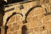
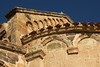
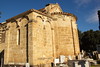
The above images may not be of the site on this page, but were taken nearby. They are loaded from Flickr so please click on them for image credits.
Click here to see more info for this site
Nearby sites
Click here to view sites on an interactive map of the areaKey: Red: member's photo, Blue: 3rd party photo, Yellow: other image, Green: no photo - please go there and take one, Grey: site destroyed
Download sites to:
KML (Google Earth)
GPX (GPS waypoints)
CSV (Garmin/Navman)
CSV (Excel)
To unlock full downloads you need to sign up as a Contributory Member. Otherwise downloads are limited to 50 sites.
Turn off the page maps and other distractions
Nearby sites listing. In the following links * = Image available
644m NNE 15° Su Livariu Nuraghe Broch or Nuraghe
3.0km NW 308° Codinas Nuraghe* Broch or Nuraghe
3.4km NE 36° Crastu Protonuraghe Broch or Nuraghe
3.5km NNE 22° Perda Pertusa Nuraghe Broch or Nuraghe
3.7km ESE 115° Crabia Nuraghe* Broch or Nuraghe
3.7km SE 130° Mascherza Nuraghe Broch or Nuraghe
3.8km NE 40° Serra Bisonzons Nuraghe Broch or Nuraghe
4.4km SSE 148° Mura Prochilis Nuraghe* Broch or Nuraghe
5.0km NNE 20° Perd'e Caddos Nuraghe* Broch or Nuraghe
5.0km WNW 299° Oppianu Nuraghe (Seneghe)* Broch or Nuraghe
5.1km SE 138° Mura Crabas Nuraghe* Broch or Nuraghe
5.1km SE 131° Mura Figus Nuraghe* Broch or Nuraghe
5.1km E 95° Toroleo Nuraghe* Broch or Nuraghe
5.1km NNE 25° Serra Crastula Nuraghe* Broch or Nuraghe
5.2km NNE 31° Genna Uda Nuraghe Broch or Nuraghe
5.5km WNW 291° Aidu de Muru Nuraghe Broch or Nuraghe
5.5km WNW 298° Maso Maiore Nuraghe* Broch or Nuraghe
5.6km W 277° Aresti Nuraghe* Broch or Nuraghe
5.8km ESE 108° Mura Cuata Tomba di Giganti* Chambered Tomb
5.8km NNE 24° Campu Scudu Nuraghe Broch or Nuraghe
5.9km W 274° Lizzos Nuraghe* Broch or Nuraghe
5.9km NNE 30° Scovaera Protonuraghe Broch or Nuraghe
6.1km WSW 256° Tunis Nuraghe* Broch or Nuraghe
6.1km NNE 24° Campu Scudu Tomba di Giganti Chambered Tomb
6.2km E 86° Mura Mandra Nuraghe* Broch or Nuraghe
View more nearby sites and additional images


 We would like to know more about this location. Please feel free to add a brief description and any relevant information in your own language.
 Wir möchten mehr über diese Stätte erfahren. Bitte zögern Sie nicht, eine kurze Beschreibung und relevante Informationen in Deutsch hinzuzufügen.
 Nous aimerions en savoir encore un peu sur les lieux. S'il vous plaît n'hesitez pas à ajouter une courte description et tous les renseignements pertinents dans votre propre langue.
 Quisieramos informarnos un poco más de las lugares. No dude en añadir una breve descripción y otros datos relevantes en su propio idioma.