


<< Text Pages >> Tschütschiwald Chindlistein - Natural Stone / Erratic / Other Natural Feature in Switzerland in Schwyz
Submitted by AlexHunger on Saturday, 18 February 2006 Page Views: 3101
Natural PlacesSite Name: Tschütschiwald Chindlistein Alternative Name: ChindlischtäiCountry: Switzerland
NOTE: This site is 4.961 km away from the location you searched for.
Canton: Schwyz Type: Natural Stone / Erratic / Other Natural Feature
Nearest Town: Luzern Nearest Village: Schwyz
Latitude: 47.030880N Longitude: 8.668660E
Condition:
| 5 | Perfect |
| 4 | Almost Perfect |
| 3 | Reasonable but with some damage |
| 2 | Ruined but still recognisable as an ancient site |
| 1 | Pretty much destroyed, possibly visible as crop marks |
| 0 | No data. |
| -1 | Completely destroyed |
| 5 | Superb |
| 4 | Good |
| 3 | Ordinary |
| 2 | Not Good |
| 1 | Awful |
| 0 | No data. |
| 5 | Can be driven to, probably with disabled access |
| 4 | Short walk on a footpath |
| 3 | Requiring a bit more of a walk |
| 2 | A long walk |
| 1 | In the middle of nowhere, a nightmare to find |
| 0 | No data. |
| 5 | co-ordinates taken by GPS or official recorded co-ordinates |
| 4 | co-ordinates scaled from a detailed map |
| 3 | co-ordinates scaled from a bad map |
| 2 | co-ordinates of the nearest village |
| 1 | co-ordinates of the nearest town |
| 0 | no data |
Internal Links:
External Links:
Glacial Erratic in Schwyz
IMPORTANT NOTE: Position of site unknown, co-ordinates given for nearest village. In hills of Tschütschi Forest near town and small chappel.
You may be viewing yesterday's version of this page. To see the most up to date information please register for a free account.
Do not use the above information on other web sites or publications without permission of the contributor.
Nearby Images from Flickr
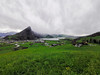
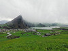
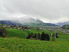
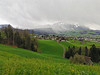
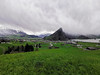
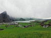
The above images may not be of the site on this page, but were taken nearby. They are loaded from Flickr so please click on them for image credits.
Click here to see more info for this site
Nearby sites
Click here to view sites on an interactive map of the areaKey: Red: member's photo, Blue: 3rd party photo, Yellow: other image, Green: no photo - please go there and take one, Grey: site destroyed
Download sites to:
KML (Google Earth)
GPX (GPS waypoints)
CSV (Garmin/Navman)
CSV (Excel)
To unlock full downloads you need to sign up as a Contributory Member. Otherwise downloads are limited to 50 sites.
Turn off the page maps and other distractions
Nearby sites listing. In the following links * = Image available
2.6km NNE 27° Steinkreuz Haggenegg* Ancient Cross
5.3km SSW 209° Hänibüel Menhir Standing Stone (Menhir)
5.7km SSW 212° Tümmlen Steinreihe Stone Row / Alignment
5.9km SW 216° Grossegg Druidenstein* Natural Stone / Erratic / Other Natural Feature
18.4km NW 321° Museum für Urgeschichte(n)* Museum
19.4km NW 305° Chilchberg Steinreihe* Stone Row / Alignment
22.1km SSW 200° Attinghausen-Geissrüggen Siedlungsplatz* Ancient Village or Settlement
22.5km NNE 22° Ufenau* Natural Stone / Erratic / Other Natural Feature
23.1km W 262° Kehrsiten Ancient Village or Settlement
23.4km NNE 26° Hurden Rosshorn Ancient Village or Settlement
24.4km NW 326° Häglimoos* Stone Circle
24.6km NNW 335° Waldhof Tumulus* Artificial Mound
24.7km NNW 331° Uerzlikon Wislig Stone Circle
26.5km NE 46° Wygarten Steinreihe Stone Row / Alignment
26.9km W 266° Dormen Schalensteine* Rock Art
26.9km NE 45° Schrotermoos Steinreihe Stone Row / Alignment
27.0km NNW 329° Wildentalholz Steinreihe* Stone Row / Alignment
27.2km NNW 327° Schliifi Steinreihen* Stone Row / Alignment
27.3km W 277° Gletschergarten Schalensteine Rock Art
27.4km NW 324° Altgrüt Lochstein* Holed Stone
27.5km NNW 328° Tannbüel Menhir and Alignment* Standing Stones
27.5km NNE 30° Moosriet Cromlech* Stone Circle
27.5km NW 326° Buelwald Menhirs* Standing Stones
27.5km NNE 30° Jona Schalenstein Rock Art
28.1km NNW 331° Wellenweid Steinreihen* Stone Row / Alignment
View more nearby sites and additional images


 We would like to know more about this location. Please feel free to add a brief description and any relevant information in your own language.
 Wir möchten mehr über diese Stätte erfahren. Bitte zögern Sie nicht, eine kurze Beschreibung und relevante Informationen in Deutsch hinzuzufügen.
 Nous aimerions en savoir encore un peu sur les lieux. S'il vous plaît n'hesitez pas à ajouter une courte description et tous les renseignements pertinents dans votre propre langue.
 Quisieramos informarnos un poco más de las lugares. No dude en añadir una breve descripción y otros datos relevantes en su propio idioma.