


<< Our Photo Pages >> Giundali Nuraghe - Broch or Nuraghe in Italy in Sardinia (Sardegna)
Submitted by SolarMegalith on Monday, 19 September 2011 Page Views: 1753
Neolithic and Bronze AgeSite Name: Giundali NuragheCountry: Italy
NOTE: This site is 0.898 km away from the location you searched for.
Region: Sardinia (Sardegna) Type: Broch or Nuraghe
Nearest Town: Ittiri
Latitude: 40.577222N Longitude: 8.573611E
Condition:
| 5 | Perfect |
| 4 | Almost Perfect |
| 3 | Reasonable but with some damage |
| 2 | Ruined but still recognisable as an ancient site |
| 1 | Pretty much destroyed, possibly visible as crop marks |
| 0 | No data. |
| -1 | Completely destroyed |
| 5 | Superb |
| 4 | Good |
| 3 | Ordinary |
| 2 | Not Good |
| 1 | Awful |
| 0 | No data. |
| 5 | Can be driven to, probably with disabled access |
| 4 | Short walk on a footpath |
| 3 | Requiring a bit more of a walk |
| 2 | A long walk |
| 1 | In the middle of nowhere, a nightmare to find |
| 0 | No data. |
| 5 | co-ordinates taken by GPS or official recorded co-ordinates |
| 4 | co-ordinates scaled from a detailed map |
| 3 | co-ordinates scaled from a bad map |
| 2 | co-ordinates of the nearest village |
| 1 | co-ordinates of the nearest town |
| 0 | no data |
Internal Links:
External Links:
I have visited· I would like to visit
SolarMegalith visited on 27th Aug 2011 - their rating: Cond: 2 Amb: 3 Access: 4
")
Remains of a nuraghe, most likely tholos-style, are located near the road SE from Ittiri. The ruins are overgrown, only lower parts of the walls have survived.
You may be viewing yesterday's version of this page. To see the most up to date information please register for a free account.
")
")
Do not use the above information on other web sites or publications without permission of the contributor.
Nearby Images from Flickr

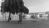
The above images may not be of the site on this page, but were taken nearby. They are loaded from Flickr so please click on them for image credits.
Click here to see more info for this site
Nearby sites
Click here to view sites on an interactive map of the areaKey: Red: member's photo, Blue: 3rd party photo, Yellow: other image, Green: no photo - please go there and take one, Grey: site destroyed
Download sites to:
KML (Google Earth)
GPX (GPS waypoints)
CSV (Garmin/Navman)
CSV (Excel)
To unlock full downloads you need to sign up as a Contributory Member. Otherwise downloads are limited to 50 sites.
Turn off the page maps and other distractions
Nearby sites listing. In the following links * = Image available
877m SSW 212° Cunedda Nuraghe 1* Broch or Nuraghe
915m SSW 204° Cunedda Nuraghe 2* Broch or Nuraghe
2.8km ESE 106° Luros Nuraghe* Broch or Nuraghe
3.4km NNE 24° Sa Figu* Stone Circle
4.2km SE 127° Monte Torru Nuraghe Broch or Nuraghe
4.8km ESE 107° Enas de Cannuja Domus de Janas* Rock Cut Tomb
5.2km NNE 19° Chizzonieddu Nuraghe Broch or Nuraghe
5.3km ENE 71° Campu Luntanu Rock-cut tomb Rock Cut Tomb
5.9km ENE 66° Segapane Nuraghe Broch or Nuraghe
6.0km NW 322° Sa Iddazza Tomba di Giganti* Chambered Tomb
6.2km ENE 63° Coa Lada Nuraghe Broch or Nuraghe
6.6km NNW 328° Passari Nuraghe* Broch or Nuraghe
6.6km ENE 62° Su Valsu Nuraghe Broch or Nuraghe
6.9km NW 318° Sa Signora Nuraghe Broch or Nuraghe
7.2km NNE 32° Mesu 'e Montes* Rock Cut Tomb
7.5km NW 313° Sos Isconcados Nuraghe* Broch or Nuraghe
7.6km NW 325° Paulis Nuraghe* Broch or Nuraghe
7.7km ENE 57° Punta Unossi Villaggio Nuragico* Ancient Village or Settlement
7.7km ENE 57° Punta Unossi Rotonda Nuragica* Ancient Temple
7.8km NE 55° Punta Unossi Nuraghe* Broch or Nuraghe
8.0km NW 317° Coaspidda Nuraghe* Broch or Nuraghe
8.1km NW 309° Monte Sant' Elia Nuraghe* Broch or Nuraghe
8.1km NNE 12° Tresnuraghes Nuraghe* Broch or Nuraghe
8.2km NW 315° Sos Iscrabitados Nuraghe* Broch or Nuraghe
8.3km NW 312° Monte Ladu Nuraghe* Broch or Nuraghe
View more nearby sites and additional images


 We would like to know more about this location. Please feel free to add a brief description and any relevant information in your own language.
 Wir möchten mehr über diese Stätte erfahren. Bitte zögern Sie nicht, eine kurze Beschreibung und relevante Informationen in Deutsch hinzuzufügen.
 Nous aimerions en savoir encore un peu sur les lieux. S'il vous plaît n'hesitez pas à ajouter une courte description et tous les renseignements pertinents dans votre propre langue.
 Quisieramos informarnos un poco más de las lugares. No dude en añadir una breve descripción y otros datos relevantes en su propio idioma.