


<< Our Photo Pages >> Coimo's cup stone - Rock Art in Italy in Piemonte
Submitted by ilsignorstano on Monday, 15 October 2007 Page Views: 4553
Rock ArtSite Name: Coimo's cup stoneCountry: Italy
NOTE: This site is 11.195 km away from the location you searched for.
Region: Piemonte Type: Rock Art
Nearest Town: Domodossola Nearest Village: Druogno
Latitude: 46.131636N Longitude: 8.402647E
Condition:
| 5 | Perfect |
| 4 | Almost Perfect |
| 3 | Reasonable but with some damage |
| 2 | Ruined but still recognisable as an ancient site |
| 1 | Pretty much destroyed, possibly visible as crop marks |
| 0 | No data. |
| -1 | Completely destroyed |
| 5 | Superb |
| 4 | Good |
| 3 | Ordinary |
| 2 | Not Good |
| 1 | Awful |
| 0 | No data. |
| 5 | Can be driven to, probably with disabled access |
| 4 | Short walk on a footpath |
| 3 | Requiring a bit more of a walk |
| 2 | A long walk |
| 1 | In the middle of nowhere, a nightmare to find |
| 0 | No data. |
| 5 | co-ordinates taken by GPS or official recorded co-ordinates |
| 4 | co-ordinates scaled from a detailed map |
| 3 | co-ordinates scaled from a bad map |
| 2 | co-ordinates of the nearest village |
| 1 | co-ordinates of the nearest town |
| 0 | no data |
Internal Links:
External Links:
I have visited· I would like to visit
lichen WhiskyRiver would like to visit
ilsignorstano has visited here
")
The cross carved on the stone indicates the "exauguration" of the site from pagan cult to christian one.
You may be viewing yesterday's version of this page. To see the most up to date information please register for a free account.
")
")
Do not use the above information on other web sites or publications without permission of the contributor.
Nearby Images from Flickr

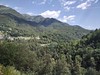
The above images may not be of the site on this page, but were taken nearby. They are loaded from Flickr so please click on them for image credits.
Click here to see more info for this site
Nearby sites
Click here to view sites on an interactive map of the areaKey: Red: member's photo, Blue: 3rd party photo, Yellow: other image, Green: no photo - please go there and take one, Grey: site destroyed
Download sites to:
KML (Google Earth)
GPX (GPS waypoints)
CSV (Garmin/Navman)
CSV (Excel)
To unlock full downloads you need to sign up as a Contributory Member. Otherwise downloads are limited to 50 sites.
Turn off the page maps and other distractions
Nearby sites listing. In the following links * = Image available
9.7km WNW 303° Masso coppellato Alpe La Prasca* Sculptured Stone
13.2km NNW 339° Muro del Diavolo* Ancient Temple
15.1km NNW 336° Sasso Coppellato* Sculptured Stone
15.2km SSE 156° Masso coppellato Val Grande Rock Art
23.7km NNW 337° Crampiolo* Sculptured Stone
24.3km NNW 338° Montorfano* Sculptured Stone
24.9km NE 39° Boschetto Schalenstein2* Rock Art
28.2km E 83° Losone Schalenstein Rock Art
29.2km E 81° Locarno Schalenstein Rock Art
29.7km S 182° Masso coppellato Bagnella Rock Art
30.4km E 82° Mezzovico-Vira Lepontische Stelen Sculptured Stone
32.5km ESE 102° Masso di Piero* Carving
33.4km ESE 121° Pineta Alta carved stone* Carving
33.4km SSE 159° Masso coppellato San Paolo Rock Art
33.4km ENE 78° Sass di Cent Cros Rock Art
33.7km E 88° Vira Gambarogno Lepontische Stele* Sculptured Stone
33.8km SSE 161° Masso Coppellato Brovello Rock Art
35.0km E 87° Ragno massi cuppellari* Rock Art
36.5km ESE 112° Bedigliora Capèla dala Barèla* Rock Art
37.0km ESE 111° Bedigliora (Banco) Lepontische Stele Sculptured Stone
37.0km ESE 111° Novaggio Lepontische Inschrift* Sculptured Stone
38.3km ESE 109° Aranno Lepontische Stelen* Sculptured Stone
38.4km S 182° Masso coppellato Pella Rock Art
38.5km NW 304° Naters Heidenstein Standing Stone (Menhir)
40.2km E 97° Mezzovico-Vira Lepontische Stele* Sculptured Stone
View more nearby sites and additional images

")
 We would like to know more about this location. Please feel free to add a brief description and any relevant information in your own language.
 Wir möchten mehr über diese Stätte erfahren. Bitte zögern Sie nicht, eine kurze Beschreibung und relevante Informationen in Deutsch hinzuzufügen.
 Nous aimerions en savoir encore un peu sur les lieux. S'il vous plaît n'hesitez pas à ajouter une courte description et tous les renseignements pertinents dans votre propre langue.
 Quisieramos informarnos un poco más de las lugares. No dude en añadir una breve descripción y otros datos relevantes en su propio idioma.