


<< Our Photo Pages >> Ziricottu Nuraghe - Broch or Nuraghe in Italy in Sardinia (Sardegna)
Submitted by SolarMegalith on Monday, 09 November 2015 Page Views: 881
Neolithic and Bronze AgeSite Name: Ziricottu NuragheCountry: Italy
NOTE: This site is 6.033 km away from the location you searched for.
Region: Sardinia (Sardegna) Type: Broch or Nuraghe
Nearest Town: Cabras
Latitude: 39.959847N Longitude: 8.463104E
Condition:
| 5 | Perfect |
| 4 | Almost Perfect |
| 3 | Reasonable but with some damage |
| 2 | Ruined but still recognisable as an ancient site |
| 1 | Pretty much destroyed, possibly visible as crop marks |
| 0 | No data. |
| -1 | Completely destroyed |
| 5 | Superb |
| 4 | Good |
| 3 | Ordinary |
| 2 | Not Good |
| 1 | Awful |
| 0 | No data. |
| 5 | Can be driven to, probably with disabled access |
| 4 | Short walk on a footpath |
| 3 | Requiring a bit more of a walk |
| 2 | A long walk |
| 1 | In the middle of nowhere, a nightmare to find |
| 0 | No data. |
| 5 | co-ordinates taken by GPS or official recorded co-ordinates |
| 4 | co-ordinates scaled from a detailed map |
| 3 | co-ordinates scaled from a bad map |
| 2 | co-ordinates of the nearest village |
| 1 | co-ordinates of the nearest town |
| 0 | no data |
Internal Links:
External Links:
I have visited· I would like to visit
SolarMegalith visited on 6th Oct 2015 - their rating: Cond: 2 Amb: 4 Access: 5
")
This small single-towered nuraghe is located in the central part of Sinis peninsula. The entrance is oriented to the south, the outer wall-face is preserved up to 1.60m of height in its southern part.
You may be viewing yesterday's version of this page. To see the most up to date information please register for a free account.
")
")
Do not use the above information on other web sites or publications without permission of the contributor.
Nearby Images from Flickr
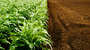
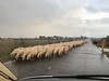
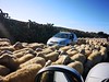
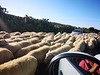
The above images may not be of the site on this page, but were taken nearby. They are loaded from Flickr so please click on them for image credits.
Click here to see more info for this site
Nearby sites
Click here to view sites on an interactive map of the areaKey: Red: member's photo, Blue: 3rd party photo, Yellow: other image, Green: no photo - please go there and take one, Grey: site destroyed
Download sites to:
KML (Google Earth)
GPX (GPS waypoints)
CSV (Garmin/Navman)
CSV (Excel)
To unlock full downloads you need to sign up as a Contributory Member. Otherwise downloads are limited to 50 sites.
Turn off the page maps and other distractions
Nearby sites listing. In the following links * = Image available
1.2km W 272° Su Archeddu 'e Su Procu Nuraghe* Broch or Nuraghe
1.4km WSW 245° Sa Tiria Nuraghe* Broch or Nuraghe
1.4km W 267° Cannevadosu Nuraghe* Broch or Nuraghe
1.4km WSW 255° Molas Nuraghe* Broch or Nuraghe
1.7km SSW 192° S'Ollastu Nuraghe* Broch or Nuraghe
1.9km SSW 194° Caombus Nuraghe* Broch or Nuraghe
2.1km SSW 209° Siau Mannu Nuraghe* Broch or Nuraghe
2.5km SSW 201° Sianeddu Nuraghe* Broch or Nuraghe
3.3km SSW 211° Su Nuraxi Nuraghe (Sinis)* Broch or Nuraghe
3.4km SW 228° Marghini Grutzu Nuraghe* Broch or Nuraghe
3.6km S 184° Sa Ruda Nuraghe* Broch or Nuraghe
3.6km WSW 255° Monti Chibuddas Nuraghe* Broch or Nuraghe
3.9km WSW 240° Piscina Arrubia Nuraghe* Broch or Nuraghe
4.2km S 188° Leporada Nuraghe* Broch or Nuraghe
5.3km W 269° Su Bardoni Tomba a Casone* Cist
5.5km SW 219° Abba Chene Sole Nuraghe Broch or Nuraghe
5.9km SSW 201° Angios Corruda Nuraghe* Broch or Nuraghe
6.7km SSW 206° Matta Tramontis Nuraghe* Broch or Nuraghe
7.3km SSW 204° Giovanni Nieddu Nuraghe* Broch or Nuraghe
9.2km NNE 30° Tradori Nuraghe* Broch or Nuraghe
9.3km NNE 27° Straderi Nuraghe* Broch or Nuraghe
11.8km NE 40° Campu Dare 2 Tomba di Giganti Chambered Tomb
11.9km ENE 59° S'Uraki Nuraghe* Broch or Nuraghe
11.9km NE 40° Campu Dare 1 Tomba di Giganti Chambered Tomb
13.8km NE 48° Tunis Nuraghe* Broch or Nuraghe
View more nearby sites and additional images


 We would like to know more about this location. Please feel free to add a brief description and any relevant information in your own language.
 Wir möchten mehr über diese Stätte erfahren. Bitte zögern Sie nicht, eine kurze Beschreibung und relevante Informationen in Deutsch hinzuzufügen.
 Nous aimerions en savoir encore un peu sur les lieux. S'il vous plaît n'hesitez pas à ajouter une courte description et tous les renseignements pertinents dans votre propre langue.
 Quisieramos informarnos un poco más de las lugares. No dude en añadir una breve descripción y otros datos relevantes en su propio idioma.