


<< Text Pages >> Kehlwald Grabhügelgruppe - Barrow Cemetery in Germany in Baden-Wuerttemberg
Submitted by AlexHunger on Tuesday, 13 September 2005 Page Views: 1780
Neolithic and Bronze AgeSite Name: Kehlwald GrabhügelgruppeCountry: Germany
NOTE: This site is 3.831 km away from the location you searched for.
Land: Baden-Wuerttemberg Type: Barrow Cemetery
Nearest Town: Freiburg Nearest Village: Deisslingen
Latitude: 48.106570N Longitude: 8.562500E
Condition:
| 5 | Perfect |
| 4 | Almost Perfect |
| 3 | Reasonable but with some damage |
| 2 | Ruined but still recognisable as an ancient site |
| 1 | Pretty much destroyed, possibly visible as crop marks |
| 0 | No data. |
| -1 | Completely destroyed |
| 5 | Superb |
| 4 | Good |
| 3 | Ordinary |
| 2 | Not Good |
| 1 | Awful |
| 0 | No data. |
| 5 | Can be driven to, probably with disabled access |
| 4 | Short walk on a footpath |
| 3 | Requiring a bit more of a walk |
| 2 | A long walk |
| 1 | In the middle of nowhere, a nightmare to find |
| 0 | No data. |
| 5 | co-ordinates taken by GPS or official recorded co-ordinates |
| 4 | co-ordinates scaled from a detailed map |
| 3 | co-ordinates scaled from a bad map |
| 2 | co-ordinates of the nearest village |
| 1 | co-ordinates of the nearest town |
| 0 | no data |
Be the first person to rate this site - see the 'Contribute!' box in the right hand menu.
Internal Links:
External Links:
Tumuli in Baden-Württemberg
IMPORTANT NOTE: Site believed to be near this position. 4 Iron age Tumuli of about 20 Meter Diameter
You may be viewing yesterday's version of this page. To see the most up to date information please register for a free account.
Do not use the above information on other web sites or publications without permission of the contributor.
Nearby Images from Flickr
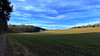
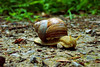

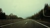
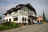
The above images may not be of the site on this page, but were taken nearby. They are loaded from Flickr so please click on them for image credits.
Click here to see more info for this site
Nearby sites
Click here to view sites on an interactive map of the areaKey: Red: member's photo, Blue: 3rd party photo, Yellow: other image, Green: no photo - please go there and take one, Grey: site destroyed
Download sites to:
KML (Google Earth)
GPX (GPS waypoints)
CSV (Garmin/Navman)
CSV (Excel)
To unlock full downloads you need to sign up as a Contributory Member. Otherwise downloads are limited to 50 sites.
Turn off the page maps and other distractions
Nearby sites listing. In the following links * = Image available
6.3km SSW 202° Schwenningen Grabhügelgruppe Barrow Cemetery
8.0km WNW 282° Judenbühl Grabhügel Round Barrow(s)
9.4km WSW 236° Franziskanermuseum Museum
9.5km NNE 14° Eichwald Grabhügelgruppe Barrow Cemetery
10.6km ESE 111° Steinerden Bruck Höhensiedlung Ancient Village or Settlement
10.6km ESE 110° Sheerers Allmand Keltische Viereckschanze Ancient Village or Settlement
10.9km ESE 111° Steinerden Bruck Grabhügelgruppe Barrow Cemetery
11.2km SW 232° Magdalenenbergle* Round Barrow(s)
12.0km SE 139° Zeugenberg Vorgeschichtlich Siedlung Ancient Village or Settlement
14.6km SW 228° Eggwald Grabhügelgruppe Barrow Cemetery
15.3km ESE 102° Dreifaltigkeitsberg Spaichingen Hillfort
15.5km NE 40° Kohlplätzle Keltische Viereckschanze Ancient Village or Settlement
15.6km NE 40° Heidenstädtle Keltische Viereckschanze Ancient Village or Settlement
15.9km S 188° Oberer Schiessbühl Grabhügelgruppe Barrow Cemetery
16.1km S 187° Unterer Schiessbühl Grabhügelgruppe Barrow Cemetery
16.9km S 182° Buckhäule Grabhügelgruppe Barrow Cemetery
17.0km NW 306° Tennenbronn Hinkelstein* Standing Stone (Menhir)
18.3km NE 49° Schömberg Grabhügelfeld Barrow Cemetery
18.6km N 359° Oberndorf Keltische Viereckschanze Ancient Village or Settlement
19.2km E 89° Steintaler Bühle Steinhügelgruppe Cairn
20.7km E 83° Heidentor Natural Stone / Erratic / Other Natural Feature
23.2km WNW 286° Schalensteine Gremmelsbach* Rock Art
24.0km ENE 60° Lochenstein Hillfort
24.5km SSW 210° Guldenen Grabhügelgruppe Barrow Cemetery
25.0km NE 44° Erzingen Grabhügelgruppe Barrow Cemetery
View more nearby sites and additional images


 We would like to know more about this location. Please feel free to add a brief description and any relevant information in your own language.
 Wir möchten mehr über diese Stätte erfahren. Bitte zögern Sie nicht, eine kurze Beschreibung und relevante Informationen in Deutsch hinzuzufügen.
 Nous aimerions en savoir encore un peu sur les lieux. S'il vous plaît n'hesitez pas à ajouter une courte description et tous les renseignements pertinents dans votre propre langue.
 Quisieramos informarnos un poco más de las lugares. No dude en añadir una breve descripción y otros datos relevantes en su propio idioma.