


<< Text Pages >> U Nicciu du Briccu du Broxin Christianised Menhir - Early Christian Sculptured Stone in Italy in Liguria
Submitted by AlexHunger on Wednesday, 06 August 2008 Page Views: 5050
Early Medieval (Dark Age)Site Name: U Nicciu du Briccu du Broxin Christianised MenhirCountry: Italy Region: Liguria Type: Early Christian Sculptured Stone
Nearest Town: Genova Nearest Village: Alpicella
Latitude: 44.405370N Longitude: 8.534460E
Condition:
| 5 | Perfect |
| 4 | Almost Perfect |
| 3 | Reasonable but with some damage |
| 2 | Ruined but still recognisable as an ancient site |
| 1 | Pretty much destroyed, possibly visible as crop marks |
| 0 | No data. |
| -1 | Completely destroyed |
| 5 | Superb |
| 4 | Good |
| 3 | Ordinary |
| 2 | Not Good |
| 1 | Awful |
| 0 | No data. |
| 5 | Can be driven to, probably with disabled access |
| 4 | Short walk on a footpath |
| 3 | Requiring a bit more of a walk |
| 2 | A long walk |
| 1 | In the middle of nowhere, a nightmare to find |
| 0 | No data. |
| 5 | co-ordinates taken by GPS or official recorded co-ordinates |
| 4 | co-ordinates scaled from a detailed map |
| 3 | co-ordinates scaled from a bad map |
| 2 | co-ordinates of the nearest village |
| 1 | co-ordinates of the nearest town |
| 0 | no data |
Internal Links:
External Links:
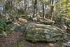
Early Christian Sculptured Stone in Liguria
Menhir built into the front of a very primitive church tower.
You may be viewing yesterday's version of this page. To see the most up to date information please register for a free account.
Do not use the above information on other web sites or publications without permission of the contributor.
Nearby Images from Flickr

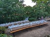
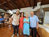
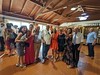
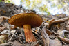
The above images may not be of the site on this page, but were taken nearby. They are loaded from Flickr so please click on them for image credits.
Click here to see more info for this site
Nearby sites
Click here to view sites on an interactive map of the areaKey: Red: member's photo, Blue: 3rd party photo, Yellow: other image, Green: no photo - please go there and take one, Grey: site destroyed
Download sites to:
KML (Google Earth)
GPX (GPS waypoints)
CSV (Garmin/Navman)
CSV (Excel)
To unlock full downloads you need to sign up as a Contributory Member. Otherwise downloads are limited to 50 sites.
Turn off the page maps and other distractions
Nearby sites listing. In the following links * = Image available
1.1km E 82° Ceresa Engraved Stone* Rock Art
1.1km E 82° Ceresa Marked Stone* Rock Art
1.3km E 82° Ceresa Menhir 1* Standing Stone (Menhir)
1.3km E 79° Ceresa Menhir 2* Standing Stone (Menhir)
1.3km E 84° Ceresa Cup Mark Stone Rock Art
1.6km ENE 77° Ceresa Rock Altar* Natural Stone / Erratic / Other Natural Feature
2.0km E 91° Monte Beigua Strada Megalitica* Ancient Trackway
2.0km E 93° South Beigua Menhir* Standing Stone (Menhir)
2.1km ENE 71° Faie Cup Mark Stone Rock Art
2.8km NNW 329° Bric Aliberti Engraved stone Rock Art
5.4km NE 45° Della Biscia Dolmen Burial Chamber or Dolmen
5.6km NE 47° Della Biscia Pria Scugia Engraved stone Rock Art
6.8km SE 129° Cian da Munega Menhir* Standing Stone (Menhir)
12.3km ENE 60° Faiallo's Stone* Standing Stone (Menhir)
12.8km ENE 59° Faiallo's standing stone (2)* Standing Stone (Menhir)
20.5km ENE 65° Issel's Cup Mark Stone Rock Art
20.5km ENE 65° Giutte Cairn Cairn
25.5km SW 222° Riparo di Rocca Due Teste* Ancient Village or Settlement
25.9km SSW 209° Pian del Ciliegio Rock Shelter* Cave or Rock Shelter
26.1km SW 214° Megalithic structure above Arma Strapatente* Cave or Rock Shelter
28.1km SW 217° Bric Le Pile* Rock Art
28.2km SW 217° Menhir close stone table near Bric Le Pile* Standing Stone (Menhir)
28.2km SW 217° Altar Stone near Bric Le Pile* Rock Art
28.2km SW 217° Anthropomorphic stele near Bric Le Pile* Standing Stone (Menhir)
28.6km SW 215° Bric Ercea* Rock Art
View more nearby sites and additional images


 We would like to know more about this location. Please feel free to add a brief description and any relevant information in your own language.
 Wir möchten mehr über diese Stätte erfahren. Bitte zögern Sie nicht, eine kurze Beschreibung und relevante Informationen in Deutsch hinzuzufügen.
 Nous aimerions en savoir encore un peu sur les lieux. S'il vous plaît n'hesitez pas à ajouter une courte description et tous les renseignements pertinents dans votre propre langue.
 Quisieramos informarnos un poco más de las lugares. No dude en añadir una breve descripción y otros datos relevantes en su propio idioma.