


<< Our Photo Pages >> Bonstetten Schladhau Cromlech - Stone Circle in Switzerland in Zürich
Submitted by aolson on Saturday, 23 February 2019 Page Views: 995
Neolithic and Bronze AgeSite Name: Bonstetten Schladhau CromlechCountry: Switzerland
NOTE: This site is 1.434 km away from the location you searched for.
Canton: Zürich Type: Stone Circle
Nearest Town: Bonstetten
Latitude: 47.308060N Longitude: 8.480830E
Condition:
| 5 | Perfect |
| 4 | Almost Perfect |
| 3 | Reasonable but with some damage |
| 2 | Ruined but still recognisable as an ancient site |
| 1 | Pretty much destroyed, possibly visible as crop marks |
| 0 | No data. |
| -1 | Completely destroyed |
| 5 | Superb |
| 4 | Good |
| 3 | Ordinary |
| 2 | Not Good |
| 1 | Awful |
| 0 | No data. |
| 5 | Can be driven to, probably with disabled access |
| 4 | Short walk on a footpath |
| 3 | Requiring a bit more of a walk |
| 2 | A long walk |
| 1 | In the middle of nowhere, a nightmare to find |
| 0 | No data. |
| 5 | co-ordinates taken by GPS or official recorded co-ordinates |
| 4 | co-ordinates scaled from a detailed map |
| 3 | co-ordinates scaled from a bad map |
| 2 | co-ordinates of the nearest village |
| 1 | co-ordinates of the nearest town |
| 0 | no data |
Internal Links:
External Links:
I have visited· I would like to visit
Megalithic89 visited on 5th Feb 2021 - their rating: Cond: 2 Amb: 4 Access: 4 Wonderful natural powerplace. Energy Ley E to W along some stones.
aolson visited on 2nd Feb 2019 - their rating: Cond: 2 Amb: 2 Access: 4 Only the remnants of the circle remain. You need to look at just the right angle to be able to picture it.
Average ratings for this site from all visit loggers: Condition: 2 Ambience: 3 Access: 4
")
Source Stonehenge in Säuliamt - Ergänzungen by Richard Walker
You may be viewing yesterday's version of this page. To see the most up to date information please register for a free account.
")
")
")
")
Do not use the above information on other web sites or publications without permission of the contributor.
Nearby Images from Flickr
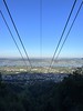


The above images may not be of the site on this page, but were taken nearby. They are loaded from Flickr so please click on them for image credits.
Click here to see more info for this site
Nearby sites
Click here to view sites on an interactive map of the areaKey: Red: member's photo, Blue: 3rd party photo, Yellow: other image, Green: no photo - please go there and take one, Grey: site destroyed
Download sites to:
KML (Google Earth)
GPX (GPS waypoints)
CSV (Garmin/Navman)
CSV (Excel)
To unlock full downloads you need to sign up as a Contributory Member. Otherwise downloads are limited to 50 sites.
Turn off the page maps and other distractions
Nearby sites listing. In the following links * = Image available
382m S 185° Bonstetten Schladhau Menhir* Standing Stone (Menhir)
1.7km N 7° Bonstetten Aebertshalden Grabhügel* Artificial Mound
2.2km S 189° Müliberg Gottert Süd* Stone Row / Alignment
2.2km N 5° Wettswil Grüt* Stone Row / Alignment
2.5km N 6° Wettswil Sitzholz* Stone Row / Alignment
2.5km SSW 208° Eggmatt East Steinreihe Stone Row / Alignment
2.5km SSW 211° Eggmatt West Steinreihe Stone Row / Alignment
2.8km SSW 204° Steinkreis Bislikerhau* Stone Circle
2.8km SSW 202° Bislikerhau Steinreihe B Stone Row / Alignment
3.0km SSW 202° Bislikerhau Steinreihe A* Stone Row / Alignment
3.2km S 175° Mühliberg Menhir* Standing Stone (Menhir)
4.1km SSW 192° Steinreihe Reservoir* Stone Row / Alignment
4.2km S 186° Steinkreis Schürmatt* Stone Circle
4.2km SSW 206° Steinreihe Hochwasserdamm* Stone Row / Alignment
4.2km S 189° Affoltern Bernhau Steinkreis* Stone Circle
4.3km S 186° Schürmatt block terrace* Misc. Earthwork
4.3km S 173° Aeugst Chindlistein* Natural Stone / Erratic / Other Natural Feature
4.4km NNW 336° Wettswil Wannenboden* Stone Row / Alignment
4.4km SSW 195° Würzhau Nord Steinreihe* Stone Row / Alignment
4.5km SSW 195° Würzhau West Steinreihe* Stone Row / Alignment
4.5km S 187° Baderholz Alignment* Stone Row / Alignment
4.6km SSW 192° Würzhau Blockhügel* Standing Stones
4.6km S 190° Nesselhau Steinreihe* Stone Row / Alignment
4.7km S 185° Schönhalde West Steinreihe* Stone Row / Alignment
4.8km S 184° Schönhalde Ost Steinreihe* Stone Row / Alignment
View more nearby sites and additional images


 We would like to know more about this location. Please feel free to add a brief description and any relevant information in your own language.
 Wir möchten mehr über diese Stätte erfahren. Bitte zögern Sie nicht, eine kurze Beschreibung und relevante Informationen in Deutsch hinzuzufügen.
 Nous aimerions en savoir encore un peu sur les lieux. S'il vous plaît n'hesitez pas à ajouter une courte description et tous les renseignements pertinents dans votre propre langue.
 Quisieramos informarnos un poco más de las lugares. No dude en añadir una breve descripción y otros datos relevantes en su propio idioma.